

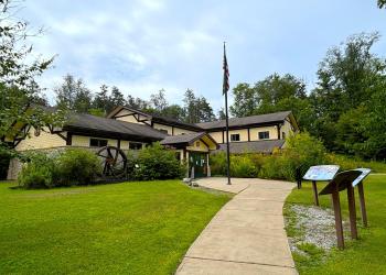
Twin Lakes Recreation Area
This very busy recreation area is located south of Kane, PA off of State Route 321.
Twin Lakes was once the site of factory buildings, stores and row houses owned by the McKean Chemical Company which made wood alcohol. A company splash dam, used to augment water levels for the chemical plant downstream once occupied the site of today's dam. When McKean Chemical Company closed in the 1920s, the US Forest Service acquired the property.
In 1936, the Civilian Conservation Corps (CCC) constructed the present dam on Hoffman Run, creating the swimming impoundment. They built the lower campground, picnic area, pavilion and bathhouse. The "twin" impoundment was never built, as money planned for its construction was diverted to build Loleta Recreation Area near Marienville, PA.
Twin Lakes has upper and lower camping loops.
The day use area is situated around a 10-acre impoundment which is fed by Hoffman Run, a heavily stocked trout stream; no boating is permitted on the impounded lake. A hardened walking path surrounds the impoundment.
Active Alerts
Reservations
Make Reservations HereGeneral Information
Camping
- Single: 48 sites
- Double site: 1
- Group: 2 sites, 50 people or less
RV Camping
A dump station is available.
Pavement Type for Parking
hardened
Hookup - Water
No
Size Restrictions
RVs 28 feet long x 10 feet h max
Hookup - Sewer
No
April 1 - October 31
Quiet hours 10:00 pm to 6:00 am
No fees are required for this site
Contact Name: Friends of Twin Lakes
Contact Phone: 814-389-3019
Address: 131 Smokey Lane Marienville, PA 16239
Phone: 814-927-6628
Hours: Tuesday to Saturday: 8:30 am to 12:30 pm and 1:00 pm to 4:00 pm (Closed on federal holidays)
Office Email: sm.fs.anf@usda.gov
Getting There
Latitude / Longitude
Latitude: 41.61416667
Longitude: -78.75555556
Directions
From Kane
- Travel south on SR 321 for 6 miles
- Turn right (West) on T361 and follow for 0.2 miles
- Turn right onto Dahoga Rd (use caution as road is narrow)
- Proceed north 2.5 miles to Twin Lakes Rd FR 191
- Continue north 2.0 miles to Twin Lakes Campground entrance
Travel Considerations
There is a maximum ten-foot clearance underpass located on the Twin Lakes entrance road. Vehicles taller than ten feet should travel northwest from Wilcox using Dahoga Road to avoid the underpass.
Facility and Amenity Information
Restrooms
Restrooms are available at this site.
Other Amenities
Amenities:
- Electricity - lower loop
- picnic table
- fire ring
- tent pad
- playground - one in each camping loop
Day Use/Beach
- portable toilets
- beach
- bathhouse
- picnic tables
- pavilions
- fishing piers
Group sites
- large grassy fields
- gravel parking areas
- pavilions
- picnic tables
- grills
- fire rings
- horse shoe pits
- vault toilets
Nearby Trails
Recreation Opportunities
Fishing - Lake & Pond Info
This campground has an accessible fishing pier.
For native trout fishing, try the Twin Lakes Trail that begins at the Black Cherry National Recreation Interpretive Trail and extends 15 miles westward or the Mill Creek Trail, which traverses 5.6 miles through gently rolling terrain; it can be accessed via the Twin Lakes Trail.
Please note that portions of the Mill Creek Trail are no longer maintained. Mill Creek Trail also connects to the Brush Hollow system and is listed on the Brush Hollow map and brochure.
For information on fishing regulations and season visit the Pennsylvania Fish and Boat Commission website.
Accessible Platform
Yes
Picnicking - Single Info
There is a large grassy area to set-up games and short trail around lake.
Picnicking - Groups Info
There is a large grassy area to set-up games and short trail around lake.
Group Cooking Facilities
Grills
Hookups - Electric
Yes
Swimming Info
The swimming area features a hiking trail, playground and accessible swimming beach. The beach has buoys to create a 100' x 60' swimming area with a sand beach.
Hiking Info
Black Cherry Interpretive Trail
This trail is a 1.6 mile trail beginning and ending near the lower campground loop.
Twin Lakes Trail
This 15.8 mile long trail begins at the long loop of the Black Cherry National Recreation Interpretive Trail located at Twin Lakes Recreation Area and travels west to join with the North Country National Scenic Trail.
Mill Creek Trail
The trail is 5.6 miles and is marked with gray diamonds. The trail starts at the Brush Hollow Trail and ends at the Twin Lakes Trail near Twin Lakes Recreation Area.
Brush Hollow Trail System
The Brush Hollow Trails offer three loops totaling 7.7 miles for cross-country skiing, hiking and mountain biking. The 5.6 mile Mill Creek Trail connects the Brush Hollow Trails with the Twin Lakes Trail.