
Rockpile Mountain Wilderness
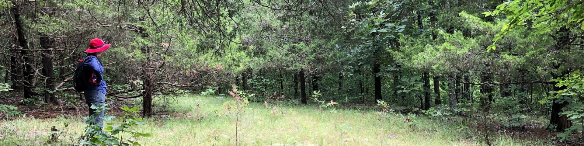
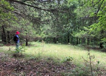
This 4,238 acre Wilderness takes its name from an ancient circle of granite rock, piled by some earlier man on top of the mountain. It is located in Madison County on the Fredericktown Ranger District, southeast of Bell Mountain and southwest of Fredericktown, Missouri. The area is primarily a broken ridge, having steep rocky slopes running from Little Grass Mountain on the north to the National Forest boundary four miles to the south.
Brochure and Maps
- Trail System Map available on the Avenza app.
Trails: From the trailhead there is a 2 mile section of maintained trail. The rest of the area is accessed by old woods roads or cross-country hiking.
Active Alerts
General Information
The Ozark climate is mild enough to make Wilderness visits feasible throughout the year, as long as visitors bring proper gear. When possible, take advantage of this opportunity and plan your 'visit outside the peak spring and fall use seasons.
Private Property – Rockpile Mountain Wilderness is surrounded by private property. Please respect the rights and property of private landowners.
Safety Information
Wilderness has inherent dangers, and is a primitive setting where you meet nature on its own terms.
- Bring a map and compass, and first aid kit.
- During temperate months, be prepared for biting insects, poison ivy and high temperatures.
- Be advised of hunting seasons.
- Avoid using the trail during excessively wet periods.
- Be sure to tell someone your plans,
- don’t hike the wilderness alone and
- carry extra supplies so you are prepared to take care of yourself in case you get lost, injured, or delayed.
- The universal distress signal is three of anything: shots, shouts, smokes, whistles.
- Be prepared to sanitize water for drinking
Camping
Dispersed camping is the term used for free camping anywhere in the National Forest OUTSIDE of a designated campground.
Dispersed camping means there are no toilets, no structures, no trash cans, no treated water, and no fire grates.
There are extra responsibilities required for this type of camp. It's a must to educate yourself before you try it, but we hope the adventure of dispersed camping in the Mark Twain National Forest calls to you!
- Pick a Campsite and follow the Leave No Trace Principles
- Camp 100 feet away from trails and water sources.
- Treat any water found in the area before consuming it.
- Human waste (Feces) must be buried at least 6 inches deep and covered.
- Pack out all of your garbage.
Commercial use will not be permitted. Special uses will not be permitted, except for access to surrounded private property.
Wilderness
- Limit your party size to 10 persons;
- no camping within 100 feet of trails, water sources and other camps.
- Terrain is sometimes steep.
- No motorized or mechanized equipment allowed.
- Practice Leave No Trace outdoor ethics;
- Never tie stock directly to trees.
- Commercial use will not be permitted.
- Special uses will not be permitted, except for access to surrounded private property.
- Pack out all of your trash
Trailheads
- No trash containers; please pack out all your trash.
- Dogs on leash
- No fireworks
No fees
Trail Use
Dogs are allowed on hiking trails, as long as they are kept on a leash. Unleashed dogs can pose a danger to your pet, the natural resources of the area, and other forest visitors.
- Leashes must be six feet, or shorter, when in developed recreation sites, including trails within the boundaries (36 CFR 261.16(j)) when they are not inside an enclosed vehicle or tent.
- Yield your leashed dog around other hikers and horses.
- Pack out your dogs waste or bury it 100 feet from water and trails.
Camping
- Keep dogs on a six-foot, or shorter, leash when they are not inside a tent.
- Store dog food in bear-resistant containers and feed your pet away from the campsite.
- Pick up and bag your dog’s waste. Place it in a provided trash receptacle or pack it out.
- Do not leave your dog unattended at any time.
- Do not leave your dog in the vehicle on a hot day.
- Keep your dog in your tent or vehicle at night.
- Ensure that there is ample water available for your pet.
Wildlife
- Do not allow them to interact with wildlife

Address: 10019 W. State Hwy. 8 Potosi, MO 63664
Phone: 573-438-5427
Hours: 8:00 am - 4:30 pm, Monday to Friday; District Offices closed 1 - 1:30 for lunch (Closed on federal holidays)
Office Email: sm.fs.marktwainnf@usda.gov
Getting There
Elevation
1305 feet
Directions
From St. Louis, take I-55 south to Hwy. 67; then south to County Road C south of Fredericktown; then south 10 miles to County Road 406 to FR2124.
Parking
Parking is available at the trailhead for the Rockpile Mountain Trail.
Facility and Amenity Information
Restrooms
Restrooms are not available at this site.
Water
Potable water is not available at this site.
Drinking water is not available in Rockpile Mountain Wilderness, open water sources within the wilderness are not recommended for drinking. Bring your own drinking water or be prepared to boil or treat water chemically.
Horse/Pack Animal Information
Horse/Pack animals are allowed at this site.
Nearby Trails
Recreation Opportunities
Backpacking Info
Rockpile Mountain Trail
The trail is located in the Rockpile Mountain Wilderness Area, from the trailhead there is a 2 mile section of maintained trail. The rest of the area is accessed by old woods roads or cross-country hiking.
Rating: Moderate. Terrain is sometimes steep. The area is within the St. Francois Mountains where elevations range from 1,305 to 520 feet.
Length: 2 miles.
Best Seasons: Fall, winter, and spring.
Leave No Trace: Pack out what you pack in.
Restrictions: Foot and Horse only.
Safety: No drinking water is available at parking areas or along the trail; bring what you will need, or be prepared to sterilize water you find. During temperate months, be prepared for biting insects, poison ivy and high temperatures. Be advised of hunting seasons. Avoid using the trail during excessively wet periods.
Surface Type: Unsurfaced, native material.
Day Hikes Info
Rockpile Mountain Trail
The trail is located in the Rockpile Mountain Wilderness Area, from the trailhead there is a 2 mile section of maintained trail. The rest of the area is accessed by old woods roads or cross-country hiking.
Rating: Moderate. Terrain is sometimes steep. The area is within the St. Francois Mountains where elevations range from 1,305 to 520 feet.
Length: 2 miles.
Best Seasons: Fall, winter, and spring.
Leave No Trace: Pack out what you pack in.
Restrictions: Foot and Horse only.
Safety: No drinking water is available at parking areas or along the trail; bring what you will need, or be prepared to sterilize water you find. During temperate months, be prepared for biting insects, poison ivy and high temperatures. Be advised of hunting seasons. Avoid using the trail during excessively wet periods.
Surface Type: Unsurfaced, native material.
Horseback Riding Info
Rockpile Mountain Trail
The trail is located in the Rockpile Mountain Wilderness Area, from the trailhead there is a 2 mile section of maintained trail. The rest of the area is accessed by old woods roads or cross-country hiking.
Rating: Moderate. Terrain is sometimes steep. The area is within the St. Francois Mountains where elevations range from 1,305 to 520 feet.
Length: 2 miles.
Best Seasons: Fall, winter, and spring.
Leave No Trace: Pack out what you pack in.
Restrictions: Foot and Horse only.
Safety: No drinking water is available at parking areas or along the trail; bring what you will need, or be prepared to sterilize water you find. During temperate months, be prepared for biting insects, poison ivy and high temperatures. Be advised of hunting seasons. Avoid using the trail during excessively wet periods.
Surface Type: Unsurfaced, native material.
Viewing Wildlife Info
A variety of wildlife species live within the Rockpile Mountain including white-tailed deer, raccoons, rabbits, squirrels, turkey, quail, songbirds, lizards and snakes.
Copperheads and rattlesnakes may be encountered. Roadrunners, collared lizards, tarantulas, wild hogs and black bears are some of the more uncommon wildlife residents.
The ultimate wildlife viewing experience is watching animals in their habitat. Here are some helpful tips to become a wildlife friendly viewer:
- Use the right tools - A field guide, a pair of binoculars and a camera. Wear clothing that is appropriate for the season and activity.
- Watch at dawn and dusk - This is the time when most wildlife species are active enough to view.
- Keep your distance - Maintain a distance that is comfortable for the wildlife.
- Stay quiet - Move slowly and quietly to increase your chances of viewing wildlife, and to avoid stressing the animals you wish to watch.
- Do not feed the wildlife - There is plenty of food available in the wild. Human food can cause digestive problems, provide improper nutrition, and even kill an animal.
An online version of the Missouri Wildlife Viewing Guide is available on their website.
Viewing Scenery Info
Rockpile Mountain itself, the steep limestone bluffs, rock formations, and caves along the St. Francis River. The narrow gorges or "shut-ins" with rushing cascades during periods of runoff and the scattered granite glades add variety to the wilderness landscape, as well as unique plant and animal communities.
Recreation Groups
This 4,238 acre Wilderness takes its name from an ancient circle of granite rock, piled by some earlier man on top of the mountain.