Welcome to Intermountain Region
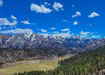
The National Forest System Lands of the Intermountain Region are located in the heart of the west, encompassing 12 forests and 1 grassland. Explore 34 million acres while enjoying all your favorite recreational activities including camping, fishing, hiking, biking, OHV use, and boating.
The forests range from heavily timbered slopes of central Idaho on the Payette National Forest to red rock open country in southern Utah. Forest lands in Nevada and the beautiful Bridger Teton National Forest of Wyoming round out the region.
Find a Forest
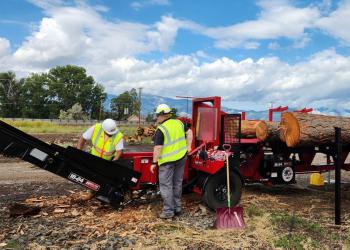
Community Wildfire Defense Grants (CWDG)
Protecting communities, infrastructure, and natural resources from the threat of wildfires.
What is Prescribed Fire?
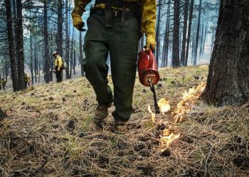
Learn more about planned, on-going and completed prescribed fire operations across the USDA Forest Service Intermountain Region.
Wildfire Crisis in the Intermountain Region
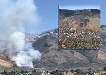
The Forest Service wildfire crisis strategy combines an historic investment from congressional funding with years of scientific research and planning into a national effort that will dramatically increase the scale of forest health treatments.