
Explore the Forest!
Ninemile Visitor & Wildlands Training Center
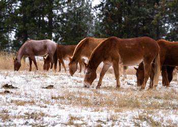
Come and check out this historic site where you can learn about the Ninemile Remount Depot which provided experienced packers and their animals for fighting fires and for backcountry work projects since the 1930s. It is also the home to the Ninemile Wildlands Training Center that holds yearly public training on stock, traditional tools, and more.
Savenac Historic Tree Nursery & Visitor Center
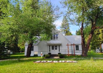
This historic nursery was founded in 1907. Nursery operations concluded in 1969 and now the site is open to the public. We invite you to stop in at the visitor center and explore our rich past, rent one of the cabins, or take a walk around the arboretum.
Rattlesnake National Recreation Area & Wilderness

Rugged peaks, winding trails, and alpine lakes, in Missoula's backyard. The southern boundary of the Rattlesnake National Recreation Area and Wilderness is four miles north of Missoula. The elevation varies from 3,600 feet at the NRA entrance to 8,620 feet on McLeod Peak.
Welcome Creek Wilderness

Located in the Rock Creek drainage east of Missoula, this nine-by-seven-mile wilderness offers steep ridges, narrow valleys, and amazing forests that are the home of a rich wildlife population. Finding a tent spot can be a challenge in this steep valley, but even in this small pocket of wilderness you can find solitude.
Selway-Bitterroot Wilderness

The Selway-Bitterroot Wilderness is the third largest wilderness in the lower 48, and adjoins the Frank Church-River of No Return Wilderness at the Magruder Corridor Road, a narrow dirt track that is the only road for miles north and south. It straddles the Bitterroot Range across the Montana-Idaho Border, and lies in several national forests, including a small part within the Lolo.
Bob Marshall Wilderness Complex
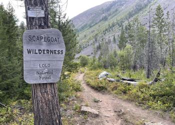
Together, the Great Bear Wilderness, the Bob Marshall Wilderness and the Scapegoat Wilderness form the Bob Marshall Wilderness Complex, an area of more than 1.5 million acres. The western half of the Scapegoat is on the Lolo National Forest, bounded on its eastern side by the Continental Divide and Scapegoat Mountain, the tallest mountain in the complex at 9,214 feet.