

Mt. Taylor RD Mt. Taylor
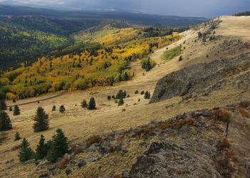
The Mt. Taylor Ranger District is comprised of two mountain ranges, Mt. Taylor and the Zuni Mountains, totaling nearly 520,000 acres of National Forest land. Mt. Taylor is the highest peak around at 11,301 feet and is an area of special religious and cultural significance to several Native American communities. Mt. Taylor, the mountain, is a dormant volcano named after President Zachary Taylor. However, eons before, it was known to the Acoma as Kaweshtima; to the Hopi Tsiipiya; to the Zuni as Dwankwi Kyabachu Yalanne; and to the Navajo Nation as Tsoodzil. It is a spiritual and cultural site for as many as 30 Native American tribes who go there to collect plants, stones, minerals, pigments, feathers, soil and sand, in addition to hunting, religious pilgrimages, accessing springs, and as a place for special offerings.
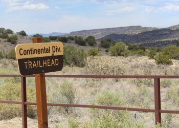
The National Scenic Trail, the Continental Divide Trail, passes through the Mt. Taylor region, while it brushes up closely with the Zuni Mountains as well. The main hiker town in this area is Grants, NM and hikers will often opt for the short detour to the top of Mt. Taylor along their journey.

Passes & Permits
Coal Mine Campground and Day Use Area requires a fee for use. The New Mexico Enchantment Pass, America the Beautiful Pass, or other Interagency Passes may cover the Day Use Fee at this site. Additional fees for camping are required. Please see posted information for more details.