
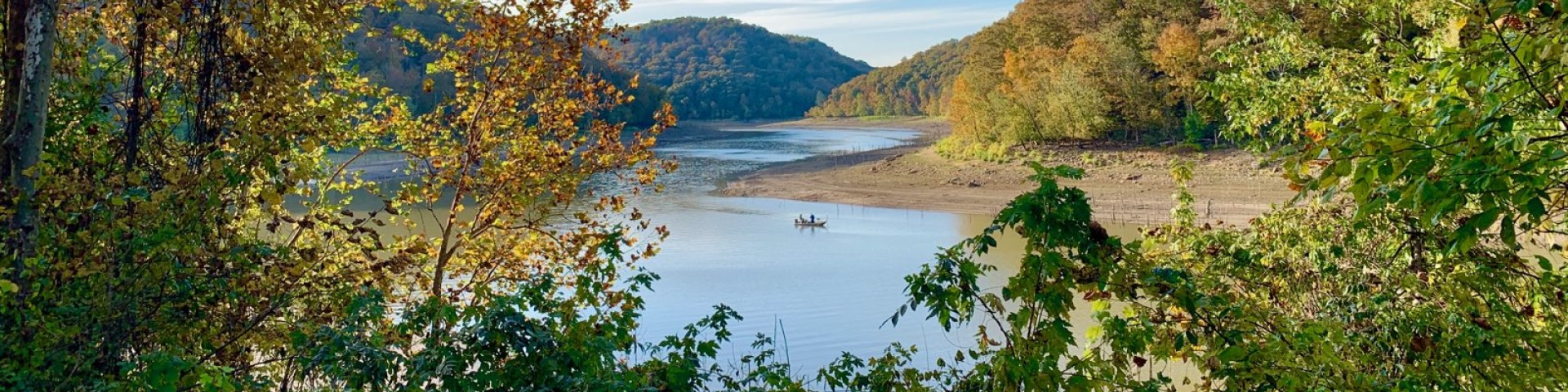
Rockcastle & Cumberland River Confluence
The Cumberland River flows north through the heart of the Daniel Boone National Forest and offers great canoeing and rafting opportunities. The river is known for Cumberland Falls, which divides the river into two distinct segments. While the falls are part of Cumberland Falls State Park, much of the winding Cumberland River, including the 16.1-mile section from Summer Shoals to the backwaters of Lake Cumberland designated as a Kentucky Wild River, flows across the Daniel Boone National Forest.
Before the Cumberland River empties into Lake Cumberland, it is joined by the Rockcastle River. The Rockcastle River, so named for the majestic cliffs that tower on either bank, flows south through portions of Jackson, Rockcastle, Laurel and Pulaski counties. While portions of the Rockcastle offer mild conditions for floating or fishing, the river is most known as one of Kentucky’s best whitewater streams. The "Rockcastle Narrows" is a precipitous gorge bounded by 100-foot cliffs. The 15.9-mile segment from KY 1956 (old Highway 80) bridge to the backwaters of Lake Cumberland, a designated a Kentucky Wild River.
The confluence of the Rockcastle and Cumberland Rivers includes recreation sites and areas located on both the London and Stearns Ranger Districts. The managing District Office is listed on each site below.
Complexes
Upper Cumberland River
KY 204 at Redbird Bridge to KY 90 at Cumberland Falls State Resort Park
Class: I, II
Miles: 17
Hours: 24
Season: November - June
Skill Level: Advanced Beginners
Most of this section is rated Class I with Class II rapids at Pitch Rapids and the KY 90 bridge. This 17-mile trip is often done in two days. Camping is allowed on national forest land if 300 feet from the water. Campers should make sure they are on national forest land, since some private land occurs along this section of river.
The canoe take-out for this section of river is 200 yards above Cumberland Falls within Cumberland Falls State Resort Park. Paddlers failing to take out here could potentially be carried over the falls. After passing through the right arch of the bridge, take out immediately. Do not attempt this section when the river is high.
Lower Cumberland River
Cumberland Falls to Mouth of Laurel
Class: III
Miles: 11.6
Hours 4-6
Season: All
Skill Level: Intermediate, Advanced
The river below the falls is one of the few whitewater runs that can be made year round. This section is rated as a Class III with several difficult rapids that should be attempted only by intermediate and advanced paddlers. It is 11.6 miles from the put-in at the state park beach below Cumberland Falls to the take-out at the Mouth of Laurel Boat Ramp within the national forest. The last several miles are flat water. Plan on 4-6 hours for the trip. A private concessionaire also runs guided raft trips on this section of river.

Mouth of Laurel Boat Ramp is located at the confluence of Laurel River and Lake Cumberland. Downstream, small motorized boats can access Lake Cumberland.
Upper Rockcastle River
Livingston to I-75 Bridge
Class: I+
Miles: 6
Season: November - June
Skill Level: Families and Beginners
This section of river is rated as Class I+. The put-in is located on private land at the Wilderness Road ford just south of Livingston on U.S. 25. Please respect the rights of private landowners. The take-out is just beyond I-75 on the right side of the river, 6 miles downstream and also on private land. The trip takes between 1 and 3 hours, depending on the water level and the paddler's ability.
I-75 Bridge to KY 1956 (Billows Bridge)
Class: I+
Miles: 10.6
Hours: 3-5
Season: November - June
Skill Level: Families and Beginners
The river from I-75 bridge to KY 1956 meanders for 10.6 miles and is considered to be a Class I+. Most of this section is flat water with a few easy shoals. The river follows KY 1329 for approximately 2 miles. There is no paved access to the river beyond I-75 until the take out, which is on the left side of the river just beyond the bridge. The take out is on private land. Plan on between 3 and 5 hours to make the trip.
Lower Rockcastle River
This section of river is designated a Kentucky Wild River and includes one of the most challenging whitewater runs in Kentucky. It is a long 16.9-mile stretch of water with several Class III and at least one Class IV rapid along the way. It should be attempted only by experienced, well-equipped paddlers.
Big Narrows and Beech Narrows can be portaged using trails on the left side of the river. Only boaters with advanced expert skills should attempt Beech Narrows due to serious "Keeper" hydraulics and undercut rocks. Plan on at least 8 hours for the trip.
The take-out is at the Bee Rock Recreation Area on the east side of the campground.
Bee Rock Complex includes a network of 12 miles of interconnected trails centered around Bee Rock Campground and the historic Sublimity Bridge. From these trails, which range from easy to strenuous in difficulty, visitors can take in scenic overlooks, majestic cliffs, seasonal wildflowers, and views of the Rockcastle River. The Rockcastle River, whose flow forms the border of Rockcastle and Laurel counties, is cuts through the heart of the area and provides smallmouth bass and rock bass populations for fishing at the Bee Rock Boat Ramp.
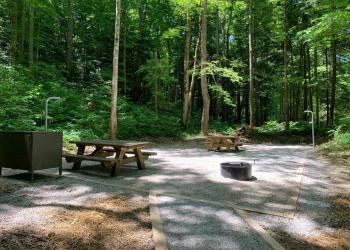
Bee Rock Campground is located off KY 192 within the Bee Rock Recreation Area along the banks of the Rockcastle River and features 25 wooded, first-come, first-served camps
Bee Rock Boat Ramp provides access to two very different paddling experiences on the Rockcastle River.