| Collection: | Sierra Ancha Historical Images |
| Keywords: | watershed |
| Location: | Sierra Ancha Experimental Forest |
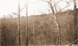
| Description: | Prescribed burning of slash and residual trees in North Fork Workman Creek. View looking west, down watershed. |
| Date: | 12/24/1969 |
| Collection: | Fort Valley Experimental Forest historical photographs |
| Keywords: |
stream flow vegetation types watershed |
| Organisms: | saguaro cactus |
| Location: | Sycamore Ck.; AZ; USA |
| Description: | Sycamore Creek below Round Valley |
| Date: | 06/1969 |
| Collection: | Fort Valley Experimental Forest historical photographs |
| Keywords: |
forest stand watershed |
| Location: | Willow Creek; AZ; USA |
| Description: | East Fork Willow Creek |
| Date: | 10/1965 |
| Collection: | Fort Valley Experimental Forest historical photographs |
| Keywords: |
forest stand watershed |
| Location: | Thomas Creek; AZ; USA |
| Description: | North Fork Thomas Creek |
| Date: | 10/1965 |
| Collection: | Fort Valley Experimental Forest historical photographs |
| Keywords: |
stream gage watershed study |
| Location: | Sunflower; AZ; USA |
| Description: | Sunflower gaging station |
| Date: | 02/1963 |
| Collection: | Sierra Ancha Historical Images |
| Keywords: | watershed |
| Location: | Sierra Ancha; NV; USA |
| Description: | Watershed |
| Date: | 09/1961 |
| Collection: | Sierra Ancha Historical Images |
| Keywords: |
research techniques watershed |
| Location: | Sierra Ancha Experimental Forest; AZ; USA |
| Description: | Whitespar A Weir dam and flume |
| Date: | 11/13/1959 |
| Collection: | Sierra Ancha Historical Images |
| Keywords: |
research techniques dam watershed |
| Location: | Sierra Ancha Experimental Forest; AZ; USA |
| Description: | Whitespar Trash rack and V-notch |
| Date: | 11/13/1959 |
| Collection: | Sierra Ancha Historical Images |
| Keywords: |
research techniques watershed |
| Location: | Sierra Ancha Experimental Forest; AZ; USA |
| Description: | s-well shelter w/Inst. platform |
| Date: | 11/13/1959 |
| Collection: | Fort Valley Experimental Forest historical photographs |
| Keywords: |
fire-effects watershed |
| Location: | Tonto NF; AZ; USA |
| Description: | 3-bar watershed burned area |
| Date: | 07/30/1959 |
| Collection: | Fort Valley Experimental Forest historical photographs |
| Keywords: |
fire-effects watershed |
| Location: | Tonto NF; AZ; USA |
| Description: | 3-bar watershed burned area |
| Date: | 07/30/1959 |
| Collection: | Fort Valley Experimental Forest historical photographs |
| Keywords: |
fire-effects watershed |
| Organisms: | oak |
| Location: | Tonto NF; AZ; USA |
| Description: | Turbinella oak with no new growth |
| Date: | 07/14/1959 |
| Collection: | Fort Valley Experimental Forest historical photographs |
| Keywords: |
brush fire-effects watershed |
| Organisms: | chaparral |
| Location: | Tonto NF; AZ; USA |
| Description: | 3-bar watershed B |
| Date: | 07/10/1959 |
| Collection: | Fort Valley Experimental Forest historical photographs |
| Keywords: |
brush watershed |
| Organisms: | oak |
| Location: | Prescott NF; AZ; USA |
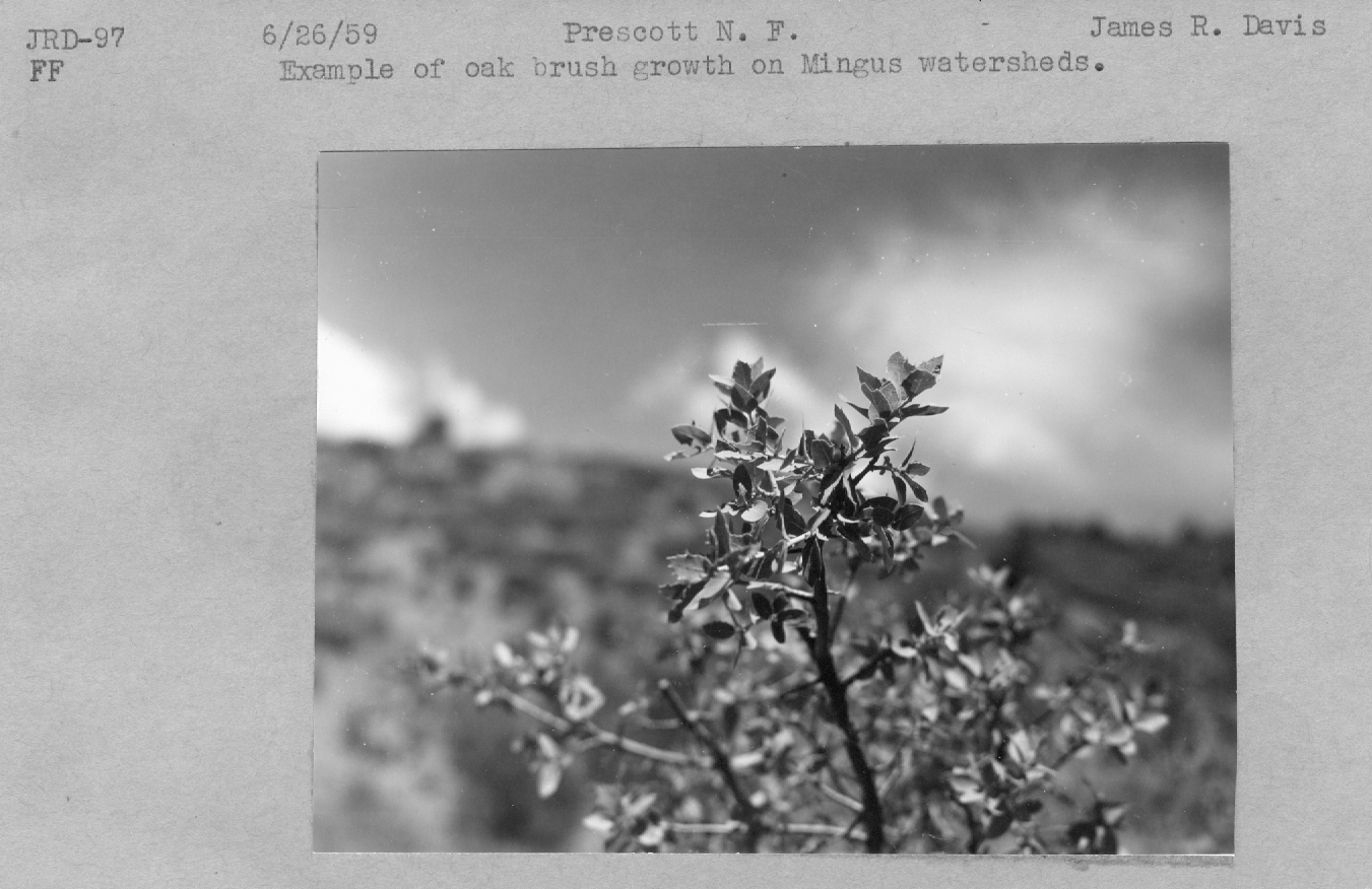
| Description: | oak brush growth |
| Date: | 06/26/1959 |
| Collection: | Fort Valley Experimental Forest historical photographs |
| Keywords: |
brush watershed |
| Organisms: | oak |
| Location: | Prescott NF; AZ; USA |
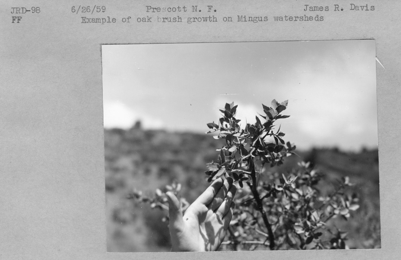
| Description: | oak brush growth |
| Date: | 06/26/1959 |
| Collection: | Fort Valley Experimental Forest historical photographs |
| Keywords: | watershed |
| Location: | Coconino National Forest; AZ; USA |
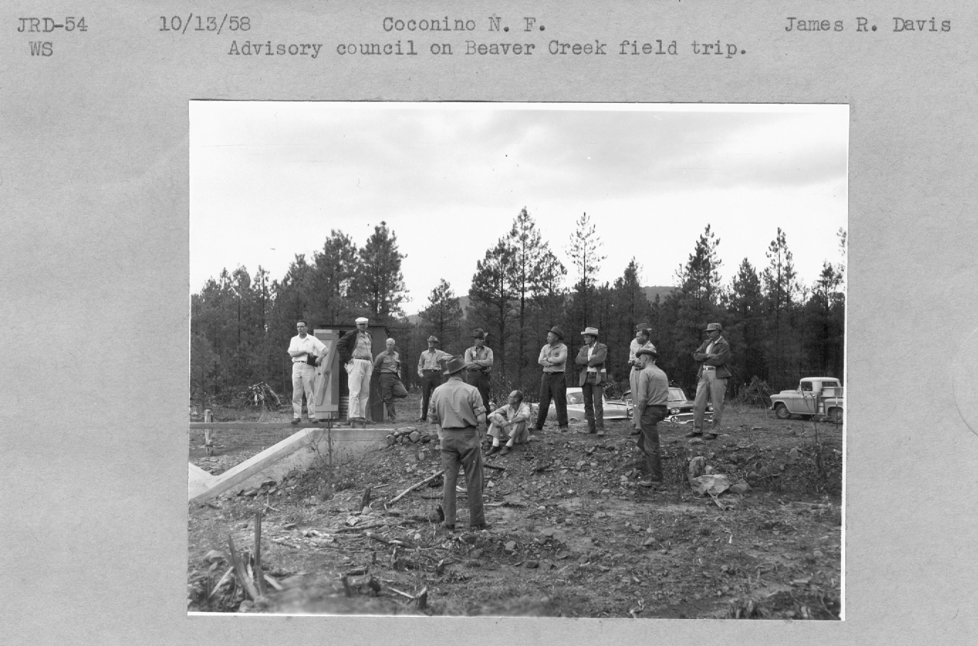
| Description: | Advisory council on Beaver creek field trip. |
| Date: | 10/13/1958 |
| Collection: | Fort Valley Experimental Forest historical photographs |
| Keywords: | watershed |
| Location: | Coconino National Forest; AZ; USA |
| Description: | Advisory council on Beaver creek field trip. |
| Date: | 10/13/1958 |
| Collection: | Fort Valley Experimental Forest historical photographs |
| Keywords: | watershed |
| Location: | Coconino National Forest; AZ; USA |
| Description: | Advisory council on Beaver creek field trip. |
| Date: | 10/13/1958 |
| Collection: | Fort Valley Experimental Forest historical photographs |
| Keywords: | watershed |
| Location: | Coconino National Forest; AZ; USA |
| Description: | Beaver creek WS-11 after clearing. |
| Date: | 09/30/1958 |
| Collection: | Sierra Ancha Historical Images |
| Keywords: | watershed |
| Location: | Sierra Ancha; USA |
| Description: | Watershed |
| Date: | 07/1947 |
| Collection: | Sierra Ancha Historical Images |
| Keywords: | watershed |
| Location: | Sierra Ancha; USA |
| Description: | Watershed |
| Date: | 05/05/1947 |
| Collection: | Sierra Ancha Historical Images |
| Keywords: | watershed |
| Location: | Sierra Ancha; USA |
| Description: | Waterhshed |
| Date: | 11/16/1945 |
| Collection: | Sierra Ancha Historical Images |
| Keywords: | watershed |
| Location: | Sierra Ancha; USA |
| Description: | Range |
| Date: | 11/16/1945 |
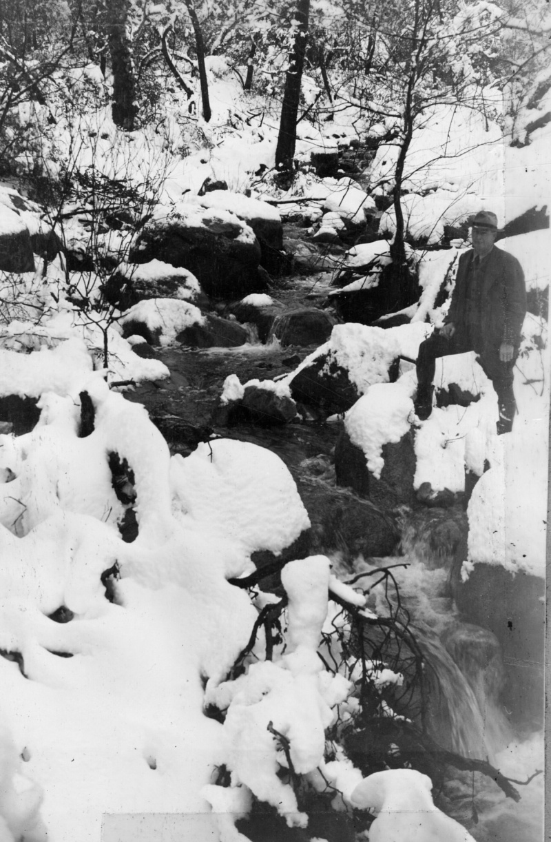
| Collection: | Sierra Ancha Historical Images |
| Keywords: |
stream flow snow personnel bridge watershed |
| Location: | Sierra Ancha Exp Forest |
| Description: | Watershed Project |
| Date: | 02/24/1944 |
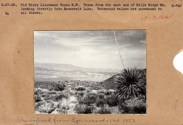
| Collection: | Fort Valley Experimental Forest historical photographs |
| Keywords: |
landscape watershed |
| Organisms: | cactus |
| Location: | Tonto NF; AZ; USA |
| Description: | Roosevelt Lake grazing allotment |
| Date: | 05/27/1943 |
| Collection: | Sierra Ancha Historical Images |
| Keywords: | watershed |
| Location: | Sierra Ancha NF |
| Description: | Watershed Project |
| Date: | 02/1943 |
| Collection: | Sierra Ancha Historical Images |
| Keywords: |
personnel watershed |
| Location: | Tonto NF; AZ; USA |
| Description: | Watershed Project |
| Date: | 03/1941 |
| Collection: | Sierra Ancha Historical Images |
| Keywords: |
livestock personnel period attire watershed |
| Location: | Sierra Ancha; USA |
| Description: | Watershed |
| Date: | 06/1939 |
| Collection: | Southern Research Station Historical Documents and Images |
| Keywords: |
selective cut watershed |
| Location: | Jones Creek drainage, Irons Fork Experimental Forest, Arkansas |
| Description: | Caption reads: "#7, Selective Watershed, Jones Creek. General view into watershed #7 before cutting. Camera faced N.E. Station on S.E. ridge of watershed. Camera Sta. #13." |
| Date: | 4/28/1939 |
| Collection: | Southern Research Station Historical Documents and Images |
| Keywords: |
selective cut watershed |
| Location: | Jones Creek drainage, Irons Fork Experimental Forest, Arkansas |
| Description: | Caption reads: "Ridge between #6 and #7 watersheds, Jones Creek. General view, #1 and #2 watersheds. Notice sharp line of demarkation [sic]: #1 selectively cut; #2 clear cut." |
| Date: | 4/28/1939 |
| Collection: | Southern Research Station Historical Documents and Images |
| Keywords: |
selective cut watershed |
| Location: | Jones Creek drainage, Irons Fork Experimental Forest, Arkansas |
| Description: | Caption reads: "Ridge between #6 and #7 watersheds, Jones Creek. General view of #3 and #4 watersheds. Line of demarkation [sic] between clear-cut watershed #4 and selectively cut watershed #3." [watersheds not yet logged?] |
| Date: | 4/28/1939 |
| Collection: | Southern Research Station Historical Documents and Images |
| Keywords: | watershed |
| Location: | Jones Creek drainage, Irons Fork Experimental Forest, Arkansas |
| Description: | Caption reads: "#2 Watershed, Jones Creek. View at upper end of clear-cut watershed. Shows natural stand before logging. Camera Sta. #16. Camera sta. 30 yds. S.W. from upper log yard. Camera faced S.W." |
| Date: | 4/28/1939 |
| Collection: | Southern Research Station Historical Documents and Images |
| Keywords: | watershed |
| Location: | Jones Creek drainage, Irons Fork Experimental Forest, Arkansas |
| Description: | Caption reads: "#6 Watershed, Jones Creek. Before cutting. General view into watershed to be clear-cut. Camera faced east." |
| Date: | 4/11/1939 |
| Collection: | Southern Research Station Historical Documents and Images |
| Keywords: | watershed |
| Location: | Jones Creek drainage, Irons Fork Experimental Forest, Arkansas |
| Description: | Caption reads: "#6 Watershed, Jones Creek. General view north into #6 watershed before clear-cutting. Camera on ridge between #6 and #7, facing north." |
| Date: | 4/11/1939 |
| Collection: | Southern Research Station Historical Documents and Images |
| Keywords: | watershed |
| Organisms: | oak |
| Location: | Jones Creek drainage, Irons Fork Experimental Forest, Arkansas |
| Description: | Caption reads: "#6 Watershed in foreground, before cutting, Jones Creek. General view into watershed taken from oak tree on divide between #6 and #7. Camera faced N.W." |
| Date: | 4/11/1939 |
| Collection: | Southern Research Station Historical Documents and Images |
| Keywords: | watershed |
| Organisms: | oak |
| Location: | Jones Creek drainage, Irons Fork Experimental Forest, Arkansas |
| Description: | Caption reads: "#6 Watershed, before cutting, Jones Creek. General view into watershed taken from oak tree on divide between #6 and #7. Camera faced N.E." |
| Date: | 4/11/1939 |
| Collection: | Sierra Ancha Historical Images |
| Keywords: | watershed |
| Location: | Sierra Ancha; USA |
| Description: | Watershed |
| Date: | 03/1939 |
| Collection: | Sierra Ancha Historical Images |
| Keywords: | watershed |
| Location: | Sierra Ancha; USA |
| Description: | Watershed |
| Date: | 03/1939 |
| Collection: | Sierra Ancha Historical Images |
| Keywords: | watershed |
| Location: | Sierra Ancha; USA |
| Description: | Watershed |
| Date: | 03/1939 |
| Collection: | Sierra Ancha Historical Images |
| Keywords: | watershed |
| Location: | Sierra Ancha; USA |
| Description: | Watershed |
| Date: | 04/28/1938 |
| Collection: | Sierra Ancha Historical Images |
| Keywords: | watershed |
| Location: | Sierra Ancha; USA |
| Description: | Watershed |
| Date: | 02/28/1938 |
| Collection: | Sierra Ancha Historical Images |
| Keywords: | watershed |
| Location: | Sierra Ancha; USA |
| Description: | Watershed |
| Date: | 02/17/1938 |
| Collection: | Sierra Ancha Historical Images |
| Keywords: | watershed |
| Location: | Sierra Ancha; USA |
| Description: | Watershed |
| Date: | 02/17/1938 |
| Collection: | Sierra Ancha Historical Images |
| Keywords: | watershed |
| Location: | Sierra Ancha; USA |
| Description: | Watershed |
| Date: | 02/17/1938 |
| Collection: | Sierra Ancha Historical Images |
| Keywords: | watershed |
| Location: | Sierra Ancha; USA |
| Description: | Watershed |
| Date: | 02/17/1938 |
| Collection: | Sierra Ancha Historical Images |
| Keywords: | watershed |
| Location: | Sierra Ancha; USA |
| Description: | Watershed |
| Date: | 11/1937 |
| Collection: | Sierra Ancha Historical Images |
| Keywords: | watershed |
| Location: | Sierra Ancha; USA |
| Description: | Watershed |
| Date: | 11/1937 |
| Collection: | Sierra Ancha Historical Images |
| Keywords: | watershed |
| Location: | Sierra Ancha; USA |
| Description: | Watershed |
| Date: | 11/1937 |
| Collection: | Sierra Ancha Historical Images |
| Keywords: | watershed |
| Location: | Sierra Ancha; USA |
| Description: | Range |
| Date: | 10/30/1937 |
| Collection: | Sierra Ancha Historical Images |
| Keywords: | watershed |
| Location: | Sierra Ancha; USA |
| Description: | Range |
| Date: | 10/30/1937 |







![Caption reads: "Ridge between #6 and #7 watersheds, Jones Creek. General view, #1 and #2 watersheds. Notice sharp line of demarkation [sic]: #1 selectively cut; #2 clear cut." Caption reads: "Ridge between #6 and #7 watersheds, Jones Creek. General view, #1 and #2 watersheds. Notice sharp line of demarkation [sic]: #1 selectively cut; #2 clear cut."](/rds/imagedb/images/_thm/28783.jpg)
![Caption reads: "Ridge between #6 and #7 watersheds, Jones Creek. General view of #3 and #4 watersheds. Line of demarkation [sic] between clear-cut watershed #4 and selectively cut watershed #3." [watersheds not yet logged?] Caption reads: "Ridge between #6 and #7 watersheds, Jones Creek. General view of #3 and #4 watersheds. Line of demarkation [sic] between clear-cut watershed #4 and selectively cut watershed #3." [watersheds not yet logged?]](/rds/imagedb/images/_thm/28784.jpg)


