| Collection: | Southern Research Station Historical Documents and Images |
| Keywords: | runoff |
| Location: | Irons Fork Experimental Forest, Arkansas |
| Description: | Caption reads: "Hoover-Nesbitt runoff plots 33&34." |
| Date: | 3/26/1941 |
| Collection: | Southern Research Station Historical Documents and Images |
| Keywords: | runoff |
| Location: | Irons Fork Experimental Forest, Arkansas |
| Description: | Caption reads: "Hoover-Nesbitt runoff plots 43&44." |
| Date: | 2/27/1941 |
| Collection: | Southern Research Station Historical Documents and Images |
| Keywords: |
weir stream gage |
| Location: | East Hoover Creek, Irons Fork Experimental Forest, Arkansas |
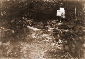
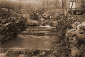
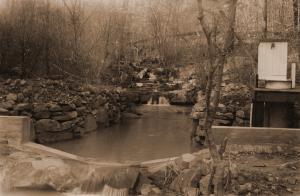
| Description: | Another view of the weir and gaging station at point #4 on East Hoover Creek, likely taken in late summer or early fall (due to leaves on trees). |
| Date: | 1941 |
| Collection: | Southern Research Station Historical Documents and Images |
| Keywords: | stream gage |
| Location: | East Hoover Creek, Irons Fork Experimental Forest, Arkansas |
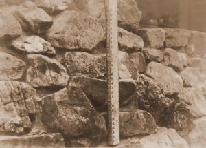
| Description: | Photograph of a hydraulic jump stick. Probably used at the weir and gaging station at point #4 on East Hoover Creek. |
| Date: | 1941 |
| Collection: | Southern Research Station Historical Documents and Images |
| Keywords: | runoff |
| Location: | East Nesbitt Creek, Irons Fork Experimental Forest, Arkansas |
| Description: | Caption reads: "Hoover-Nesbitt runoff plots 45&46. View of surface runoff plots 45&46 taken from ladder tripod below plots. Plots are located on lower contour trail in East Nesbitt Creek. Covertype--trees." |
| Date: | 11/18/1940 |
| Collection: | Southern Research Station Historical Documents and Images |
| Keywords: | runoff |
| Location: | East Nesbitt Creek, Irons Fork Experimental Forest, Arkansas |
| Description: | Caption reads: "Hoover-Nesbitt runoff plots 41&42. View of surface runoff plots 41&42 taken from ladder tripod below plots. Plots are located on lower contour trail in East Nesbitt Creek. Covertype--trees&reproduction." |
| Date: | 11/15/1940 |
| Collection: | Southern Research Station Historical Documents and Images |
| Keywords: | runoff |
| Location: | East Nesbitt Creek, Irons Fork Experimental Forest, Arkansas |
| Description: | Caption reads: "Hoover-Nesbitt runoff plots 47&48. View of surface runoff plots 47&48 taken from ladder tripod below plots. Plots are located on lower contour trail in East Nesbitt Creek. Covertype--reproduction (pine-hardwood)." |
| Date: | 10/28/1940 |
| Collection: | Southern Research Station Historical Documents and Images |
| Keywords: | runoff |
| Location: | West Hoover Creek, Irons Fork Experimental Forest, Arkansas |
| Description: | Caption reads: "Hoover-Nesbitt runoff plots 49&50. View of surface runoff plots 49&50 taken from ladder tripod below plots. Plots are located on lower contour trail in West Hoover Creek. Covertype--trees & reproduction." |
| Date: | 10/28/1940 |
| Collection: | Southern Research Station Historical Documents and Images |
| Keywords: | runoff |
| Location: | West Hoover Creek, Irons Fork Experimental Forest, Arkansas |
| Description: | Caption reads: "Hoover-Nesbitt runoff plots 51&52. View of surface runoff plots 51&52 taken from ladder tripod below plots. Plots are located on lower contour trail in West Hoover Creek. Covertype--trees." |
| Date: | 10/28/1940 |
| Collection: | Southern Research Station Historical Documents and Images |
| Keywords: | runoff |
| Location: | West Hoover Creek, Irons Fork Experimental Forest, Arkansas |
| Description: | Caption reads: "Hoover-Nesbitt runoff plots 53&54. View of surface runoff plots 53&54 taken from ladder tripod below plots. Plots are located on lower contour trail in West Hoover Creek. Covertype--reproduction." |
| Date: | 10/28/1940 |
| Collection: | Southern Research Station Historical Documents and Images |
| Keywords: | runoff |
| Location: | West Hoover Creek, Irons Fork Experimental Forest, Arkansas |
| Description: | Caption reads: "Hoover-Nesbitt runoff plots 55&56. View of surface runoff plots 55&56 taken from ladder tripod below plots. Plots are located on lower contour trail in West Hoover Creek. Covertype--open." |
| Date: | 10/28/1940 |
| Collection: | Southern Research Station Historical Documents and Images |
| Keywords: | runoff |
| Location: | East Hoover Creek, Irons Fork Experimental Forest, Arkansas |
| Description: | Caption reads: "Hoover-Nesbitt runoff plots 57&58. View of surface runoff plots 57&58 taken from ladder tripod below plots. Plots are located on lower contour trail in East Hoover Creek. Covertype--trees&reproduction." |
| Date: | 10/28/1940 |
| Collection: | Southern Research Station Historical Documents and Images |
| Keywords: | runoff |
| Location: | East Hoover Creek, Irons Fork Experimental Forest, Arkansas |
| Description: | Caption reads: "Hoover-Nesbitt runoff plots 59&60. View of surface runoff plots 59&60 taken from ladder tripod below plots. Plots are located on lower contour trail in East Hoover Creek. Covertype--trees." |
| Date: | 10/28/1940 |
| Collection: | Southern Research Station Historical Documents and Images |
| Keywords: | runoff |
| Location: | East Hoover Creek, Irons Fork Experimental Forest, Arkansas |
| Description: | Caption reads: "Hoover-Nesbitt runoff plots 61&62. View of surface runoff plots 61&62 taken from ladder tripod below plots. Plots are located on lower contour trail in East Hoover Creek. Covertype--reproduction." |
| Date: | 10/28/1940 |
| Collection: | Southern Research Station Historical Documents and Images |
| Keywords: | runoff |
| Location: | East Hoover Creek, Irons Fork Experimental Forest, Arkansas |
| Description: | Caption reads: "Hoover-Nesbitt runoff plots 63&64. View of surface runoff plots 63&64 taken from ladder tripod below plots. Plots are located on lower contour trail in East Hoover Creek. Covertype--open." |
| Date: | 10/28/1940 |
| Collection: | Southern Research Station Historical Documents and Images |
| Keywords: | runoff |
| Location: | West Hoover Creek, Irons Fork Experimental Forest, Arkansas |
| Description: | Caption reads: "Hoover-Nesbitt runoff plots 19&20. View of surface runoff plots 19&20 taken from ladder tripod below plots. Plots are located on upper contour trail in West Hoover Creek. Covertype--trees&reproduction." |
| Date: | 10/23/1940 |
| Collection: | Southern Research Station Historical Documents and Images |
| Keywords: | runoff |
| Location: | West Hoover Creek, Irons Fork Experimental Forest, Arkansas |
| Description: | Caption reads: "Hoover-Nesbitt runoff plots 21&22. View of surface runoff plots 21&22 taken from ladder tripod below plots. Plots are located on upper contour trail in West Hoover Creek. Covertype--open." |
| Date: | 10/23/1940 |
| Collection: | Southern Research Station Historical Documents and Images |
| Keywords: | runoff |
| Location: | West Hoover Creek, Irons Fork Experimental Forest, Arkansas |
| Description: | Caption reads: "Hoover-Nesbitt runoff plots 23&24. View of surface runoff plots 23&24 taken from ladder tripod below plots. Plots are located on upper contour trail in West Hoover Creek. Covertype--reproduction." |
| Date: | 10/23/1940 |
| Collection: | Southern Research Station Historical Documents and Images |
| Keywords: | runoff |
| Location: | East Hoover Creek, Irons Fork Experimental Forest, Arkansas |
| Description: | Caption reads: "Hoover-Nesbitt runoff plots 25&26. View of surface runoff plots 25&26 taken from ladder tripod below plots. Plots are located on upper contour trail in East Hoover Creek. Covertype--reproduction." |
| Date: | 10/23/1940 |
| Collection: | Southern Research Station Historical Documents and Images |
| Keywords: | runoff |
| Location: | East Hoover Creek, Irons Fork Experimental Forest, Arkansas |
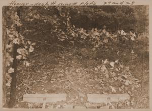
| Description: | Caption reads: "Hoover-Nesbitt runoff plots 27&28. View of surface runoff plots 27&28 taken from ladder tripod below plots. Plots are located on upper contour trail in East Hoover Creek. Covertype--trees&reproduction." |
| Date: | 10/23/1940 |
| Collection: | Southern Research Station Historical Documents and Images |
| Keywords: | runoff |
| Location: | East Hoover Creek, Irons Fork Experimental Forest, Arkansas |
| Description: | Caption reads: "Hoover-Nesbitt runoff plots 29&30. View of surface runoff plots 29&30 taken from ladder tripod below plots. Plots are located on upper contour trail in East Hoover Creek. Covertype--trees." |
| Date: | 10/23/1940 |
| Collection: | Southern Research Station Historical Documents and Images |
| Keywords: | runoff |
| Location: | East Hoover Creek, Irons Fork Experimental Forest, Arkansas |
| Description: | Caption reads: "Hoover-Nesbitt runoff plots 31&32. View of surface runoff plots 31&32 taken from ladder tripod below plots. Plots are located on upper contour trail in East Hoover Creek. Covertype--open." |
| Date: | 10/23/1940 |
| Collection: | Southern Research Station Historical Documents and Images |
| Keywords: | runoff |
| Location: | West Nesbitt Creek, Irons Fork Experimental Forest, Arkansas |
| Description: | Caption reads: "Hoover-Nesbitt runoff plots 33&34. View of surface runoff plots 33&34 taken from ladder tripod below plots. Plots are located on lower contour trail in West Nesbitt Creek. Covertype--trees and reproduction." |
| Date: | 10/23/1940 |
| Collection: | Southern Research Station Historical Documents and Images |
| Keywords: | runoff |
| Location: | West Nesbitt Creek, Irons Fork Experimental Forest, Arkansas |
| Description: | Caption reads: "Hoover-Nesbitt runoff plots 35&36. View of surface runoff plots 35&36 taken from ladder tripod below plots. Plots are located on lower contour trail in West Nesbitt Creek. Covertype--open." |
| Date: | 10/23/1940 |
| Collection: | Southern Research Station Historical Documents and Images |
| Keywords: | runoff |
| Location: | East Nesbitt Creek, Irons Fork Experimental Forest, Arkansas |
| Description: | Caption reads: "Hoover-Nesbitt runoff plots 11&12. View of surface runoff plots 11&12 taken from ladder tripod below plots. Plots are located on upper contour trail in East Nesbitt Creek. Covertype--trees&reproduction." |
| Date: | 10/22/1940 |
| Collection: | Southern Research Station Historical Documents and Images |
| Keywords: | runoff |
| Location: | East Nesbitt Creek, Irons Fork Experimental Forest, Arkansas |
| Description: | Caption reads: "Hoover-Nesbitt runoff plots 13&14. View of surface runoff plots 13&14 taken from ladder tripod below plots. Plots are located on upper contour trail in East Nesbitt Creek. Covertype--reproduction (hardwood)." |
| Date: | 10/22/1940 |
| Collection: | Southern Research Station Historical Documents and Images |
| Keywords: | runoff |
| Location: | East Nesbitt Creek, Irons Fork Experimental Forest, Arkansas |
| Description: | Caption reads: "View of surface runoff plots 15&16 taken from ladder tripod below plots. Plots are located on upper contour trail in East Nesbitt Creek. Covertype--trees." |
| Date: | 10/22/1940 |
| Collection: | Southern Research Station Historical Documents and Images |
| Keywords: | runoff |
| Location: | West Hoover Creek, Irons Fork Experimental Forest, Arkansas |
| Description: | Caption reads: "Hoover-Nesbitt runoff plots 17&18. View of surface runoff plots 17&18 taken from ladder tripod below plots. Plots are located on upper contour trail in West Hoover Creek. Covertype--trees." |
| Date: | 10/22/1940 |
| Collection: | Southern Research Station Historical Documents and Images |
| Keywords: | runoff |
| Location: | West Nesbitt Creek, Irons Fork Experimental Forest, Arkansas |
| Description: | Caption reads: "Hoover-Nesbitt runoff plots 37&38. View of surface runoff plots 37&38 taken from ladder tripod below plots. Plots are located on lower contour trail in West Nesbitt Creek. Covertype--trees." |
| Date: | 10/22/1940 |
| Collection: | Southern Research Station Historical Documents and Images |
| Keywords: | runoff |
| Location: | West Nesbitt Creek, Irons Fork Experimental Forest, Arkansas |
| Description: | Caption reads: "Hoover-Nesbitt runoff plots 39&40. View of surface runoff plots 39&40 taken from ladder tripod below plots. Plots are located on lower contour trail in West Nesbitt Creek. Covertype--reproduction." |
| Date: | 10/22/1940 |
| Collection: | Southern Research Station Historical Documents and Images |
| Keywords: | runoff |
| Location: | East Nesbitt Creek, Irons Fork Experimental Forest, Arkansas |
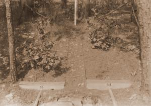
| Description: | Caption reads: "Hoover-Nesbitt runoff plots 43&44. View of surface runoff plots 43&44 taken from ladder tripod below plots. Plots are located on lower contour trail in East Nesbitt Creek. Covertype--open." |
| Date: | 10/22/1940 |
| Collection: | Southern Research Station Historical Documents and Images |
| Keywords: | dam |
| Location: | Irons Fork Experimental Forest, Arkansas |
| Description: | Caption reads: "Earthen dam, 7 ft. high and 100 ft. long, which will impound 1.25 acre feet of storm flow from a drainage area of 110 acres. Irons Fork Exp. Forest, Ark." |
| Date: | 4/10/1940 |
| Collection: | Southern Research Station Historical Documents and Images |
| Keywords: | experimental forest |
| Location: | East Hoover Creek, Irons Fork Experimental Forest, Arkansas |
| Description: | Caption reads: "Figure 1. View of watershed above Gaging Point No. 4, East Hoover Creek, taken from hillside opposite gaging point. Watershed area 194.6 acres." From "Report on the Hoover-Nesbitt Creek Watersheds, Irons Fork Experimental Forest" by Norman E. Hawes, unpublished 10 page report written on April 9, 1940. |
| Date: | Apr-40 |
| Collection: | Southern Research Station Historical Documents and Images |
| Keywords: | experimental forest |
| Location: | Irons Fork Experimental Forest, Arkansas |
| Description: | Caption reads: "Figure 2. Stream channel below junction of watersheds No. 1 and No. 2. Area above point of view approximately 400 acres." From "Report on the Hoover-Nesbitt Creek Watersheds, Irons Fork Experimental Forest" by Norman E. Hawes, unpublished 10 page report written on April 9, 1940. |
| Date: | Apr-40 |
| Collection: | Southern Research Station Historical Documents and Images |
| Keywords: |
weir stream gage |
| Location: | West Nesbitt Creek, Irons Fork Experimental Forest, Arkansas |
| Description: | Caption reads: "Figure 4. Channel above Gaging Point No. 1, West Nesbitt Creek. Watershed area 156.0 acres." From "Report on the Hoover-Nesbitt Creek Watersheds, Irons Fork Experimental Forest" by Norman E. Hawes, unpublished 10 page report written on April 9, 1940. |
| Date: | Apr-40 |
| Collection: | Southern Research Station Historical Documents and Images |
| Keywords: |
weir stream gage |
| Location: | East Nesbitt Creek, Irons Fork Experimental Forest, Arkansas |
| Description: | Caption reads: "Figure 5. Gaging Point No. 2, East Nesbitt Creek. Watershed area 107.3 acres." From "Report on the Hoover-Nesbitt Creek Watersheds, Irons Fork Experimental Forest" by Norman E. Hawes, unpublished 10 page report written on April 9, 1940. |
| Date: | Apr-40 |
| Collection: | Southern Research Station Historical Documents and Images |
| Keywords: |
weir stream gage |
| Location: | East Nesbitt Creek, Irons Fork Experimental Forest, Arkansas |
| Description: | Caption reads: "Figure 6. Channel about 700 feet above Gaging Point No. 2, East Nesbitt Creek. Watershed area 75.0 acres above this point." Photo taken by E.S. Proctor in April 1940. From "Report on the Hoover-Nesbitt Creek Watersheds, Irons Fork Experimental Forest" by Norman E. Hawes, unpublished 10 page report written on April 9, 1940. |
| Date: | Apr-40 |
| Collection: | Southern Research Station Historical Documents and Images |
| Keywords: |
weir stream gage |
| Location: | West Hoover Creek, Irons Fork Experimental Forest, Arkansas |
| Description: | Caption reads: "Figure 7. Gaging Point No. 3, West Hoover Creek. Watershed area 159.5 acres." From "Report on the Hoover-Nesbitt Creek Watersheds, Irons Fork Experimental Forest" by Norman E. Hawes, unpublished 10 page report written on April 9, 1940. |
| Date: | Apr-40 |
| Collection: | Southern Research Station Historical Documents and Images |
| Keywords: |
weir stream gage |
| Location: | West Hoover Creek, Irons Fork Experimental Forest, Arkansas |
| Description: | Caption reads: "Figure 8. Gaging Point No. 3, West Hoover Creek. Watershed area 159.5 acres." From "Report on the Hoover-Nesbitt Creek Watersheds, Irons Fork Experimental Forest" by Norman E. Hawes, unpublished 10 page report written on April 9, 1940. |
| Date: | Apr-40 |
| Collection: | Southern Research Station Historical Documents and Images |
| Keywords: |
weir stream gage |
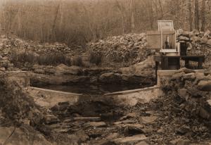
| Location: | East Hoover Creek, Irons Fork Experimental Forest, Arkansas |
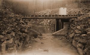
| Description: | Caption reads: "Gaging Point No. 4, East Hoover Creek. Watershed area 194.6 acres." From "Report on the Hoover-Nesbitt Creek Watersheds, Irons Fork Experimental Forest" by Norman E. Hawes, unpublished 10 page report written on April 9, 1940. |
| Date: | Apr-40 |
| Collection: | Southern Research Station Historical Documents and Images |
| Keywords: | stream |
| Location: | East Hoover Creek, Irons Fork Experimental Forest, Arkansas |
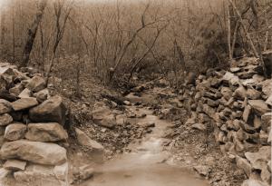
| Description: | Caption reads: "Figure 10. Channel 300 feet above Gaging Point No. 4, East Hoover Creek. Watershed area about 185 acres above this point." From "Report on the Hoover-Nesbitt Creek Watersheds, Irons Fork Experimental Forest" by Norman E. Hawes, unpublished 10 page report written on April 9, 1940. |
| Date: | Apr-40 |
| Collection: | Southern Research Station Historical Documents and Images |
| Keywords: |
weir stream gage |
| Location: | West Nesbitt Creek, Irons Fork Experimental Forest, Arkansas |
| Description: | Caption reads: "Figure 3. Gaging Point No. 1, West Nesbitt Creek. Watershed area 156.0 acres." From "Report on the Hoover-Nesbitt Creek Watersheds, Irons Fork Experimental Forest" by Norman E. Hawes, unpublished 10 page report written on April 9, 1940. |
| Date: | Mar-40 |
| Collection: | Southern Research Station Historical Documents and Images |
| Keywords: | road |
| Organisms: | shortleaf pine |
| Location: | Irons Fork Experimental Forest, Arkansas |
| Description: | Newly built road on the Irons Fork Experimental Forest. |
| Date: | circa 1940 |
| Collection: | Southern Research Station Historical Documents and Images |
| Keywords: | road |
| Organisms: | shortleaf pine |
| Location: | Irons Fork Experimental Forest, Arkansas |
| Description: | Newly built road on the Irons Fork Experimental Forest. |
| Date: | circa 1940 |
| Collection: | Southern Research Station Historical Documents and Images |
| Keywords: |
impoundment dam |
| Location: | Irons Fork Experimental Forest, Arkansas |
| Description: | Caption reads: "Impounding dams. No. 3 East Lateral, Rock Creek." |
| Date: | 12/13/1939 |
| Collection: | Southern Research Station Historical Documents and Images |
| Keywords: |
ditch water diverter |
| Location: | Irons Fork Experimental Forest, Arkansas |
| Description: | Caption reads: "Contour ditch to serve as a diversion-spreader of run-off." |
| Date: | 12/13/1939 |
| Collection: | Southern Research Station Historical Documents and Images |
| Keywords: | runoff |
| Location: | East Hoover Creek, Irons Fork Experimental Forest, Arkansas |
| Description: | Caption reads: "Plots 63 and 64 of Hoover-Nesbitt surface runoff study showing collection troughs and 23-gallon collection cans." |
| Date: | 12/10/1939 |
| Collection: | Southern Research Station Historical Documents and Images |
| Keywords: |
selective cut watershed |
| Location: | Jones Creek drainage, Irons Fork Experimental Forest, Arkansas |
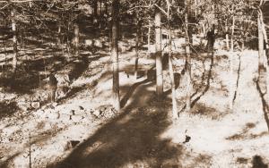
| Description: | Caption reads: "#7, Selective Watershed, Jones Creek. General view into watershed #7 before cutting. Camera faced N.E. Station on S.E. ridge of watershed. Camera Sta. #13." |
| Date: | 4/28/1939 |
| Collection: | Southern Research Station Historical Documents and Images |
| Keywords: | poletimber |
| Organisms: | shortleaf pine |
| Location: | Jones Creek drainage, Irons Fork Experimental Forest, Arkansas |
| Description: | Caption reads: "#7 Watershed, Jones Creek. General view of pole-sized stand on south slope, #7 watershed. These trees would all be taken were the watershed to be clear cut. Camera on ridge looking west. Camera Sta. #14." |
| Date: | 4/28/1939 |
| Collection: | Southern Research Station Historical Documents and Images |
| Keywords: |
selective cut watershed |
| Location: | Jones Creek drainage, Irons Fork Experimental Forest, Arkansas |
| Description: | Caption reads: "Ridge between #6 and #7 watersheds, Jones Creek. General view, #1 and #2 watersheds. Notice sharp line of demarkation [sic]: #1 selectively cut; #2 clear cut." |
| Date: | 4/28/1939 |















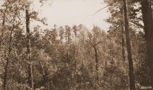

![Caption reads: "Ridge between #6 and #7 watersheds, Jones Creek. General view, #1 and #2 watersheds. Notice sharp line of demarkation [sic]: #1 selectively cut; #2 clear cut." Caption reads: "Ridge between #6 and #7 watersheds, Jones Creek. General view, #1 and #2 watersheds. Notice sharp line of demarkation [sic]: #1 selectively cut; #2 clear cut."](/rds/imagedb/images/_thm/28783.jpg)