

| imageID: | 23024 |
| Description: | Watershed Project |
| Keywords: | watershed research flooding |
| Photographer: | M. W. Talbot |
| Original collection id: | 184559 |
| Media: | Black & White Print |
| Collection: | Sierra Ancha Historical Images |
| Quality: | 3 |
| Location: | Sierra Ancha; AZ; USA |
| Date(yyyy): | 1923 |
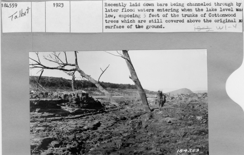
| Comments: | Recently laid down bars being channeled through by later flood waters entering when the lake level was low, exposing 5 ft of the trunks of Cottonwood trees which are still covered above the original surface of the ground. |
| Citation: | Use of this image is governed by Creative Commons CC BY. If you use the image, please include the following citation: Olberding, Susan D.; Huebner, Daniel P.; Edminster, Carleton B. 2007. Sierra Ancha Experimental Forest historical photographs. Fort Collins, CO: U.S. Department of Agriculture, Forest Service, Rocky Mountain Research Station. https://doi.org/10.2737/RDS-2007-0006 |
Your help is appreciated. If you see an image that has any inaccuracy please send a note to the Archive team. Thank you!