

| imageID: | 23183 |
| Description: | Watershed Project |
| Keywords: | grasses regeneration flooding overgrazed drainage |
| Photographer: | C. K. Cooperrider |
| Original collection id: | 235412 |
| Media: | Black & White Print |
| Collection: | Sierra Ancha Historical Images |
| Quality: | 3 |
| Location: | Tonto NF; AZ; USA |
| Date(mm/yyyy): | 11/1928 |
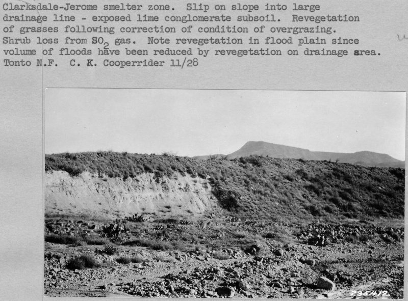
| Comments: | Clarksdale-Jerome smelter zone. Slip on slope into large drainage line-explosed lime conglomerate subsoil. Revegetation of grasses following correction of condtion of overgrazing. Shrub loss from SO2 gas. Note revegetation in flood plain since volume of floods have been reduced by revegetation on drainage area. |
| Citation: | Use of this image is governed by Creative Commons CC BY. If you use the image, please include the following citation: Olberding, Susan D.; Huebner, Daniel P.; Edminster, Carleton B. 2007. Sierra Ancha Experimental Forest historical photographs. Fort Collins, CO: U.S. Department of Agriculture, Forest Service, Rocky Mountain Research Station. https://doi.org/10.2737/RDS-2007-0006 |
Your help is appreciated. If you see an image that has any inaccuracy please send a note to the Archive team. Thank you!