

| imageID: | 24089 |
| Description: | Watershed |
| Keywords: | dam |
| Photographer: | B.A. Hendricks |
| Original collection id: | 379092 |
| Media: | Black and white print |
| Collection: | Sierra Ancha Historical Images |
| Quality: | 3 |
| Location: | Sierra Ancha; USA |
| Date(mm/dd/yyyy): | 04/17/1939 |
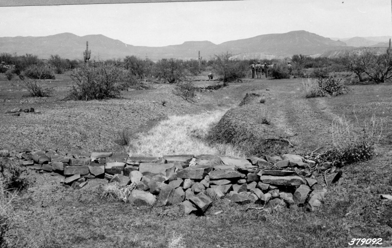
| Comments: | Revegetation of curly mesquite in bottom of gully and below loose rock dam- This type of dam holds back flow of water and allows it to percolate out gradually- Tonto rangers maybe seen in middle ground. Area fenced in 1934 on Horrel Range S.of Roosevelt Lake. |
| Citation: | Use of this image is governed by Creative Commons CC BY. If you use the image, please include the following citation: Olberding, Susan D.; Huebner, Daniel P.; Edminster, Carleton B. 2007. Sierra Ancha Experimental Forest historical photographs. Fort Collins, CO: U.S. Department of Agriculture, Forest Service, Rocky Mountain Research Station. https://doi.org/10.2737/RDS-2007-0006 |
Your help is appreciated. If you see an image that has any inaccuracy please send a note to the Archive team. Thank you!