

| imageID: | 24251 |
| Description: | Watershed Project |
| Keywords: | personnel runoff erosion storm gully |
| Photographer: | Jerry M. Johnson |
| Original collection id: | 385774 |
| Media: | Black & White Print |
| Collection: | Sierra Ancha Historical Images |
| Quality: | 3 |
| Location: | Sierra Ancha Exp Forest; AZ; USA |
| Date(mm/dd/yyyy): | 08/30/1939 |
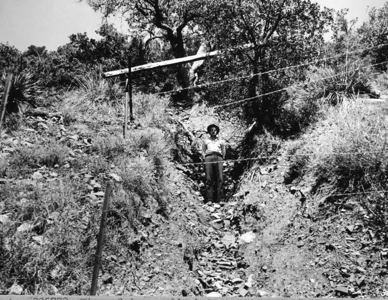
| Comments: | Similar to 385773. View of deep gully between areas 4 & 5, Steep Slpe Run-off Plots. A cow grazing on the fenced area, which includes the run-off and the space betwen, fell into this gully and later died. Gullies like these are the result of accelerated erosion following exceptional summer rain storms when flows of mud & rock originating on deteriorated area above move down the slope. |
| Citation: | Use of this image is governed by Creative Commons CC BY. If you use the image, please include the following citation: Olberding, Susan D.; Huebner, Daniel P.; Edminster, Carleton B. 2007. Sierra Ancha Experimental Forest historical photographs. Fort Collins, CO: U.S. Department of Agriculture, Forest Service, Rocky Mountain Research Station. https://doi.org/10.2737/RDS-2007-0006 |
Your help is appreciated. If you see an image that has any inaccuracy please send a note to the Archive team. Thank you!