

| imageID: | 24463 |
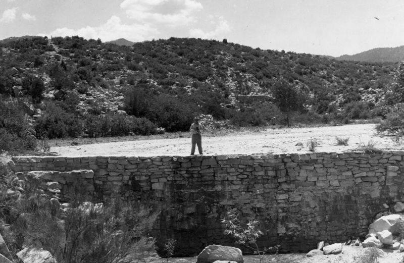
| Description: | Watershed Project |
| Keywords: | personnel watershed structures dam |
| Photographer: | B.A. Hendricks |
| Original collection id: | 421851 |
| Media: | Black & White Print |
| Collection: | Sierra Ancha Historical Images |
| Quality: | 3 |
| Location: | Crook NF; AZ; USA |
| Date(mm/dd/yyyy): | 07/30/1942 |
| Comments: | Closer view of check dam shown in 421850. Basin above operates as a sand tank. Water stored in the sand and gravel deposits seeps out slowly near the base of the dam. Dam affects deposition for a distance of 600 ft upstream from dam. Deposits at surface average about 75 ft in width. Miami Watershed. |
| Citation: | Use of this image is governed by Creative Commons CC BY. If you use the image, please include the following citation: Olberding, Susan D.; Huebner, Daniel P.; Edminster, Carleton B. 2007. Sierra Ancha Experimental Forest historical photographs. Fort Collins, CO: U.S. Department of Agriculture, Forest Service, Rocky Mountain Research Station. https://doi.org/10.2737/RDS-2007-0006 |
Your help is appreciated. If you see an image that has any inaccuracy please send a note to the Archive team. Thank you!