| Collection: | RMRS Archive Images |
| Keywords: |
map forest pathology |
| Organisms: | aspen |
| Location: | CO; United States |
| Description: | Map of Colorado with Aspen type and [aspen canker] survey plots |
| Date: | 1/1964 |
| Collection: | RMRS Archive Images |
| Keywords: |
map forest pathology |
| Location: | United States |
| Description: | Distribution of articularia brooms in the SW |
| Date: | 1/1961 |
| Collection: | RMRS Archive Images |
| Keywords: |
map forest pathology |
| Organisms: | mistletoe |
| Location: | United States |
| Description: | The known distribution of A. vaginatum f. cryptopodum on ponderosa pine by counties in the SW |
| Date: | 5/1960 |
| Collection: | RMRS Archive Images |
| Keywords: |
map forest pathology |
| Location: | CO; United States |
| Description: | Map of Colo. showing plot locations |
| Date: | 4/1960 |
| Collection: | RMRS Archive Images |
| Keywords: |
map forest pathology |
| Organisms: | mistletoe |
| Location: | Sunset Crater N.M.; AZ; USA |
| Description: | Advance of mistletoe into the Black Ash Dune Zone near Sunset Crater National Monument |
| Date: | 4/1960 |
| Collection: | RMRS Archive Images |
| Keywords: |
map forest pathology |
| Location: | CO; United States |
| Description: | Aspen decay plot distribution on Colo. |
| Date: | 9/1958 |
| Collection: | RMRS Archive Images |
| Keywords: |
map forest pathology |
| Organisms: | ponderosa pine |
| Location: | Rocky Mountains; United States |
| Description: | Ponderosa pine distribution in the Rocky Mountains |
| Date: | 2/1958 |
| Collection: | RMRS Archive Images |
| Keywords: |
map forest pathology |
| Organisms: | lodgepole pine |
| Location: | Rocky Mountains; United States |
| Description: | Lodgepole pine distribution in the Rocky Mountains |
| Date: | 2/1958 |
| Collection: | RMRS Archive Images |
| Keywords: |
map forest pathology |
| Organisms: | douglas fir |
| Location: | United States |
| Description: | Douglas fir distribution in the Rocky Mtns. |
| Date: | 2/1958 |
| Collection: | RMRS Archive Images |
| Keywords: |
map figure forest pathology |
| Organisms: | mistletoe |
| Location: | Grand Canyon N.P.; AZ |
| Description: | A stem and crown projection map of spread Plot 1 showing an infection center in an even-aged, 100 yr. old stand at Grand Canyon N.P., Ariz. |
| Date: | 1958 |
| Collection: | RMRS Archive Images |
| Keywords: |
map forest pathology |
| Organisms: | mistletoe |
| Location: | Guatemala, Mexico, and the U.S. |
| Description: | The known distribution of A. vaginatum (including cryptopodum) in Guatemala, Mexico, and the U.S. |
| Date: | 1958 |
| Collection: | RMRS Archive Images |
| Keywords: |
map DM plot forest pathology |
| Organisms: | mistletoe |
| Location: | Grand Canyon N.P. |
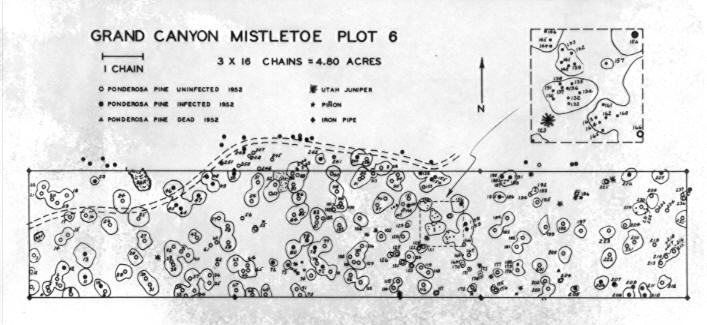
| Description: | Mistletoe survey, Grand Canyon N.P. |
| Date: | 11/20/1954 |
| Collection: | RMRS Archive Images |
| Keywords: |
map forest pathology |
| Location: | Mescalero I. R.; NM; United States |
| Description: | Mistletoe survey, map 1, survey boundary and cut-over areas |
| Date: | 2/26/1954 |
| Collection: | RMRS Archive Images |
| Keywords: |
map forest pathology |
| Location: | Mescalero I. R.; NM; United States |
| Description: | Mistletoe survey, map 2, percent of forest area with ponderosa pine mistletoe |
| Date: | 2/26/1954 |
| Collection: | RMRS Archive Images |
| Keywords: |
map forest pathology |
| Location: | Mescalero I. R.; NM; United States |
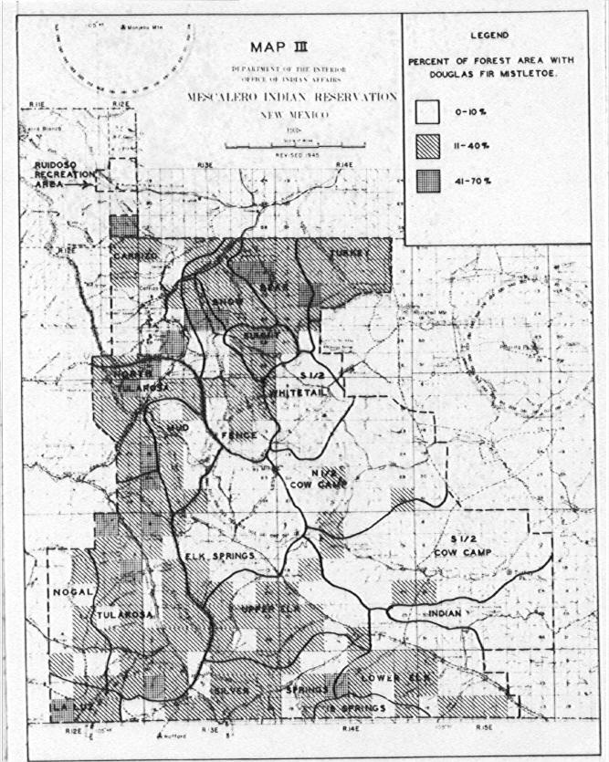
| Description: | Mistletoe survey, map 3, percent of forest area with douglas fir mistletoe |
| Date: | 2/26/1954 |
| Collection: | RMRS Archive Images |
| Keywords: |
map forest pathology |
| Organisms: | mistletoe |
| Location: | Mescalero I. R.; NM; United States |
| Description: | Stem map of plot No. 2 |
| Date: | 10/25/1953 |
| Collection: | RMRS Archive Images |
| Keywords: |
map forest pathology |
| Organisms: | mistletoe |
| Location: | Mescalero I. R.; NM; United States |
| Description: | Stem map of plot No. 1 |
| Date: | 10/25/1953 |
| Collection: | RMRS Archive Images |
| Keywords: |
map forest pathology |
| Location: | United States |
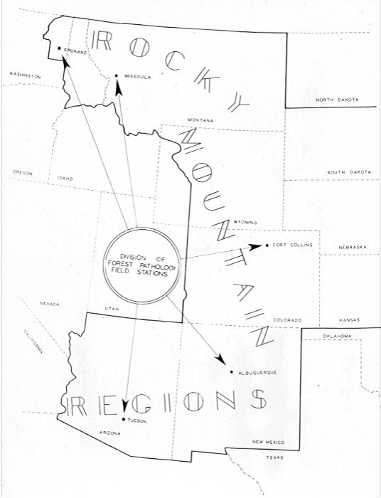
| Description: | F.S. regions 1,2,3 map used in report. |
| Date: | 4/1952 |
| Collection: | RMRS Archive Images |
| Keywords: |
map forest pathology |
| Organisms: | mistletoe |
| Location: | Wing Mountain; AZ |
| Description: | Wing Mountian Study, Plot 3B. Distribution of trees and mistletoe in 1941 |
| Date: | 1951 |
| Collection: | RMRS Archive Images |
| Keywords: |
map mistletoe control project DM plot forest pathology |
| Location: | Grand Canyon N.P.; AZ; United States |
| Description: | Mistletoe survey, plot 5 |
| Date: | 1951 |

![Map of Colorado with Aspen type and [aspen canker] survey plots Map of Colorado with Aspen type and [aspen canker] survey plots](/rds/imagedb/images/18249.jpg)


