


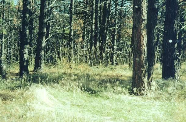
| Collection: | RMRS Archive Images |
| Location: | Arthur's Rock; CO; United States |
| Description: | Vegetation investigation. Arthur's Rock. Plot#1. Northwest corner to East. F-8. Plot established Sept. 1974 |
| Date: | 11/3/1976 |
| Collection: | RMRS Archive Images |
| Location: | Arthur's Rock; CO; United States |
| Description: | Vegetation investigation. Arthur's Rock. Plot-1. Northwest corner to East. F-6.5. Plot established Sept. 1974 |
| Date: | 11/3/1976 |

| Collection: | RMRS Archive Images |
| Location: | Arthur's Rock; CO; United States |
| Description: | Vegetation investigation. Arthur's Rock. Plot-1. North to South. F-8. Plot established Sept. 1974 |
| Date: | 11/3/1976 |

| Collection: | RMRS Archive Images |
| Location: | Arthur's Rock; CO; United States |
| Description: | Vegetation investigation. Arthur's Rock. Plot-1. North to South. F-6.5. Plot established Sept. 1974 |
| Date: | 11/3/1976 |

| Collection: | RMRS Archive Images |
| Location: | Arthur's Rock; CO; United States |
| Description: | Vegetation investigation. Arthur's Rock. Plot-2. North to South. F-6. Plot established Sept. 1974 |
| Date: | 11/3/1976 |

| Collection: | RMRS Archive Images |
| Location: | Arthur's Rock; CO; United States |
| Description: | Vegetation investigation. Arthur's Rock. Plot-2. North to South. F-5.6. Plot established Sept. 1974 |
| Date: | 11/3/1976 |

| Collection: | RMRS Archive Images |
| Location: | Arthur's Rock; CO; United States |
| Description: | Vegetation investigation. Arthur's Rock. Plot-2. North to South. F-6. Plot established Sept. 1974 |
| Date: | 11/3/1976 |

| Collection: | RMRS Archive Images |
| Location: | Arthur's Rock; CO; United States |
| Description: | Vegetation investigation. Arthur's Rock. Plot-4. North to South. F-8. Plot established Sept. 1974 |
| Date: | 11/3/1976 |

| Collection: | RMRS Archive Images |
| Location: | Arthur's Rock; CO; United States |
| Description: | Vegetation investigation. Arthur's Rock. Plot-4. North to South. F-6.5. Plot established Sept. 1974 |
| Date: | 11/3/1976 |

| Collection: | RMRS Archive Images |
| Location: | Arthur's Rock; CO; United States |
| Description: | Vegetation investigation. Arthur's Rock. Plot-4. North to South. F-8. Plot established Sept. 1974 |
| Date: | 11/3/1976 |

| Collection: | RMRS Archive Images |
| Location: | Arthur's Rock; CO; United States |
| Description: | Vegetation investigation. Arthur's Rock. Plot-2. North to South. F-5.6. Plot established Sept. 1974 |
| Date: | 11/3/1976 |

| Collection: | RMRS Archive Images |
| Location: | Arthur's Rock; CO; United States |
| Description: | Vegetation investigation. Arthur's Rock. Plot-3. South to North . F-5.6. Plot established Sept. 1974 |
| Date: | 11/3/1976 |

| Collection: | RMRS Archive Images |
| Location: | Arthur's Rock; CO; United States |
| Description: | Vegetation investigation. Arthur's Rock. Plot-3. South to North. F-5. Plot established Sept. 1974 |
| Date: | 11/3/1976 |

| Collection: | RMRS Archive Images |
| Location: | Arthur's Rock; CO; United States |
| Description: | Vegetation investigation. Arthur's Rock. Plot-3. South to North. F-6. Plot established Sept. 1974 |
| Date: | 11/3/1976 |

| Collection: | RMRS Archive Images |
| Location: | Arthur's Rock; CO; United States |
| Description: | Vegetation investigation. Arthur's Rock. Plot-3. South to North. F-5.6. Plot established Sept. 1974 |
| Date: | 11/3/1976 |

| Collection: | RMRS Archive Images |
| Location: | Arthur's Rock; CO; United States |
| Description: | Vegetation investigation. Arthur's Rock. Plot-3. Southwest to Northeast @ mid-plot. F-6. Plot established Sept. 1974 |
| Date: | 11/3/1976 |

| Collection: | RMRS Archive Images |
| Keywords: | watershed management |
| Organisms: | ponderosa pine |
| Location: | Beaver Creek; AZ; United States |
| Description: | oak mixed with pine |
| Date: | 11/1976 |

| Collection: | RMRS Archive Images |
| Keywords: | watershed management |
| Location: | Beaver Creek; AZ; United States |
| Description: | Livestock: Specific Studies |
| Date: | 11/1976 |

| Collection: | RMRS Archive Images |
| Keywords: | watershed management |
| Organisms: | ponderosa pine |
| Location: | Beaver Creek; AZ; United States |
| Description: | Not Available |
| Date: | 10/1976 |

| Collection: | RMRS Archive Images |
| Keywords: | watershed management |
| Organisms: | pinyon-juniper |
| Location: | Beaver Creek; AZ; United States |
| Description: | Utah Juniper in Arizona |
| Date: | 10/1976 |