| Collection: | Fort Valley Experimental Forest historical photographs |
| Keywords: |
forest stand sample plot |
| Location: | Fort Valley Exp. Forest; AZ; USA |
| Description: | Coc S2 PSP |
| Date: | 1995 |
| Collection: | Fort Valley Experimental Forest historical photographs |
| Keywords: |
forest stand study |
| Location: | Fort Valley Experimental Forest; AZ; USA |
| Description: | Taylor Woods, northwest corner of Subplot 6. |
| Date: | 06/1983 |
| Collection: | Sierra Ancha Historical Images |
| Keywords: |
forest stand fire-effects |
| Location: | Sierra Ancha Experimental Forest; AZ; USA |
| Description: | Results of prescribed burning |
| Date: | 12/24/1969 |
| Collection: | Sierra Ancha Historical Images |
| Keywords: |
forest stand fire-effects |
| Location: | Sierra Ancha Experimental Forest; AZ; USA |
| Description: | View of stand after prescribed burn |
| Date: | 12/24/1969 |
| Collection: | Sierra Ancha Historical Images |
| Keywords: |
forest stand fire-effects |
| Location: | Sierra Ancha Experimental Forest; AZ; USA |
| Description: | Conditions after prescribed burning |
| Date: | 12/24/1969 |
| Collection: | Fort Valley Experimental Forest historical photographs |
| Keywords: |
logging snow forest stand |
| Location: | Apache NF; AZ; USA |
| Description: | Looking WSW in clearcut blocks east of Reno lookout road. East of main draw about 100 yards up slope on old logging road. |
| Date: | 03/15/1967 |
| Collection: | Fort Valley Experimental Forest historical photographs |
| Keywords: |
snow cleared plots forest stand study |
| Location: | Apache NF; AZ; USA |
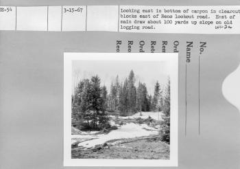
| Description: | Looking East in bottom of canyon in clearcut blocks east of Reno lookout road. East of main draw about 100 yards up slope on old logging road. |
| Date: | 03/15/1967 |
| Collection: | Sierra Ancha Historical Images |
| Keywords: |
snow forest stand study |
| Location: | Apache NF; AZ; USA |
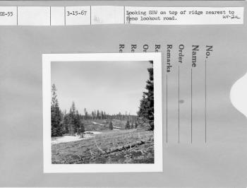
| Description: | Looking SSW on top of ridge nearest to Reno lookout rd. |
| Date: | 03/15/1967 |
| Collection: | Sierra Ancha Historical Images |
| Keywords: |
logging forest stand |
| Location: | Apache NF; AZ; USA |
| Description: | Looking east on top of ridge nearest to Reno lookout rd. |
| Date: | 03/15/1967 |
| Collection: | Fort Valley Experimental Forest historical photographs |
| Keywords: |
snow forest stand |
| Location: | Hannagan Meadow; AZ; USA |
| Description: | North of Hannagan Meadow lodge looking SSW through Hannagan Meadow. |
| Date: | 03/15/1967 |
| Collection: | Sierra Ancha Historical Images |
| Keywords: |
forest stand study |
| Location: | Apache NF; AZ; USA |
| Description: | Repeat of EE-47 only at a later date. |
| Date: | 03/15/1967 |
| Collection: | Sierra Ancha Historical Images |
| Keywords: |
forest stand study |
| Location: | Apache NF; AZ; USA |
| Description: | Repeat of EE-48 only at a later date |
| Date: | 03/15/1967 |
| Collection: | Sierra Ancha Historical Images |
| Keywords: |
snow forest stand study |
| Location: | Apache NF; AZ; USA |
| Description: | Repeat of EE-49 only at a later date |
| Date: | 03/15/1967 |
| Collection: | Sierra Ancha Historical Images |
| Keywords: |
forest stand study |
| Location: | Apache NF; AZ; USA |
| Description: | Repeat of EE-50 only at a later date. |
| Date: | 03/15/1967 |
| Collection: | Fort Valley Experimental Forest historical photographs |
| Keywords: |
snow forest stand study |
| Location: | Apache NF; AZ; USA |
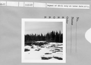
| Description: | Repeat of EE-51 only at a later date. |
| Date: | 03/15/1967 |
| Collection: | Fort Valley Experimental Forest historical photographs |
| Keywords: |
snow forest stand study |
| Location: | Apache NF; AZ; USA |
| Description: | Repeat of EE-52 only at a later date. |
| Date: | 03/15/1967 |
| Collection: | Fort Valley Experimental Forest historical photographs |
| Keywords: |
forest stand study |
| Location: | Apache NF; AZ; USA |
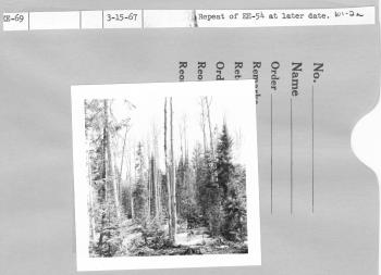
| Description: | Repeat of EE-54 at a later date |
| Date: | 03/15/1967 |
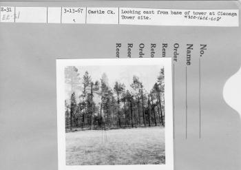
| Collection: | Fort Valley Experimental Forest historical photographs |
| Keywords: | forest stand |
| Location: | Castle Creek; AZ; USA |
| Description: | Looking east from base of tower at cienaga tower site. |
| Date: | 03/13/1967 |
| Collection: | Fort Valley Experimental Forest historical photographs |
| Keywords: |
cleared plots forest stand study |
| Location: | Castle Creek; AZ; USA |
| Description: | Looking east from recording rain gage. Clearcut plot. |
| Date: | 03/13/1967 |
| Collection: | Fort Valley Experimental Forest historical photographs |
| Keywords: |
grasses forest stand |
| Location: | Castle Creek; AZ; USA |
| Description: | Looking north from base of tower Forest study site. |
| Date: | 03/13/1967 |
| Collection: | Sierra Ancha Historical Images |
| Keywords: | forest stand |
| Location: | Castle Creek; AZ; USA |
| Description: | Looking west at Power line that crosses highway between Campbell and Castle Creek. |
| Date: | 03/13/1967 |
| Collection: | Sierra Ancha Historical Images |
| Keywords: |
forest stand fire-effects |
| Location: | Workman Creek; AZ; USA |
| Description: | South Fork- Residual stand near streambed left after 1966 logging. |
| Date: | 01/31/1967 |
| Collection: | Fort Valley Experimental Forest historical photographs |
| Keywords: | forest stand |
| Location: | Workman Creek; AZ; USA |
| Description: | Workman Ck. South Fork. |
| Date: | 11/1966 |
| Collection: | Fort Valley Experimental Forest historical photographs |
| Keywords: | forest stand |
| Location: | Workman Creek; AZ; USA |
| Description: | Workman Ck. South Fork. |
| Date: | 11/1966 |
| Collection: | Fort Valley Experimental Forest historical photographs |
| Keywords: |
forest stand watershed |
| Location: | Willow Creek; AZ; USA |
| Description: | East Fork Willow Creek |
| Date: | 10/1965 |
| Collection: | Fort Valley Experimental Forest historical photographs |
| Keywords: |
forest stand watershed |
| Location: | Thomas Creek; AZ; USA |
| Description: | North Fork Thomas Creek |
| Date: | 10/1965 |
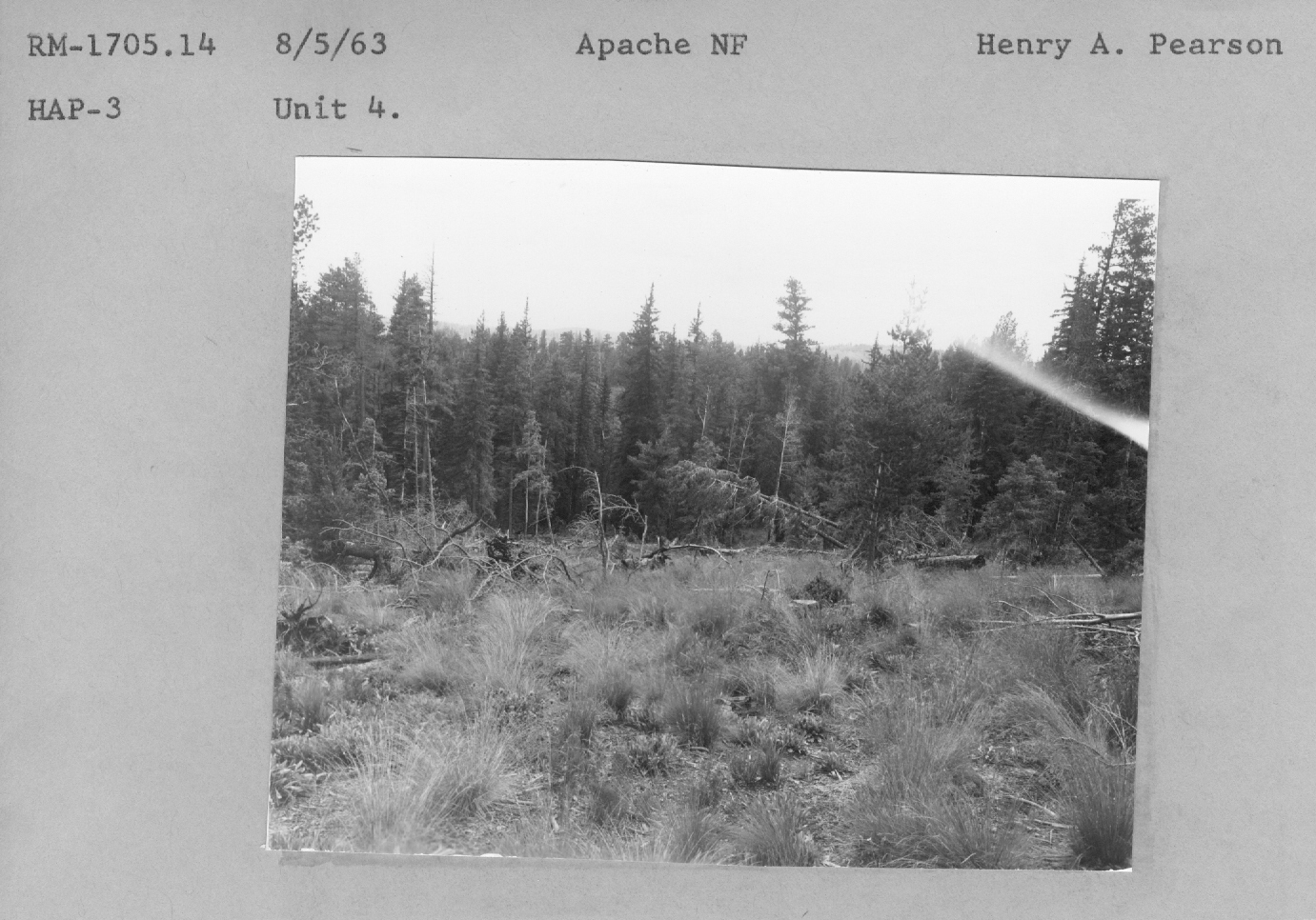
| Collection: | Fort Valley Experimental Forest historical photographs |
| Keywords: |
forest stand study |
| Location: | Apache National Forest; AZ; USA |
| Description: | Unit 4 RM- 1705.14 |
| Date: | 08/05/1963 |
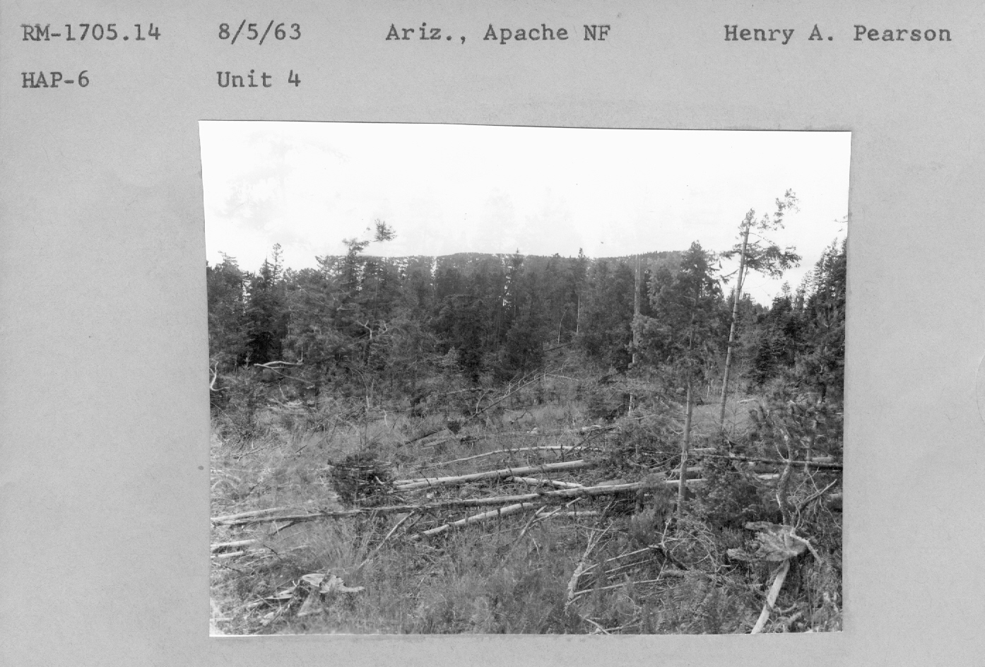
| Collection: | Fort Valley Experimental Forest historical photographs |
| Keywords: |
forest stand study |
| Location: | Apache National Forest; AZ; USA |
| Description: | Unit 4 RM- 1705.14 |
| Date: | 08/05/1963 |
| Collection: | Fort Valley Experimental Forest historical photographs |
| Keywords: |
forest stand study |
| Location: | Apache National Forest; AZ; USA |
| Description: | Unit 4 RM- 1705.14 |
| Date: | 08/05/1963 |
| Collection: | Fort Valley Experimental Forest historical photographs |
| Keywords: |
forest stand range study |
| Location: | Apache National Forest; AZ; USA |
| Description: | forest/range study plot |
| Date: | 08/05/1963 |
| Collection: | Fort Valley Experimental Forest historical photographs |
| Keywords: |
forest stand range study |
| Location: | Apache National Forest; AZ; USA |
| Description: | forest/range study plot |
| Date: | 08/05/1963 |
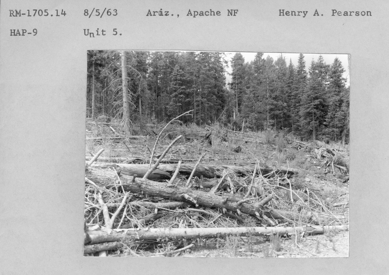
| Collection: | Fort Valley Experimental Forest historical photographs |
| Keywords: |
forest stand range study |
| Location: | Apache National Forest; AZ; USA |
| Description: | Unit 5. RM- 1705.14 |
| Date: | 08/05/1963 |
| Collection: | Fort Valley Experimental Forest historical photographs |
| Keywords: |
forest stand range study |
| Location: | Apache National Forest; AZ; USA |
| Description: | Unit 5. RM- 1705.14 |
| Date: | 08/05/1963 |
| Collection: | Fort Valley Experimental Forest historical photographs |
| Keywords: |
logging forest stand study |
| Location: | Apache National Forest; AZ; USA |
| Description: | logging on a plot |
| Date: | 08/05/1963 |
| Collection: | Fort Valley Experimental Forest historical photographs |
| Keywords: |
forest stand study |
| Location: | Apache National Forest; AZ; USA |
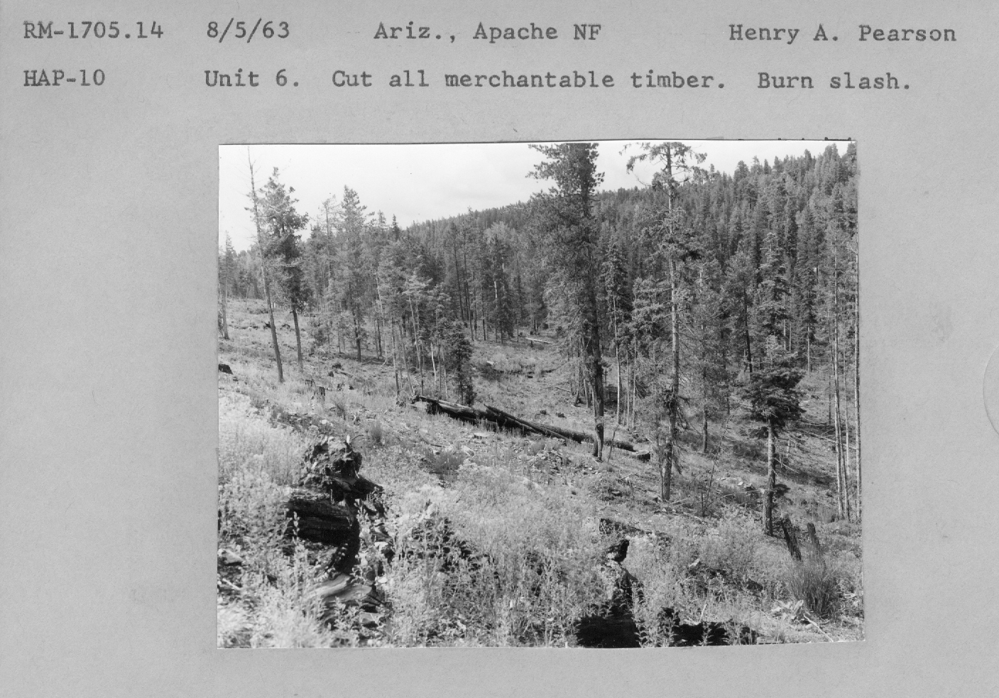
| Description: | Unit 6 RM- 1705.14 |
| Date: | 08/05/1963 |
| Collection: | Fort Valley Experimental Forest historical photographs |
| Keywords: |
forest stand range study |
| Location: | Apache National Forest; AZ; USA |
| Description: | Unit 7.Pteridium in burned strip. |
| Date: | 08/05/1963 |
| Collection: | Fort Valley Experimental Forest historical photographs |
| Keywords: | forest stand |
| Location: | Apache National Forest; AZ; u |
| Description: | Unit 9. Untreated. RM-1705.14 |
| Date: | 08/05/1963 |
| Collection: | Fort Valley Experimental Forest historical photographs |
| Keywords: |
forest stand study |
| Location: | Apache National Forest; AZ; USA |
| Description: | Unit 9. Untreated. RM-1705.14 |
| Date: | 08/05/1963 |
| Collection: | Fort Valley Experimental Forest historical photographs |
| Keywords: | forest stand |
| Organisms: | mistletoe |
| Location: | Fort Valley Exp. Forest; AZ; USA |
| Description: | MRS plot 1A. Repeat of H-85 (468052). P.P. 4A. 65.7' E of corner line acre plot 19 looking S19 degrees E. One tag--infected. |
| Date: | 10/22/1955 |
| Collection: | Fort Valley Experimental Forest historical photographs |
| Keywords: | forest stand |
| Location: | Fort Valley Exp. Forest; AZ; USA |
| Description: | MRS plot 4A. Repeat of H-106 (468073). P.P. 15A. 34.4' S 66 degrees of W 1/4 cor of line acre no. 38 looking N80 degrees W. One tag--infected. |
| Date: | 06/24/1955 |
| Collection: | Fort Valley Experimental Forest historical photographs |
| Keywords: | forest stand |
| Location: | Fort Valley Exp. Forest; AZ; USA |
| Description: | MRS plot 5B. Repeat of H-115 (468082). P.P. 13A, 13.2'S 58 degrees E of SE corner of line acre no. 45 looking S 69degrees W. Note windfalls. |
| Date: | 06/24/1955 |
| Collection: | Fort Valley Experimental Forest historical photographs |
| Keywords: | forest stand |
| Location: | Fort Valley Exp. Forest; AZ; USA |
| Description: | MRS plot 5B. Repeat of H-116 (468083). P.P. 14A, 92.8' S 4 degrees E of SE corner of line acre no. 44 looking S 46degrees W. One tag--infected. |
| Date: | 06/24/1955 |
| Collection: | Fort Valley Experimental Forest historical photographs |
| Keywords: | forest stand |
| Location: | Fort Valley Exp. Forest; AZ; USA |
| Description: | MRS plot 6C. Repeat of H-120 (468087). P.P. 11N. Center of line acre No. 35 looking N 32 degrees W. |
| Date: | 06/24/1955 |
| Collection: | Fort Valley Experimental Forest historical photographs |
| Keywords: | forest stand |
| Location: | Fort Valley Exp. Forest; AZ; USA |
| Description: | MRS plot 6C. Repeat of H-121 (468088). P.P. 10N. 6.3'W of SE cor. of line acre No. 35 looking N 1 degree E. One tag--infected. Two tags--dead. |
| Date: | 06/24/1955 |
| Collection: | Fort Valley Experimental Forest historical photographs |
| Keywords: | forest stand |
| Location: | Fort Valley Exp. Forest; AZ; USA |
| Description: | MRS plot 6C. Repeat of H-123 (468090). P.P. 12N. 35.4' S 85 degrees E of SW cor. of line acre No. 46 looking N. |
| Date: | 06/24/1955 |
| Collection: | Fort Valley Experimental Forest historical photographs |
| Keywords: | forest stand |
| Location: | Fort Valley Exp. Forest; AZ; USA |
| Description: | MRS plot 7B. Repeat of H-125 (468092). P.P. 16N 75.5' S 39 Degrees E of center of line acre No. 33 looking N45 Degrees W. One tag--infected. Saplings in right background severly infected. |
| Date: | 06/24/1955 |
| Collection: | Fort Valley Experimental Forest historical photographs |
| Keywords: | forest stand |
| Location: | Fort Valley Exp. Forest; AZ; USA |
| Description: | MRS plot 8A. Repeat of H-133 (468100). P.P. 13N, 4' W of NW cor. of line acre No. 75 looking N28 degrees W. |
| Date: | 06/24/1955 |
| Collection: | Fort Valley Experimental Forest historical photographs |
| Keywords: | forest stand |
| Location: | Fort Valley Exp. Forest; AZ; USA |
| Description: | MRS plot 8A. Repeat of H-134 (468101). P.P. 15N, 21.3' S 52 degrees E of S 1/4 cor. of line acre No. 75 looking N20 degrees W. |
| Date: | 06/24/1955 |
| Collection: | Fort Valley Experimental Forest historical photographs |
| Keywords: | forest stand |
| Location: | Fort Valley Exp. Forest; AZ; USA |
| Description: | MRS plot 8A. Repeat of H-135 (468102). P.P. 14N, 27.8' N 6 degrees E of center of line acre No. 75 looking N33 degrees W. One tag--infected. |
| Date: | 06/24/1955 |
| Collection: | Fort Valley Experimental Forest historical photographs |
| Keywords: | forest stand |
| Location: | Fort Valley Exp. Forest; AZ; USA |
| Description: | MRS plot 3B. Repeat of H-96 (468063). P.P. 13P. Center of line acre No. 15 looking S48 degrees E. One tag--infected. Note windfall. Note single infected pole to right rear of yellow pine. |
| Date: | 06/23/1955 |


