| Collection: | Southern Research Station Historical Documents and Images |
| Keywords: |
weir stream gage |
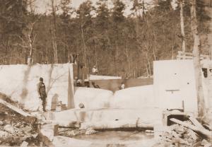
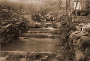
| Location: | West Nesbitt Creek, Irons Fork Experimental Forest, Arkansas |
| Description: | Caption reads: "A modified Columbus deep-notch weir and approach basis under construction on West Nesbitt Creek." |
| Date: | Mar-42 |
| Collection: | Southern Research Station Historical Documents and Images |
| Keywords: |
weir stream gage |
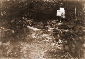
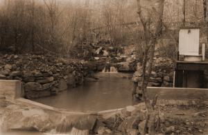
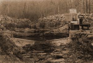
| Location: | East Hoover Creek, Irons Fork Experimental Forest, Arkansas |
| Description: | Another view of the weir and gaging station at point #4 on East Hoover Creek, likely taken in late summer or early fall (due to leaves on trees). |
| Date: | 1941 |
| Collection: | Southern Research Station Historical Documents and Images |
| Keywords: |
weir stream gage |
| Location: | West Nesbitt Creek, Irons Fork Experimental Forest, Arkansas |
| Description: | Caption reads: "Figure 4. Channel above Gaging Point No. 1, West Nesbitt Creek. Watershed area 156.0 acres." From "Report on the Hoover-Nesbitt Creek Watersheds, Irons Fork Experimental Forest" by Norman E. Hawes, unpublished 10 page report written on April 9, 1940. |
| Date: | Apr-40 |
| Collection: | Southern Research Station Historical Documents and Images |
| Keywords: |
weir stream gage |
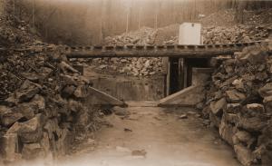
| Location: | East Nesbitt Creek, Irons Fork Experimental Forest, Arkansas |
| Description: | Caption reads: "Figure 5. Gaging Point No. 2, East Nesbitt Creek. Watershed area 107.3 acres." From "Report on the Hoover-Nesbitt Creek Watersheds, Irons Fork Experimental Forest" by Norman E. Hawes, unpublished 10 page report written on April 9, 1940. |
| Date: | Apr-40 |
| Collection: | Southern Research Station Historical Documents and Images |
| Keywords: |
weir stream gage |
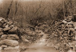
| Location: | East Nesbitt Creek, Irons Fork Experimental Forest, Arkansas |
| Description: | Caption reads: "Figure 6. Channel about 700 feet above Gaging Point No. 2, East Nesbitt Creek. Watershed area 75.0 acres above this point." Photo taken by E.S. Proctor in April 1940. From "Report on the Hoover-Nesbitt Creek Watersheds, Irons Fork Experimental Forest" by Norman E. Hawes, unpublished 10 page report written on April 9, 1940. |
| Date: | Apr-40 |
| Collection: | Southern Research Station Historical Documents and Images |
| Keywords: |
weir stream gage |
| Location: | West Hoover Creek, Irons Fork Experimental Forest, Arkansas |
| Description: | Caption reads: "Figure 7. Gaging Point No. 3, West Hoover Creek. Watershed area 159.5 acres." From "Report on the Hoover-Nesbitt Creek Watersheds, Irons Fork Experimental Forest" by Norman E. Hawes, unpublished 10 page report written on April 9, 1940. |
| Date: | Apr-40 |
| Collection: | Southern Research Station Historical Documents and Images |
| Keywords: |
weir stream gage |
| Location: | West Hoover Creek, Irons Fork Experimental Forest, Arkansas |
| Description: | Caption reads: "Figure 8. Gaging Point No. 3, West Hoover Creek. Watershed area 159.5 acres." From "Report on the Hoover-Nesbitt Creek Watersheds, Irons Fork Experimental Forest" by Norman E. Hawes, unpublished 10 page report written on April 9, 1940. |
| Date: | Apr-40 |
| Collection: | Southern Research Station Historical Documents and Images |
| Keywords: |
weir stream gage |
| Location: | East Hoover Creek, Irons Fork Experimental Forest, Arkansas |
| Description: | Caption reads: "Gaging Point No. 4, East Hoover Creek. Watershed area 194.6 acres." From "Report on the Hoover-Nesbitt Creek Watersheds, Irons Fork Experimental Forest" by Norman E. Hawes, unpublished 10 page report written on April 9, 1940. |
| Date: | Apr-40 |
| Collection: | Southern Research Station Historical Documents and Images |
| Keywords: |
weir stream gage |
| Location: | West Nesbitt Creek, Irons Fork Experimental Forest, Arkansas |
| Description: | Caption reads: "Figure 3. Gaging Point No. 1, West Nesbitt Creek. Watershed area 156.0 acres." From "Report on the Hoover-Nesbitt Creek Watersheds, Irons Fork Experimental Forest" by Norman E. Hawes, unpublished 10 page report written on April 9, 1940. |
| Date: | Mar-40 |

