| Collection: | Pacific Northwest Research Station, Alaska Image Archive |
| Keywords: |
forest mensuration increment development and structure of stands surveying and mapping |
| Location: | Alaska; Prince of Wales Island; Karta Bay |
| Description: | Plot #1, from the west side of the center 1/10th acre plot. Note presence of reprod. where stand is more open (2/3 Basal Area). |
| Date: | 4/28/1966 |
| Collection: | Pacific Northwest Research Station, Alaska Image Archive |
| Keywords: |
forest mensuration increment development and structure of stands surveying and mapping |
| Location: | Alaska; Prince of Wales Island; Karta Bay |
| Description: | Plot #1. Looking south from the north end of the center 1/10th acre plot (2/3 Basal Area). |
| Date: | 4/28/1966 |
| Collection: | Pacific Northwest Research Station, Alaska Image Archive |
| Keywords: |
forest mensuration increment development and structure of stands surveying and mapping |
| Location: | Alaska; Prince of Wales Island; Karta Bay |
| Description: | Plot #2. Looking northeast from corner 1 of center 1/10th acre plot (control plot). |
| Date: | 4/28/1966 |
| Collection: | Pacific Northwest Research Station, Alaska Image Archive |
| Keywords: |
forest mensuration increment development and structure of stands general matters (including sampling methods in increment determination) |
| Location: | Alaska; Admiralty Island; Whitewater Bay |
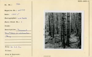
| Description: | Permanent Plot #302 at Whitewater Bay. Photo point: 1. |
| Date: | 1966 |
| Collection: | Pacific Northwest Research Station, Alaska Image Archive |
| Keywords: |
forest mensuration increment development and structure of stands general matters (including sampling methods in increment determination) |
| Location: | Alaska; Revillagigedo Island; Traitors Cove; Virgin Bay |
| Description: | Plot #334, Virgin Bay. |
| Date: | 1964 |
| Collection: | Pacific Northwest Research Station, Alaska Image Archive |
| Keywords: |
forest mensuration increment development and structure of stands surveying and mapping |
| Location: | Alaska; Revillagigedo Island; Traitors Cove; Virgin Bay |
| Description: | Virgin Bay P.P. # 332, est.7-26-63. Lower Plot. Photo point: 1. |
| Date: | 7/26/1963 |
| Collection: | Pacific Northwest Research Station, Alaska Image Archive |
| Keywords: |
forest mensuration increment development and structure of stands surveying and mapping |
| Location: | Alaska; Revillagigedo Island; Traitors Cove; Virgin Bay |
| Description: | Virgin Bay P.P. # 333, established 7-26-63. Mid Plot. |
| Date: | 7/26/1963 |
| Collection: | Pacific Northwest Research Station, Alaska Image Archive |
| Keywords: |
forest mensuration increment development and structure of stands surveying and mapping |
| Location: | Alaska; Revillagigedo Island; Traitors Cove; Virgin Bay |
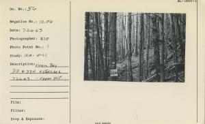
| Description: | Virgin Bay P.P. # 334, established 7-26-63. Upper Plot. |
| Date: | 7/26/1963 |
| Collection: | Pacific Northwest Research Station, Alaska Image Archive |
| Keywords: |
forest mensuration increment development and structure of stands surveying and mapping |
| Location: | Alaska; Tuxekan Passage |
| Description: | Plot 300 Tuxekan Pass Growth Plot outside plot toward water. John Tallmadge. |
| Date: | 8/11/1961 |
| Collection: | Pacific Northwest Research Station, Alaska Image Archive |
| Keywords: |
forest mensuration increment development and structure of stands surveying and mapping |
| Location: | Alaska; Tuxekan Passage |
| Description: | Plot 300 Tuxekan Pass Growth Plot. From camera point #2(1141). |
| Date: | 8/11/1961 |


