


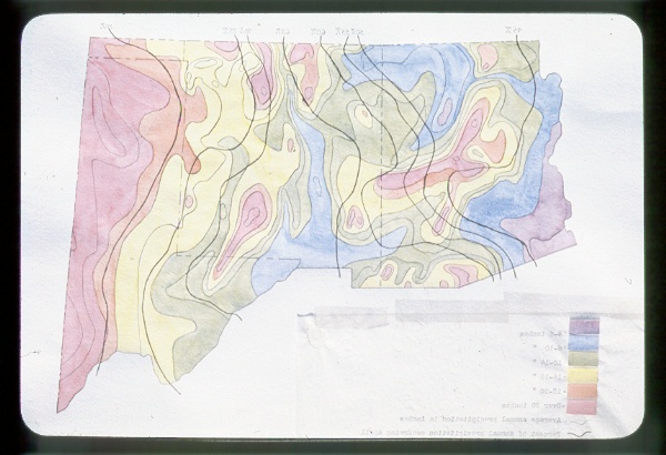
| Collection: | Penobscot Experimental Forest Historical Photo Archive |
| Keywords: |
Study 58 thinning map |
| Location: | Penobscot Experimental Forest; Maine |
| Description: | Study 58 layout |
| Date: | 1970s |

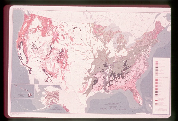
| Collection: | RMRS Archive Images |
| Keywords: |
map watershed management |
| Location: | AZ; United States |
| Description: | High water yield areas in AZ |
| Date: | 1970 |

| Collection: | RMRS Archive Images |
| Keywords: |
map watershed management |
| Location: | Beaver Creek; AZ; United States |
| Description: | Salt-Verde River Basin |
| Date: | 1970 |

| Collection: | RMRS Archive Images |
| Keywords: |
map watershed management |
| Location: | Beaver Creek; AZ; United States |
| Description: | Pilot Watersheds on Beaver Creek, Arizona |
| Date: | 1970 |

| Collection: | RMRS Archive Images |
| Keywords: |
map watershed management |
| Location: | Beaver Creek; AZ; United States |
| Description: | Not Available |
| Date: | 1970 |

| Collection: | RMRS Archive Images |
| Keywords: |
map watershed management |
| Location: | Beaver Creek; AZ; United States |
| Description: | Not Available |
| Date: | 1970 |

| Collection: | RMRS Archive Images |
| Keywords: |
map watershed management |
| Location: | Beaver Creek; AZ; United States |
| Description: | Vegetation Types on Woods Canyon, Arizona |
| Date: | 1970 |

| Collection: | RMRS Archive Images |
| Keywords: |
map watershed management |
| Location: | Beaver Creek; AZ; United States |
| Description: | Not Available |
| Date: | 1970 |

| Collection: | RMRS Archive Images |
| Keywords: |
map watershed management |
| Location: | Beaver Creek; AZ; United States |
| Description: | Not Available |
| Date: | 1970 |
| Collection: | RMRS Archive Images |
| Keywords: |
map watershed management |
| Location: | United States |
| Description: | Not Available |
| Date: | 1970 |

| Collection: | RMRS Archive Images |
| Keywords: |
map watershed management |
| Location: | White Mountains; AZ; United States |
| Description: | Apache-Sitgreaves N.F. |
| Date: | 1970 |

| Collection: | RMRS Archive Images |
| Keywords: |
map watershed management |
| Location: | Beaver Creek; AZ; United States |
| Description: | Not Available |
| Date: | 1970 |

| Collection: | RMRS Archive Images |
| Keywords: |
map watershed management |
| Location: | AZ; United States |
| Description: | Growth Areas of Arizona |
| Date: | 1970 |

| Collection: | RMRS Archive Images |
| Keywords: |
map watershed management |
| Location: | AZ; United States |
| Description: | Not Available |
| Date: | 1970 |
| Collection: | RMRS Archive Images |
| Keywords: |
map watershed management |
| Location: | AZ; United States |
| Description: | Not Available |
| Date: | 1970 |
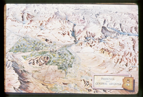
| Collection: | RMRS Archive Images |
| Keywords: |
map watershed management |
| Location: | AZ; United States |
| Description: | Phoenix and Central Arizona |
| Date: | 1970 |

| Collection: | RMRS Archive Images |
| Keywords: |
map watershed management |
| Location: | AZ; United States |
| Description: | High Water Yield Areas in Arizona |
| Date: | 1970 |

| Collection: | RMRS Archive Images |
| Keywords: |
map watershed management |
| Location: | AZ; United States |
| Description: | Salt River Watershed, Arizona |
| Date: | 1970 |