| Collection: | Pacific Northwest Research Station, Alaska Image Archive |
| Keywords: |
hydrology water conservation, soil conservation and erosion watershed management studies on stream-flow and bank erosion: |
| Location: | Alaska; Prince of Wales Island; Indian Creek |
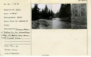
| Description: | Panorama taken on Indian Creek to characterize status of debris, logs, stumps, sand-gravel bars. Three photos glued together. Photo point: INDIAN-A. |
| Date: | 1/14/1961 |
| Collection: | Pacific Northwest Research Station, Alaska Image Archive |
| Keywords: |
hydrology water conservation, soil conservation and erosion watershed management studies on stream-flow and bank erosion: |
| Location: | Alaska; Prince of Wales Island; Indian Creek |
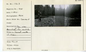
| Description: | Panorama taken on Indian Creek from same point as Indian-A. Looking downstream. Located about 12-1500 ft up from mouth of stream. Three photos glued together. Photo point: INDIAN-B. |
| Date: | 1/14/1961 |
| Collection: | Pacific Northwest Research Station, Alaska Image Archive |
| Keywords: |
hydrology water conservation, soil conservation and erosion watershed management studies on stream-flow and bank erosion: |
| Location: | Alaska; Prince of Wales Island; Indian Creek |
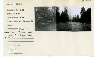
| Description: | Panorama view looking upstream. Picture point was 100 ft. downstream from INDIAN-A. Two photos glued together. Photo point: INDIAN-C. |
| Date: | 1/14/1961 |
| Collection: | Pacific Northwest Research Station, Alaska Image Archive |
| Keywords: |
hydrology water conservation, soil conservation and erosion watershed management studies on stream-flow and bank erosion: |
| Location: | Alaska; Prince of Wales Island; Indian Creek |
| Description: | Same location as INDIAN-C. View is downstream. Four photos glued together. Photo point: INDIAN-D. |
| Date: | 1/14/1961 |
| Collection: | Pacific Northwest Research Station, Alaska Image Archive |
| Keywords: |
hydrology water conservation, soil conservation and erosion watershed management studies on stream-flow and bank erosion: |
| Location: | Alaska; Prince of Wales Island; Indian Creek |
| Description: | View from point 100 ft downstream from Point-C. View is upstream. Four photos glued together. Photo point: INDIAN-E. |
| Date: | 1/14/1961 |
| Collection: | Pacific Northwest Research Station, Alaska Image Archive |
| Keywords: |
hydrology water conservation, soil conservation and erosion watershed management studies on stream-flow and bank erosion: |
| Location: | Alaska; Prince of Wales Island; Indian Creek |
| Description: | Panorama view downstream 100' from Point-E. View is toward mouth of stream. Three photos glued together. Photo point: INDIAN-F. |
| Date: | 1/14/1961 |
| Collection: | Pacific Northwest Research Station, Alaska Image Archive |
| Keywords: |
hydrology water conservation, soil conservation and erosion watershed management studies on stream-flow and bank erosion: |
| Location: | Alaska; Prince of Wales Island; Indian Creek |
| Description: | View is downstream. Picture point is 100' downstream from Point-E. Three photos glued together. Photo point: INDIAN-G. |
| Date: | 1/14/1961 |
| Collection: | Pacific Northwest Research Station, Alaska Image Archive |
| Keywords: |
hydrology water conservation, soil conservation and erosion watershed management studies on stream-flow and bank erosion: |
| Location: | Alaska; Prince of Wales Island |
| Description: | Text covered by photos. Daniel M. Bishop also listed as photographer. Four photos glued together. Harris River? Photo point: 38 |
| Date: | 9/16/1960 |
| Collection: | Pacific Northwest Research Station, Alaska Image Archive |
| Keywords: |
hydrology water conservation, soil conservation and erosion watershed management studies of infiltration, run-off and water erosion:effects of forestry practices (polluted water) |
| Location: | Alaska; Prince of Wales Island |
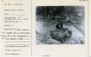
| Description: | This photo was made from a 4 x 5 neg. taken from an enlarged 35 mm color slide. |
| Date: | summer, 1960 |
| Collection: | Pacific Northwest Research Station, Alaska Image Archive |
| Keywords: |
hydrology water conservation, soil conservation and erosion watershed management studies on stream-flow and bank erosion: miscellaneous |
| Location: | Alaska; Prince of Wales Island; Maybeso Valley |
| Description: | Maybeso Creek Road - washout. |
| Date: | 12/8/1959 |
| Collection: | Pacific Northwest Research Station, Alaska Image Archive |
| Keywords: |
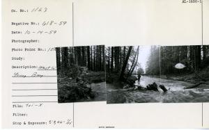
hydrology water conservation, soil conservation and erosion watershed management studies on stream-flow and bank erosion: |
| Location: | Alaska; Admiralty Island; Young Bay |
| Description: | West Creek - Young Bay. Photo point: 107. Three photos glued together. |
| Date: | 10/14/1959 |
| Collection: | Pacific Northwest Research Station, Alaska Image Archive |
| Keywords: |
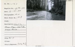
hydrology water conservation, soil conservation and erosion watershed management studies on stream-flow and bank erosion: |
| Location: | Alaska; Admiralty Island; Young Bay |
| Description: | West Creek - Young Bay. Next to gage house. Photo point: 108. Two photos glued together. |
| Date: | 10/14/1959 |
| Collection: | Pacific Northwest Research Station, Alaska Image Archive |
| Keywords: |
hydrology water conservation, soil conservation and erosion watershed management studies on stream-flow and bank erosion: |
| Location: | Alaska; Admiralty Island; Young Bay |
| Description: | West Creek - Young Bay. Photo point: 109. Two photos glued together. |
| Date: | 10/14/1959 |
| Collection: | Pacific Northwest Research Station, Alaska Image Archive |
| Keywords: |
hydrology water conservation, soil conservation and erosion watershed management studies on stream-flow and bank erosion: |
| Location: | Alaska; Admiralty Island; Young Bay |
| Description: | West Creek - Young Bay. Photo point: 110. Two photos glued together. |
| Date: | 10/14/1959 |
| Collection: | Pacific Northwest Research Station, Alaska Image Archive |
| Keywords: |
hydrology water conservation, soil conservation and erosion watershed management studies on stream-flow and bank erosion: |
| Location: | Alaska; Admiralty Island; Young Bay |
| Description: | West Creek - Young Bay. Photo point: 111. Three photos glued together. |
| Date: | 10/14/1959 |
| Collection: | Pacific Northwest Research Station, Alaska Image Archive |
| Keywords: |
hydrology water conservation, soil conservation and erosion watershed management studies on stream-flow and bank erosion: |
| Location: | Alaska; Prince of Wales Island; Old Tom Creek |
| Description: | Old Tom Creek photo point. Camera located on log above gage house. View downstream toward log bridge. Two photos from same location: taken 9/23/1959 and repeated in 1961. Photo point: 61. |
| Date: | 9/23/1959 |
| Collection: | Pacific Northwest Research Station, Alaska Image Archive |
| Keywords: |
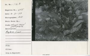
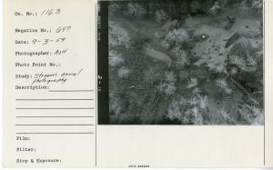
hydrology water conservation, soil conservation and erosion watershed management studies on stream-flow and bank erosion: |
| Location: | Alaska; Prince of Wales Island; Maybeso Valley |
| Description: | Maybeso Creek. |
| Date: | 9/3/1959 |

