| Collection: | Southern Research Station Historical Documents and Images |
| Keywords: | watershed |
| Organisms: | oak |
| Location: | Jones Creek drainage, Irons Fork Experimental Forest, Arkansas |
| Description: | Caption reads: "#6 Watershed in foreground, before cutting, Jones Creek. General view into watershed taken from oak tree on divide between #6 and #7. Camera faced N.W." |
| Date: | 4/11/1939 |
| Collection: | Southern Research Station Historical Documents and Images |
| Keywords: | watershed |
| Organisms: | oak |
| Location: | Jones Creek drainage, Irons Fork Experimental Forest, Arkansas |
| Description: | Caption reads: "#6 Watershed, before cutting, Jones Creek. General view into watershed taken from oak tree on divide between #6 and #7. Camera faced N.E." |
| Date: | 4/11/1939 |
| Collection: | Southern Research Station Historical Documents and Images |
| Keywords: |
skid trail erosion |
| Location: | Jones Creek drainage, Irons Fork Experimental Forest, Arkansas |
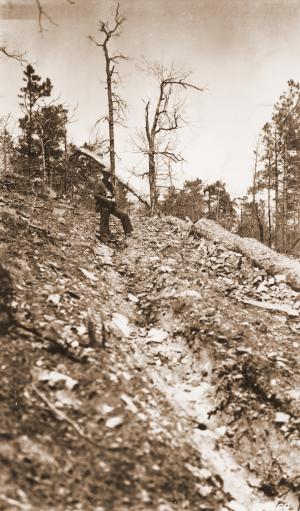
| Description: | Caption reads: "#4 Watershed, Jones Creek. Skid trail in watershed. Shows washing after 2-in. rain. Picture taken 2 days after rain. Camera Sta. #1." |
| Date: | 4/7/1939 |
| Collection: | Southern Research Station Historical Documents and Images |
| Keywords: |
skid trail erosion |
| Location: | Jones Creek drainage, Irons Fork Experimental Forest, Arkansas |
| Description: | Caption reads: "#4 Watershed, Jones Creek. Skid trail (area). Camera Sta. #2." |
| Date: | 4/7/1939 |
| Collection: | Southern Research Station Historical Documents and Images |
| Keywords: |
skid trail erosion |
| Location: | Jones Creek drainage, Irons Fork Experimental Forest, Arkansas |
| Description: | Caption reads: "#4 Watershed, Jones Creek. Logging road: shows erosion and severe washing following 2-inch rain of April 5, 1939. Camera Sta. #3." |
| Date: | 4/7/1939 |
| Collection: | Southern Research Station Historical Documents and Images |
| Keywords: | logging road |
| Location: | Irons Fork Experimental Forest, Arkansas |
| Description: | Caption reads: "Logging road plot, Jones Creek." |
| Date: | circa 1939 |
| Collection: | Southern Research Station Historical Documents and Images |
| Keywords: | logging |
| Location: | Irons Fork Experimental Forest, Arkansas |
| Description: | Caption reads: "Logging unit #6, Jones Creek. Showing slash conditions." |
| Date: | circa 1939 |
| Collection: | Southern Research Station Historical Documents and Images |
| Keywords: |
logging selective cut |
| Location: | Jones Creek drainage, Irons Fork Experimental Forest, Arkansas |
| Description: | Caption reads: "Picture taking from logging unit #6, Jones Creek. Looking west across creek to selectively cut unit #3 on left and clear cut unit #4 on right." |
| Date: | circa 1939 |
| Collection: | Southern Research Station Historical Documents and Images |
| Keywords: |
dam storm flow |
| Location: | Irons Fork Experimental Forest, Arkansas |
| Description: | Man building part of earthen dam to help hold stormflow water as a part of a research study on the Irons Fork Experimental Forest in Arkansas. |
| Date: | circa 1939 |
| Collection: | Southern Research Station Historical Documents and Images |
| Keywords: | dam |
| Location: | Irons Fork Experimental Forest, Arkansas |
| Description: | A man using a USFS bulldozer to move earth and stone, probably to build an earthen dam and holding pond on the Irons Fork Experimental Forest on the Ouachita National Forest in western Arkansas. |
| Date: | circa 1939 |


