| Collection: | Pacific Northwest Research Station, Alaska Image Archive |
| Keywords: |
land use, land-use policy, afforestation policy relations between forest, agricultural and pastoral land clearing of the forest afforestation of agricultural and pastoral land shifting cultivation (policy) land use |
| Location: | Alaska |
| Description: | Farm across road from IAS 2-21-194. |
| Date: | 7/20/1960 |
| Collection: | Pacific Northwest Research Station, Alaska Image Archive |
| Keywords: |
forest fires fire losses, fire damage to timber stands from the economic point of view |
| Location: | Alaska |
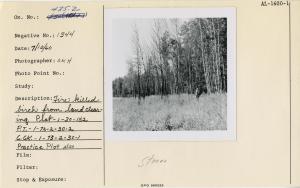
| Description: | Fire killed birch from land clearing. Plot-1-30-152 P.T.-1-73-2-30-2 C.G.K.-1-73-2-30-1. Practice Plot also. |
| Date: | 7/12/1960 |
| Collection: | Pacific Northwest Research Station, Alaska Image Archive |
| Keywords: |
work science (work studies) harvesting of wood storage of wood in the forest and at log dumps (landings) |
| Location: | Alaska; Thomas Bay; Spray Island |
| Description: | Log dump at Meur's Spray Is. Operation -3' low tide. |
| Date: | 6/9/1960 |
| Collection: | Pacific Northwest Research Station, Alaska Image Archive |
| Keywords: |
forest engineering roads and bridges |
| Location: | Alaska; Thomas Bay? |
| Description: | Meur's Patterson Cr. Rd and part of area to be logged, est. 45 M/A, 22", 5 log. |
| Date: | 6/9/1960 |
| Collection: | Pacific Northwest Research Station, Alaska Image Archive |
| Keywords: |
plant ecology vegetation types, ecotypes |
| Location: | Alaska; Little Susitna River |
| Description: | Stereo view of cottonwood stand along the Little Susitna River. |
| Date: | 1960 |
| Collection: | Pacific Northwest Research Station, Alaska Image Archive |
| Keywords: |
plant ecology vegetation types, ecotypes |
| Location: | Alaska; Keystone Canyon; Bridal Veil Falls |
| Description: | Bridal Veil Falls in Keystone Canyon on the Glenn Highway to Valdez. |
| Date: | 1960 |
| Collection: | Pacific Northwest Research Station, Alaska Image Archive |
| Keywords: |
plant ecology vegetation types, ecotypes |
| Location: | Alaska; Yukon River |
| Description: | Looking up the Yukon River, at a point between McGrath and Unalakleet. |
| Date: | 1960 |
| Collection: | Pacific Northwest Research Station, Alaska Image Archive |
| Keywords: |
plant ecology vegetation types, ecotypes |
| Location: | Alaska; Copper River; Mount Drum |
| Description: | Mount Drum and Copper River. |
| Date: |
| Collection: | Pacific Northwest Research Station, Alaska Image Archive |
| Keywords: |
land use, land-use policy, afforestation policy relations between forest and waste land: utilization and afforestation of waste land: deforestation |
| Location: | Alaska; Worthington Glacier |
| Description: | Worthington Glacier. |
| Date: |


