| Collection: | Southern Research Station Historical Documents and Images |
| Keywords: | runoff |
| Location: | East Hoover Creek, Irons Fork Experimental Forest, Arkansas |
| Description: | Caption reads: "Hoover-Nesbitt runoff plots 63&64." |
| Date: | 4/5/1941 |
| Collection: | Southern Research Station Historical Documents and Images |
| Keywords: |
weir stream gage |
| Location: | East Hoover Creek, Irons Fork Experimental Forest, Arkansas |
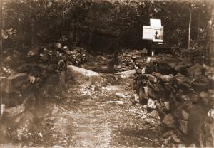
| Description: | Another view of the weir and gaging station at point #4 on East Hoover Creek, likely taken in late summer or early fall (due to leaves on trees). |
| Date: | 1941 |
| Collection: | Southern Research Station Historical Documents and Images |
| Keywords: | stream gage |
| Location: | East Hoover Creek, Irons Fork Experimental Forest, Arkansas |
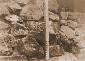
| Description: | Photograph of a hydraulic jump stick. Probably used at the weir and gaging station at point #4 on East Hoover Creek. |
| Date: | 1941 |
| Collection: | Southern Research Station Historical Documents and Images |
| Keywords: | runoff |
| Location: | East Hoover Creek, Irons Fork Experimental Forest, Arkansas |
| Description: | Caption reads: "Hoover-Nesbitt runoff plots 57&58. View of surface runoff plots 57&58 taken from ladder tripod below plots. Plots are located on lower contour trail in East Hoover Creek. Covertype--trees&reproduction." |
| Date: | 10/28/1940 |
| Collection: | Southern Research Station Historical Documents and Images |
| Keywords: | runoff |
| Location: | East Hoover Creek, Irons Fork Experimental Forest, Arkansas |
| Description: | Caption reads: "Hoover-Nesbitt runoff plots 59&60. View of surface runoff plots 59&60 taken from ladder tripod below plots. Plots are located on lower contour trail in East Hoover Creek. Covertype--trees." |
| Date: | 10/28/1940 |
| Collection: | Southern Research Station Historical Documents and Images |
| Keywords: | runoff |
| Location: | East Hoover Creek, Irons Fork Experimental Forest, Arkansas |
| Description: | Caption reads: "Hoover-Nesbitt runoff plots 61&62. View of surface runoff plots 61&62 taken from ladder tripod below plots. Plots are located on lower contour trail in East Hoover Creek. Covertype--reproduction." |
| Date: | 10/28/1940 |
| Collection: | Southern Research Station Historical Documents and Images |
| Keywords: | runoff |
| Location: | East Hoover Creek, Irons Fork Experimental Forest, Arkansas |
| Description: | Caption reads: "Hoover-Nesbitt runoff plots 63&64. View of surface runoff plots 63&64 taken from ladder tripod below plots. Plots are located on lower contour trail in East Hoover Creek. Covertype--open." |
| Date: | 10/28/1940 |
| Collection: | Southern Research Station Historical Documents and Images |
| Keywords: | runoff |
| Location: | East Hoover Creek, Irons Fork Experimental Forest, Arkansas |
| Description: | Caption reads: "Hoover-Nesbitt runoff plots 25&26. View of surface runoff plots 25&26 taken from ladder tripod below plots. Plots are located on upper contour trail in East Hoover Creek. Covertype--reproduction." |
| Date: | 10/23/1940 |
| Collection: | Southern Research Station Historical Documents and Images |
| Keywords: | runoff |
| Location: | East Hoover Creek, Irons Fork Experimental Forest, Arkansas |
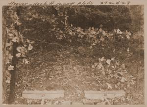
| Description: | Caption reads: "Hoover-Nesbitt runoff plots 27&28. View of surface runoff plots 27&28 taken from ladder tripod below plots. Plots are located on upper contour trail in East Hoover Creek. Covertype--trees&reproduction." |
| Date: | 10/23/1940 |
| Collection: | Southern Research Station Historical Documents and Images |
| Keywords: | runoff |
| Location: | East Hoover Creek, Irons Fork Experimental Forest, Arkansas |
| Description: | Caption reads: "Hoover-Nesbitt runoff plots 29&30. View of surface runoff plots 29&30 taken from ladder tripod below plots. Plots are located on upper contour trail in East Hoover Creek. Covertype--trees." |
| Date: | 10/23/1940 |


