| Collection: | Pacific Northwest Research Station, Alaska Image Archive |
| Keywords: |
hydrology water conservation, soil conservation and erosion watershed management studies of infiltration, run-off and water erosion:effects of forestry practices (polluted water) |
| Location: | Alaska; Prince of Wales Island; Twelvemile Arm |
| Description: | Taken in 12 - mi. gravel quarry. Note the clay-silt deposit. Photo point: 71. |
| Date: | 9/30/1960 |
| Collection: | Pacific Northwest Research Station, Alaska Image Archive |
| Keywords: |
hydrology water conservation, soil conservation and erosion watershed management studies of infiltration, run-off and water erosion:effects of forestry practices (polluted water) |
| Location: | Alaska; Prince of Wales Island; Twelvemile Arm |
| Description: | Taken in 12 - mi. gravel quarry. View tries to show the depth (3-4") of muck deposited. Photo point: 71. |
| Date: | 9/30/1960 |
| Collection: | Pacific Northwest Research Station, Alaska Image Archive |
| Keywords: |
hydrology water conservation, soil conservation and erosion watershed management studies of infiltration, run-off and water erosion:effects of forestry practices (polluted water) |
| Location: | Alaska; Prince of Wales Island; Twelvemile Arm |
| Description: | Taken in 12 - mi. gravel quarry at a dry time. Note 2-3" of silt-clay deposits. Photo point: 71. |
| Date: | 9/30/1960 |
| Collection: | Pacific Northwest Research Station, Alaska Image Archive |
| Keywords: |
hydrology water conservation, soil conservation and erosion watershed management control on burnt or otherwise prepared areas, roadsides etc: by special cover |
| Location: | Alaska; Prince of Wales Island; Twelvemile Arm |
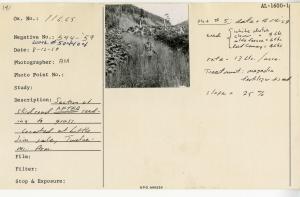
| Description: | Section of skid road AFTER seeding to grass. Located at Little Jim sale, Twelvemile Arm, Plot#5. Date: 4-14-1959. Seed: white dutch clover = 9 lbs., alto fescue = 6 lbs., reed canary= 4 lbs. Rate: 13 lbs/acre. Treatment: magadin fertilizer + seed. Slope: 25%. |
| Date: | 8/12/1959 |
| Collection: | Pacific Northwest Research Station, Alaska Image Archive |
| Keywords: |
hydrology water conservation, soil conservation and erosion watershed management studies of infiltration, run-off and water erosion:effects of forestry practices (polluted water) |
| Location: | Alaska; Prince of Wales Island; Twelvemile Arm |
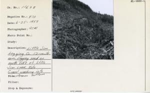
| Description: | Little Jim Logging Company, 12-mile Arm. Logging road on north side of Little Jim Creek. Note gravel washing into stream bottom. |
| Date: | 6/25/1958 |
| Collection: | Pacific Northwest Research Station, Alaska Image Archive |
| Keywords: |
hydrology water conservation, soil conservation and erosion watershed management studies of infiltration, run-off and water erosion:effects of forestry practices (polluted water) |
| Location: | Alaska; Prince of Wales Island; Twelvemile Arm |
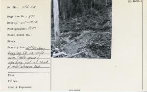
| Description: | Little Jim Logging Company, 12-mile Arm. Note gravel washing out of road & into stream bed. |
| Date: | 6/25/1958 |
| Collection: | Pacific Northwest Research Station, Alaska Image Archive |
| Keywords: |
work science (work studies) harvesting of wood logging and transport forest engineering descriptions of individual logging operations |
| Location: | Alaska; Prince of Wales Island; Twelvemile Arm |
| Description: | Little Jim Logging Co. General view of logging camp. Note road system & camp on beach at left. |
| Date: | 6/23/1958 |
| Collection: | Pacific Northwest Research Station, Alaska Image Archive |
| Keywords: |
regeneration and formation of stands natural regeneration |
| Location: | Alaska; Prince of Wales Island; Twelvemile Arm |
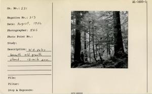
| Description: | W.H. poles beneath old growth stand. 12-mile arm. |
| Date: | 8/1956 |
| Collection: | Pacific Northwest Research Station, Alaska Image Archive |
| Keywords: |
animal ecology game and fish management hunting, shooting and fishing fish management: fishing |
| Location: | Alaska; Prince of Wales Island; Twelvemile Arm |
| Description: | Male & female pink salmon. Fresh run & not yet spawned out. 18" ruler along side typical specimens. |
| Date: | 9/16/1950 |
| Collection: | Pacific Northwest Research Station, Alaska Image Archive |
| Keywords: |
plant ecology ecosystems vegetation types ecotypes |
| Location: | Alaska; Prince of Wales Island; Twelvemile Arm |
| Description: | Muskeg & scrub type east of 12-mile arm. Elev. 480 ft, 1/2 mile from beach. Looking down drainage of 12 to 15% slope. Same area as Neg No. 441, 439. |
| Date: | 6/10/1950 |
| Collection: | Pacific Northwest Research Station, Alaska Image Archive |
| Keywords: |
plant ecology ecosystems vegetation types ecotypes |
| Location: | Alaska; Prince of Wales Island; Twelvemile Arm |
| Description: | Muskeg draw on east side of 12-mile arm. 16% slope runs between pot holes. Elev. 480 ft. Trees are L.P., WRC, AC, Mhem - poor quality. Same area as Neg No. 439, 442. |
| Date: | 6/10/1950 |
| Collection: | Pacific Northwest Research Station, Alaska Image Archive |
| Keywords: |
plant ecology ecosystems vegetation types ecotypes |
| Location: | Alaska; Prince of Wales Island; Twelvemile Arm |
| Description: | Scrub muskeg type E. side 12-mile arm, 1/2 mile from beach. Pot holes are terrace fashion, slope averages 8%. Each pot hole appears to be growing its own dam. |
| Date: | 6/10/1950 |


