

Recreation
The Salmon-Challis National Forest is a land of rugged mountains split by untamed rivers. Escape into the backcountry in the Lemhi, Bitterroot, Pioneer, or Lost River Mountain Ranges. Visit the Bighorn Crags within the legendary Frank Church – River of No Return Wilderness and see a fantastic collection of granite peaks and alpine lakes. Raft the Wild & Scenic Rivers. Climb Idaho’s highest peak, Mount Borah. Relax at one of our campgrounds, or fish for trout or steelhead in our many lakes and streams. Enjoy miles of scenery while driving along Scenic Byways.
The forest is rich with America’s heritage. Historic cabins, ranger stations, lookouts, mining ghost towns, and the Lewis & Clark and the Nez Perce National Historic Trails link today’s visitor with the past. Visit the ghost town of Custer and tour the Yankee Fork Gold Dredge while travelling the Custer Motorway. Visit the Mackay Mine Hill to see a glimpse of the area’s copper mining legacy.
Are you planning a trip to the Salmon-Challis National Forest this summer for a day hike or a backpacking trip? We have an interactive map just for you! CLICK HERE and you can find out if the trail you were planning to hike was maintained during the 2025 field season! Interested in Trail Maintenance Planned on the Salmon-Challis National Forest 2026? CLICK HERE!
Hot Springs: The Salmon-Challis National Forest has many hotspring across the Forest. The water and pools associated with the springs may be near or above the boiling temperature and can cause severe, possibly even fatal, burns. PLEASE BE CAUTIOUS AND TEST THE WATER TEMPERATURE BEFORE YOU ENTER!!


This area is bounded by the peaks and ridgelines of the Lemhi and Beaverhead Mountain ranges and includes all the drainages down to the Lemhi River, flowing north from its

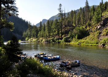
A land of steep mountains, deep canyons, and wild rivers, the Middle Fork of the Salmon River is the second largest Wilderness in the lower 48 states at 2.4 million acres.

This area encompasses the timbered mountainsides and wildflower covered ridgelines of the North Fork of the Salmon River drainage, from its confluence with the main stem to
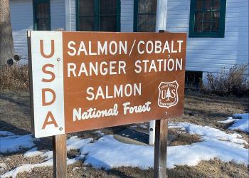
This Ranger District is expansive and takes in the Salmon river mountains and most of the forest that one can see from the town of Salmon.