
Welcome to Chattahoochee-Oconee National Forest
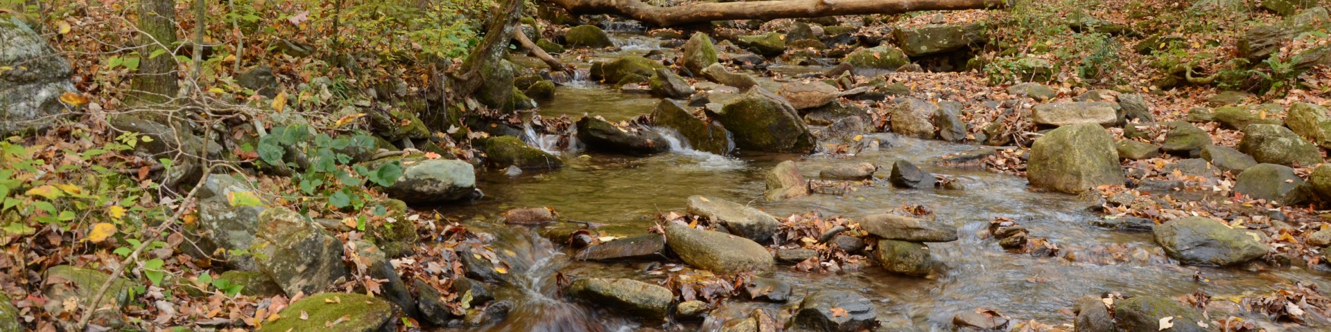
Featuring nearly 867,000 acres across 26 counties, thousands of miles of clear-running streams and rivers, approximately 850 miles of recreation trails, and dozens of campgrounds, picnic areas, and other recreation activity opportunities, these lands are rich in natural scenery, history and culture in Georgia.
Recreation Opportunities
From the rolling hills of the Piedmont to the mountains of the southern Appalachian mountains, there are all kinds of outdoor activities to enjoy. Learn more about this area and an overview of outdoor recreation on the national forests.
Off-Highway Vehicle Use

The Chattahoochee National Forest located in North Georgia, and the Oconee National Forest located in Central Georgia, are popular with individuals and family groups that want a scenic and often challenging ride within the National Forest.
Prescribed Fire Tracker
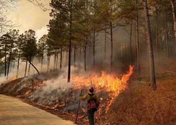
Track all prescribed burns taking place across the Southern Region and sign up for #BurnAlerts.
Forest Maps
Oconee National Forest (North End)
Oconee National Forest (South End)
PAPER MAPS FOR PURCHASE
If Out of Stock, contact the Forest Service office nearest you to purchase a map in-person.
DIGITAL MAPS FOR PURCHASE
Blue Ridge Ranger District (Blairsville)
Chattooga River Ranger District (Lakemont)
Conasauga Ranger District (Chatsworth)
Oconee Ranger District (Eatonton)
Interactive Visitor Maps - Click on Southern Region, Chattahoochee or Oconee NF
Why Use the Avenza App
Offline Access
Avenza allows you to download georeferenced maps for offline use. This is especially valuable in remote areas where cell service is unavailable—ensuring you can still navigate even without a signal. You can download the app for Android or Apple devices.
GPS Location on the Map
Even when offline, Avenza uses your device’s GPS to show your real-time location directly on the map. This helps prevent getting lost, especially in complex trail systems or unfamiliar terrain.
Trail Accuracy
Many OHV trail maps available in Avenza (especially those published by the USDA Forest Service, BLM, and other land agencies) are official Motor Vehicle Use Maps (MVUMs). These maps show:
- Legal trails and roads open to OHV use
- Seasonal closures
- Vehicle class restrictions
Custom Marking and Tracking
You can drop pins, add notes, record tracks, and measure distances. This is helpful for marking waypoints, camp spots, hazards, or areas of interest.
Map Variety and Updates
Avenza hosts a huge library of maps from public and private sources. Many Forest Service districts regularly update their MVUMs or recreation maps on Avenza, ensuring you're using the most current legal trail info.
Compliance and Safety
Using MVUMs via Avenza ensures you're riding only on authorized routes, helping you avoid:
- Fines for riding in closed or protected areas
- Environmental damage
- Safety risks due to terrain or closures


