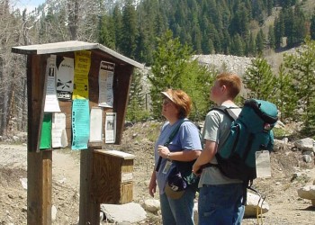
Winom-Frazier OHV Trails
The Winom-Frazier OHV Complex is located northeast of the North Fork John Day Wilderness on both the Umatilla and Wallowa-Whitman National Forests. The area is named for it's location near Frazier Meadow and Creek, and Winom Meadows. Elevations in the riding area vary from 4,600 feet near Cable Creek to 6,900 feet at Tower Mountain. The area provides riders with a full range of difficulty from 'easiest' to 'most difficult'. The trails are also open to horses, hikers and mountain bikes.
Development History
Early development efforts for this OHV trail complex began in the late 1980s following the designation of the North Fork John Day Wilderness. At that time, previous OHV trail use was prohibited in the new wilderness area but still desired by local OHV users and groups like the North West Trail Rider Association. To provide for these riding opportunities, construction grants were submitted by the Umatilla and Wallowa-Whitman National Forests to the Oregon Department of Transportation who administered the grant at that time. In 1990 the first grant was awarded and some of the earlier trails like the Lookout/Little Fly Trail were constructed in 1990, and the Big Ridge Trail in 1991.
Riding Opportunities
There are about 150 miles of trails in the Winom-Frazier area. Trails within the Winom-Frazier area are open to Class I (quads) and Class III (motorcycle) ATVs. Not every trail is open to both classes as some trails are designated for motorcycle only. In addition, trails allowing Class I vehicles may also allow Class IV (Side by Side) vehicles provided the vehicle is less than 50” wide as measured at the widest point. OHVs wider than 50 inches are prohibited. An Oregon ATV Permit is required to operate an OHV on this area, and other public lands in Oregon.
Trail Maps
Start with this Winom-Frazier (W-F) OHV Trail Index Map (294 KB) to locate the section of trail and trailhead or access point along a forest road you are interested in riding from. The trail map numbers go from north to south along the trail area.
- W-F OHV Trail Map - 1 (267 KB)
- W-F OHV Trail Map - 2 (289 KB)
- W-F OHV Trail Map - 3 (294 KB)
- W-F OHV Trail Map - 4 (346 KB)
The North West Trail Riders Association's website also includs more information and maps for Winom-Frazier.
Access
This area designated trailheads, campgrounds and other informal access points. Developed access areas include:
Trails
The trails shown below are only the ones managed by the Wallowa-Whitman National Forest.
Trail No. | OHV Trail Name | Miles | Index Map |
O-1932 | Big Ridge | 9.3 | 3 |
O-1941 | Chicken Hill | 9.7 | 3 |
O-1941A | Chicken Hill A * | 0.4 | 3 |
O-1945 | Chicken Rock | 1.8 | none |
O-1935 | Little Fly | 2.2 | 2,3 |
O-1853 | Lookout Creek | 3.9 | 3,4 |
O-1854 | Lookout Ridge | 4.2 | 2,3,4 |
O-1939 | Lookout- Little Fly | 4.3 | 2,4 |
O-1952 | Loop | 4.3 | 1,2 |
O-1932A | Outlaw | 1.5 | 2,3,4 |
O-1950A | Umapine Tie * | 0.2 | 2, |
O-1950B | Umapine B * | 0.6 | 2 |
O-1950C | Umapine C * | 7.8 | 2 |
(* Trail is shown but not labeled on map)
Partners
The Winom-Frazier OHV Complex is managed in part by grant funds received from the Oregon Parks and Recreation Department. Local partners for this system also include the North West Trail Riders Association.