
Current Conditions
Please visit this page for the latest updates regarding information and conditions around the forest.
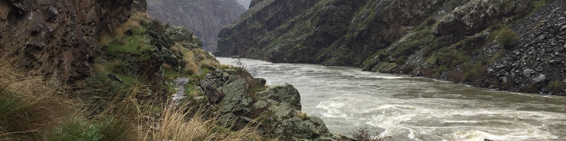
Seasonal Information
| 2025 NON-MOTORIZED CALENDAR for the Snake River |
2025 Primary Season: May 23 - September 10 *From Kirkwood to Wild Sheep Rapids in Wild River Section |

What is the Non-Motorized Period?
The 1994 Wild and Scenic Snake River Recreation Management Plan (revised in 1999) established 2 seasons to manage river use. The primary season is from the Friday before Memorial Day through September 10, inclusive. During the primary season, motorized craft will not be permitted access to the section of wild river between the top of Wild Sheep Rapid and the upper landing at Kirkwood Historic Ranch, Monday through Wednesday, every other week, starting the first Monday of June for a maximum of 21 days. When the nonmotorized period falls on a 4th of July weekend (i.e., July 4 is on a Friday, Saturday, or Sunday), the nonmotorized period is moved to the following week, and will alternate every other week until the end of that primary season. This limitation of motorized use is known as the non-motorized period. The amount of both commercial and private, float and powerboat use is regulated during the primary season.
The secondary season is from September 11 through the Thursday before Memorial Day. During the secondary season, there are no use level restrictions on watercraft in the wild and scenic river.
For Information about the current river levels and flows on the Snake River, please try one of these links:
The information at this website is provided by Idaho Power. It displays the 4 day river flow in cubic feet per second (CFS) for the Snake River below Hells Canyon Dam.
Trails Updates
This trail report provides the known conditions for the main summer recreation trails in the Blue Mountains/Grande Ronde River Basin recreation area. In general this recreation area includes trails found south and west of La Grande, Oregon, starting north of the Anthony Lake recreation area along Forest Road 73 (Elkhorn Drive Scenic Byway) through the Grande Ronde River up to Mt. Emily.
View the Blue Mountains/Grande Ronde River Basin trails report.
This trail report provides the known conditions for the main summer recreation trails in the Hells Canyon National Recreation Area (HCNRA) in Oregon. It includes trails found in the HCNRA in Oregon along the Wild and Scenic Snake River, in the Hells Canyon Wilderness, and on the Wallowa Valley Ranger District outside of the HCNRA located east and north of Enterprise, Oregon.
View the Hells Canyon National Recreation Area in Oregon trails report.
This trail report provides the known conditions for the main summer recreation trails in the Hells Canyon National Recreation Area (HCNRA) in Idaho. The report includes trails found in the HCNRA in Idaho along the Snake River, in the uplands and in the Hells Canyon Wilderness (Seven Devils area).
Please refer to either the Hells Canyon reports for Idaho or Oregon.
The trail report provides the known conditions for the winter recreation trails in the Southern Elkhorn Mountains/Powder River Basin recreation area. In general this recreation area includes trails found west of Baker City and Unity, Oregon, starting in the Monument Rock Wilderness areas going north to the Anthony Lake recreation area along Forest Road 73 (Elkhorn Drive Scenic Byway).
This trail report provides the known conditions for the main summer recreation trails in the Wallowa Mountains and Eagle Cap Wilderness.
Roads Report
This Forest Road and Access Report summarizes the current known conditions for many of the main roads across the Wallowa-Whitman National Forest. Most forest roads are only seasonally open and driveable from the late spring through the fall. When they are 'maintained' the road has been driven by district road engineers and the observed hazards have been removed. The tables below summarize road conditions in areas near cities with Forest Service offices. Not all of the roads or road segments are Forest Service maintained roads.
Vehicle Recommendation
- (A) = Suitable for most low-clearance passenger cars
- (B) = Not suitable for most low-clearance vehicles or trailers. High-clearance and/or 4 wheel drive vehicles recommended.
Please be advised that snow levels are ever changing and that roads and trails may be covered with snow. Please contact your local Ranger District for the most current information on roads and trails.
| Road Name & Location | Road Number | Vehicle Recommendation and Condition |
|---|---|---|
| State Highway 7 (Baker City to Austin Junction) | State Highway 7 | ODOT keeps highway 245 open year round. (A) - Paved two lane road. |
| Elkhorn Drive Scenic Byway (Highways 520 and 24 to Sumpter to Granite) | Baker County 520, and Grant County 24 | (A) - Paved two lane road. Baker County highway 520 and Grant County highway 24 are kept open to Granite year round. |
| Elkhorn Drive Scenic Byway (Granite north and east to Anthony Lakes) | FS Road 73 | (A) - Paved two lane road. *Not maintained for winter travel. This section is 24 miles in length. |
| Elkhorn Drive Scenic Byway (Anthony Lakes to Baker City) | FS Road 73 and County roads | (A) - Paved two lane road. The highways are maintained for winter travel by Union County, Baker County and Anthony Lakes Ski Resort. |
| Dooley Mountain | State Highway 245 | (A) - Paved two lane. ODOT keeps highway 245 open year round. |
| Road Name & Location | Road Number | Vehicle Recommendation and Condition |
|---|---|---|
| Hells Canyon/ Scenic Byway | FS 39 | (A) - Double lane paved road with turnouts. |
| Freezeout Road | FS 4230 | (A) - Single lane, native surface with minimal turnouts |
| Hat Point Road | FS 4240 | (A) – Single lane gravel road with turnouts. |
| Dug Bar Road | County 735 /FS 4260 | (B) –Not suitable for most low-clearance vehicles or trailers. High-clearance and/or 4 wheel drive vehicles recommended. |
| Wellamotkin Drive(Highway 3 to Coyote Campground) | FS 46 | (A) single lane gravel road with turnouts. |
| Chesnimnus Road | FS 4625 | (A) - Single lane gravel road with turnouts. |
| Upper Imnaha River Road | County 727/FS 3955 | (A) - Single lane gravel roadwith turnouts. Last 5 miles is FS 3955. |
| Road Name & Location | Road Number | Vehicle Recommendation and Condition |
|---|---|---|
| Clear Creek and Fish Lake | FS 66 | Maintained year round to the SnoPark. From the snow park to the 39 road is a designated, groomed snowmobile trail and is not maintained for winter travel. (A) - One lane gravel road. **road has washboard and is rough from Halfway** |
| Summit and Eagle Creek | FS 77 | (A) - One lane gravel road. |
| East Eagle Creek | FS 7745 | (A) - One lane gravel road with turnouts. |
| Road Name & Location | Road Number | Vehicle Recommendation and Condition |
|---|---|---|
| Spring Creek | FS21 | OHVs prohibited on FS 21 road between I-84 and 2100410 junction (Forest Order 385) and off road on the southeast side of the 2100 road Dec 15 - May 1 Forest Order 233 (A) First 3 miles from I-84 two lane gravel road, remainder one lane with turnouts. |
| Mt. Emily Summit | FS 31 | Road maintained by Umatilla NF, Walla Walla Ranger District. Check Umatilla NF, Walla Walla Ranger District Recreation Report for conditions. A) - One lane road with turnouts. |
| FS 3106 | A) - One lane road with turnouts. | |
| Fox Hill Road | FS 3120 | (A) Single lane road with turnouts. (B) OHVs prohibited on FS 3120 road from its junction with County Road 7 to its junction with FS 3120400. (Forest Order 385). |
| Ladd Canyon | FS 43 | (A) - One lane road with turnouts. OHVs prohibited on FS 43 road between I-84 and FS 4305 road junction. (Forest Order 385). |
| West Side | FS 4305 | Timber sale operations on the 5140 road. Trucks enter 51 road at Grande Ronde Guard Station at the 4305 junction. Road 5140 is being maintained for LOGGING USE ONLY. (A)Single lane road with turnouts. |
| Grande Ronde River | FS 51 | Timber sale operations on the 5140 road. Trucks enter 51 road at Grande Ronde Guard Station at the 4305 junction. Road 5140 is being maintained for LOGGING USE ONLY. (A) Two lane paved road. OHV traffic prohibited by Oregon State Law. |
| Rainbow Road | FS 5125 | (A) Single lane road with turnouts. OHVs prohibited on FS 5125 road from its junction with FS 51 Road to its junction with Forest Road 5138. (Forest Order 385). |
| FS 5140 | 4/11/2018 Road 5140 is being maintained for LOGGING USE ONLY. Not maintained for winter travel. Designated snowmobile trail during winter months. Timber sale operations on the 5140 road. Trucks enter 51 road at Grande Ronde Guard Station at the 4305 junctions. | |
| Blue Springs | FS 5155 | Not maintained for winter passenger vehicle travel. (A) Single Lane Road with turnouts. |
| Umapine | FS 5160 | (A)- One lane road with turnouts. OHVs prohibited on FS 5160 road between its junction with FS 5155 Road to its junction with Forest Road 51. (Forest Order 385). |
| Rock Springs | FS 62 | (A)- One lane road with turnouts. OHVs prohibited on FS 62 road between its junction with County Road 62 to its junction with Forest Road 6205. (Forest Order 385) |
| Moss Springs | FS 6220 | (A) - One lane road with turnouts. Recommend high clearance vehicles from Moss Springs to Point Prominence. OHVs prohibited on FS 6220 between County Road 65 to Moss Springs Campground. (Forest Order 385) |
| Big Creek | FS 67 | (A) - One lane with turnouts. OHVs prohibited on FS 67 between 6710 junction and Road 77 junction (Forest Order 385) |
| Balm Creek | FS 70 | Not maintained for winter passenger vehicle travel. Designated snowmobile route during winter months. (A) One lane road with turnouts. |
| Eagle Creek | FS 77 (Hwy 203 to Boulder Park) | (A) One lane with turnouts. |
| Main Eagle Creek | FS 7755 | (A) – Two lane gravel road. |
| North Fork Catherine Creek | FS 7785 | (A) One lane road with turnouts. |
| Buck Creek | FS 7787 | (A) One lane road with turnouts. |
| Road Name & Location | Road Number | Vehicle Recommendation and Condition |
| East Camp Creek | FS 16 | Not maintained for winter travel. (A) One lane road. |
| Journey Though Time Scenic Byway (Unity to Blue Mtn Summit) | OR Hwy 26 | This road is maintained for winter and year round travel by ODOT, which maintains the road throughout the year. (A) - Two lane paved road. |
| North Fork Burnt River | Baker County Road 529 | This road is maintained for winter and year round travel by Baker County. (A) - Two lane gravel road. |
| South Fork Burnt River | FS 6005 | (A) - One lane road. |
| Road Name & Location | Road Number | Vehicle Recommendation and Condition |
|---|---|---|
| Big Canyon Road | FS1805 | (B) - One lane jeep trail. ATV/OHV only |
| Black Lake | FS112 | (B) - One lane, steep rough road. Closed by snow seasonally, generally October to June |
| Cow Creek | FS 242 | (A) - One lane, steep road 8 miles long. |
| Crooked Road | FS 672 | (A) - One lane, gravel road with turnouts. |
| Kirkwood Creek | FS 2062 | (B) - One lane jeep trail. ATV/OHV only |
| Loop Road | FS 2060/ 1819 | (A) - One lane, limited turnouts, rocky and rutted (FS 1819 is 5 miles long, FS 2060 is 9 miles). |
| Pittsburg Landing (Deer Creek Road) | County 493 | (A) -gravel road, 17 miles from Salmon River bridge to Snake River. Steep on westside of Pittsburg Saddle. |
| Race Creek Road | FS 241 | (A) - One lane, gravel road with turnouts, 13 miles long. |
| Rim View | FS 420 | (B) - One lane rough native surface. Not suitable for passenger cars. Soft shoulders. |
| Seven Devils/ Heavens Gate | FS 517 | (A) - One lane, gravel road starting at forest boundary with turnouts. Road is 18 miles long from highway 95 to Heavens Gate Lookout. Closed by snow seasonally; chains recommended due to ice and snow |