

Welcome to Carson National Forest
The Carson National Forest spans 1.5 million acres of Northern New Mexico, encompassing portions of the Sangre de Cristo Mountains, San Juan Mountains and the San Juan Basin. With elevations ranging from 6,500 to over 13,000 feet, the forest boasts diverse ecosystems, from the sagebrush to alpine and tundra.
Visitors can enjoy a wide range of outdoor activities, including hiking, mountain biking, camping, hunting and fishing. The forest is also home to New Mexico's tallest point, Wheeler Peak.
The Latest
Fire Restrictions in Effect

Stage 1 fire restrictions are currently in effect, prohibiting campfires and smoking with some exemptions.
Timber Harvest in Progress

Forest and watershed restoration efforts with New Mexico Forestry Division are ongoing to the south of Taos, N.M.
Firewood Permits Now Available Online

Skip the trip to our offices. You can now purchase firewood permits online!
Know Before You Go
Current Conditions

Check out the general conditions found on the forest each season.
Campground Openings
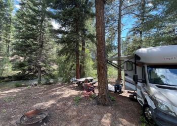
With warmer weather arriving, campgrounds are beginning to open.
Visitor Maps

Need a map? There are a number of ways to help you get to where you're going.