
Visitor Maps and Guides
Get ready for your visit by checking out our detailed maps, brochures, and information guides. Visitor maps and publications are available in-person at forest offices and online at the US Geological Survey Map Store or Discover Your Northwest Online Store.
- Discover Your Northwest: A wide selection of maps, books, and guides highlighting the Northwest’s natural and cultural history. Proceeds support educational programs and services.
- US Geological Survey: The national source to locate Forest Service maps, National Park maps, state maps, topographic maps, and more.
Forest Visitor Maps

Search for Forest Service Visitor, District, Wilderness or other specialty maps online via the US Geological Survey Map Store. Search for a specific National Forest Visitor map using our online Map Finder.
Mobile Friendly Maps
Download available forest & grassland maps to your mobile device via the Avenza app. Available maps include: Forest, Wilderness, District, Winter Recreation, and Motor Vehicle Use Maps.
Free Topo Maps

These free downloadable geo-enabled quadrangle maps are created by the Forest Service. FSTopo is an automated map product using inter-agency authoritative data and is updated annually.
Motor Vehicle Use Map

Motor vehicles and ATVs/ORVs are only permitted on National Forest System routes that are shown on the Motor Vehicle Use Map map. (Does not apply to existing state, county, or private roads.)
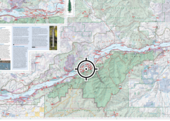
Interactive Visitor Map
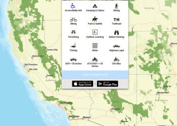
View the online National Interactive Visitor Map to explore recreation sites on Forest Service lands across the country.