
Planning
Columbia Gorge National Scenic Area Management Plan
The Management Plan establishes the primary management direction for the Scenic Area, providing a framework for what we do and where it is done. All other plans tier to the management plan.
- Management Plan for the Columbia River Gorge National Scenic Area (Columbia River Gorge Commission website)
- The Scenic Area Management plan recently underwent a review and revision. Learn more about that process on the Gorge Commission website.
Monitoring Reports
Monitoring reports document our management activities and accomplishments while comparing these actions to the Management Plan direction, as well as projected outputs.
Wild and Scenic River Management Plans
The National Wild and Scenic Rivers System was created by Congress in 1968 to preserve rivers with outstanding natural, cultural, and recreational values in a free-flowing condition for future generations. US Forest Service at Columbia River Gorge National Scenic Area manages two Wild and Scenic Rivers in Washington the Klickitat and White Salmon Wild and Scenic Rivers.
- Lower Klickitat River Wild and Scenic Management Plan (.pdf)
- Lower White Salmon River Wild and Scenic Management Plan (.pdf)
Land and Resource Management Plans
- Mt Hood and Gifford Pinchot National Forest Plans also apply to Columbia River Gorge National Scenic Area.
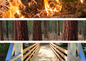
CRGNSA Management Plan Disaster Recovery Revision
Following recent wildfires, the Columbia River Gorge Commission (CRGC) and the USDA Forest Service, Columbia River Gorge National Scenic Area are working to update disaster recovery requirements outlined in Management Plan in the Columbia River Gorge National Scenic Area. A draft of revisions is now available on the CRGC website: https://www.gorgecommission.org/
Public comment is open until October 22, 2025 and may be emailed to: PublicComment@Gorgecommission.org
For questions, please contact Krystyna Wolniakowski (Columbia River Gorge Commission) at 509-713-9623 or krystyna.wolniakowski@gorgecommission.org or Casey Gatz (USDA Forest Service) at 503-319-1300 or casey.gatz@usda.gov
Northwest Forest Plan & Amendment
The Northwest Forest Plan covers 24.5 million acres of federally managed lands in California, Oregon, and Washington. It was established in 1994 to address threats to threatened and endangered species while also contributing to social and economic sustainability in the region. Over 30 years later, the Northwest Forest Plan needs to be updated to accommodate changed ecological and social conditions.