
Visitor Maps and Guides
You can purchase National Forest Visitor Maps online through USGS.
San Bernardino National Forest Atlas

National Forest Atlases are collections of topographic quadrangle maps at a scale of 1:63,360 (1 inch to the mile), featuring Forest Service recreation facilities and infrastructure.
San Bernardino National Forest Visitor Guide

The visitor guide is now available to view online and print at home! This is the forest's 20 page guide containing a variety of useful information for visitors to the forest. You need Adobe Reader to view this file (4.15 MB). This guide (English only) is also available for free at all San Bernardino National Forest offices and visitor centers.
We also have PDF (online only) versions in these languages:
Motor Vehicle Use Maps (MVUM)
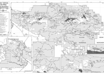
The Motor Vehicle Use Map (MVUM) displays National Forest System routes (roads and trails) or areas designated open to motorized travel. San Bernardino National Forest MVUM maps are also available for free at the local Ranger Station.
San Bernardino National Forest Visitor Map

The Forest Service publishes a variety of map products to help you plan your next adventure or enjoy your next visit! This is the current version of the San Bernardino National Forest Visitor Map, 2018 Edition.
Avenza Maps™

Avenza Maps™ is a mobile map app that allows you to download maps for offline use on your iOS and Android smartphone or tablet.
Forest Atlas of the United States

Advances in technologies and analytical methods and the availability of other spatial data, such as satellite imagery and digital elevation models, now make it possible to present information about U.S. forests in novel ways.
Forest Service GeoData

Through the Geodata Clearinghouse, you can find datasets related to forests and grasslands, including maps you can download.
USGS

Forest Visitor Maps for each national forest and grassland provide forest-wide information on attractions, facilities, services, and opportunities.
Explore the Interactive Visitor Map

The interactive Visitor Map provides the public with an online view of Forest Service roads, trails, recreation sites, wilderness areas, and wild & scenic rivers.
Sand to Snow National Monument Interactive Map

The Sand to Snow National Monument is an ecological and cultural treasure jointly managed by U.S. Forest Service and the Bureau of Land Management (BLM).
- Back Country Safety Tips
- Wilderness Ethics and Etiquette
- San Gorgonio Wilderness Trails
- Barton Flats Area Non-Wilderness Trails
- Woodland Trail Brochure
- Big Bear Valley Trails
- Lake Arrowhead Area Trails
- Lytle Creek Area Trails
- Chaparral Neighborhoods Trail Brochure
- Mormon Rocks Trail Brochure
- Idyllwild/San Jacinto Area Trails
- Randall Henderson Trail Brochure
- Horse Sense
- You are in Bear Country
- Prospecting
- Recreational Target Shooting on the Mountaintop and Front Country Ranger Districts