Welcome to Sequoia National Forest
Located in Central California, the forest offers 52 developed campgrounds... more than 1,147 miles of trails including 47 miles of the Pacific Crest Trail... over 314,448 acres of wilderness, with 222 miles of Wild and Scenic Rivers and 2,617 rivers and streams... world-class whitewater rapids... and 158 ponds and lakes. Plus boating, fishing, biking, horseback riding, and more.
Recreate Responsibly — Wildfire Edition
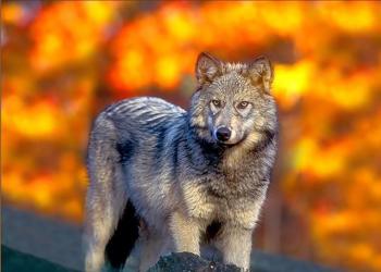
Giant Sequoia National Monument

Established April 2000, this national monument sits in California’s central and southern Sierra Nevada Mountains. Its 328,315 acres protect nearly half of the giant sequoia groves in the world. Check at district offices for more information. No entry fee but $12 parking per vehicle at a few locations and cash only.
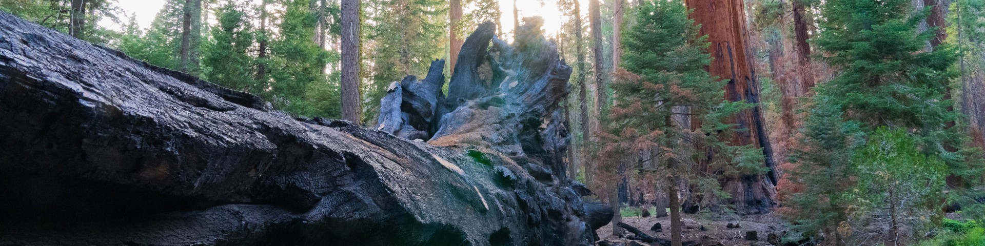
The Trail of 100 Giants

Popular with visitors worldwide. Open seasonally, usually late May through Nov. 30, this trail sits in the Giant Sequoia National Monument at an elevation of 6,400 feet. The paved, mostly flat 1.4-mile loop travels by two dozen Giant Sequoias with benches to soak in the serenity and suitable for strollers and wheelchairs. No entry fee into the forest but parking $12 cash.
Golden Trout Wilderness

Established in 1978, this wilderness sits across two national forests and one national park. Its 303,287 acres offer lush green meadows, rivers, pristine lakes, massive rock formations, unparalleled views, and abundant plants and wildlife. Elevation from 4,800 to 12,000 feet. Check with forests and park for fire restrictions, group size, stock limits, bear and food storage requirements. Golden Trout Wilderness pass required for overnight stays.
Wild and Scenic Rivers

This Act from 1968 helps preserve the free-flowing nature of rivers like the Kern River and Kings River. Both rivers offer prehistoric and historic sites with stunning views, rugged terrain, lush meadows, and music only rivers play. Upper Kern River is home to the Kern River rainbow trout. Both rivers offer hiking, horseback riding and pack trips, camping, whitewater rafting, fishing and just relaxing “away from it all”.
Recreate Responsibility

This means minimizing your impact on nature and helping preserve outdoor spaces now and for the future. Consider planning your trip by checking the weather, trail conditions, and regulations. Be kind and courteous, while leaving no trace. Pack out what you bring in. Don’t feed animals or birds. Leave plants where they are. And stay on trails. Keep campfires in designated rings and drown until cold to the touch.
Volunteer Opportunities

Are you one of those exceptional people who roll out of bed on weekends, vacations and holidays to generously give your time and talents to caring for the land? Volunteers with agreements can earn an America the Beautiful Volunteer Pass, good for one year for entrance or standard amenity day-use fees. For volunteer opportunities, reach out to the closest ranger district below or email SM.FS.SequoiaNF@usda.gov: