






Maclay Flat Nature Trail
The Maclay Flat Nature Trail is a great place to birdwatch or to take a quiet walk along the Bitterroot River. Maclay Flat is located on the west edge of Missoula, making this a local favorite spot for walking and jogging.
View this trail on the interactive map.
Maclay Flat Photos




Specific Trail Information
Trail Number
Trail Type
Accessibility
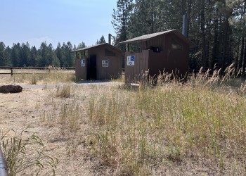
Handicap accessible vault toilets.
General Information
This site is accessible and has nature trails, parking, restrooms, river access, and interpretive signs. Benches are available along the trail. The parking lot is paved and the path is gravelled. In the spring, the Bitterroot River sometimes overflows and temporarily submerges portions of the trail.
No drinking water available.
Please visit the Forest's Alerts page for information on restrictions, in particular please review the Food/Wildlife Attractant Storage Order to help reduce the likelihood of human-to-bear conflicts.
Pets must be leashed. No horses. No bikes.

Address: 24 Fort Missoula Road Missoula, MT 59804
Phone: 406-329-3814
Hours: Monday-Friday, 9 a.m. to 4:00 p.m. (Closed on federal holidays)
Getting There
Directions
From Interstate 90, take the Highway 93, Reserve Street, exit and head south. Turn right onto Blue Mountain Road (has a light signal) and head west 2 miles to the Maclay Flat Nature Trail.


