
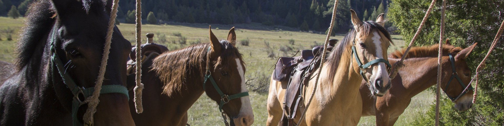
Horse Riding and Camping
Horseback riding is permitted on most national forests. Often, specific trails will be designated for horseback riding, so check the forest website before you hit the trails. Trail etiquette for multiple use trails calls for horses to have the right-of-way. Hikers should yield to horses. Bicyclists should yield to horses and hikers. Horse riders are responsible for the control of their horse at all times. Many trails are open to multiple non-motorized uses, meaning the trails are shared by hikers, horse riders, and bicyclists.
Search for Horse Riding and Camping Opportunities
Abajo - Harts Draw Recreation Area
Site Open
The Abajo - Harts Draw Recreation Area is located in southeastern Utah west of Monticello, south of Canyonlands National Park and north of Blanding, Utah. The area extends from the east Forest…
Allen Canyon Trail (453)
The Allen Canyon Trail (453) is 1.7 miles long. It begins at the end of Forest Road (FR) 5384 and ends at the southern boundary of the Manti-La Sal National Forest, west f Blanding, Utah. The trail…
Arch Canyon Trail
The Arch Canyon Trail #002 is 4.9 miles long. It begins at the Forest Service Boundary off of a 7.5 miles long jeep road (rough unmaintained jeep road on BLM land). The trail follows the bottom of…
Aspen Flat Trail
The Aspen Flat Trail #018 is 5.3 miles long. The south end of this trail is located at Forest Road #381, a small spur off of Forest Road #079 (North Creek). The north end of this trail is located at…
Aspen Flat/Shay Ridge Trailhead
Site Open
This trailhead (TH) marks the beginning of the northern end of both the Aspen Flat and Shay Ridge Trails. There is a dirt parking area here that is used for both trails. The Shay Ridge…
Bachelor Basin Trail
The Bachelor Basin trail is 6.6 miles long and located on the Moab Ranger District of the Manti-La Sal National Forest. It begins at the Miner's Basin Trailhead and ends at FR 0207/Castleton Gateway…
Beef Basin Wash Trail
The Beef Basin Wash Trail #423 is 2.6 miles long. It begins at Forest Road #093 and ends at Forest Trail #424. This trail connects with the White Rim Trail for a longer loop.Difficulty Level: Most…
Big Bear CreekTrail
The Big Bear Creek Trail #5108 is 11.1 miles long and forms a loop between Big Bear and Little Bear Creeks. It begins and ends at Forest Road #50311. This trail passes through mixed conifer and open…
Black Canyon Trail
The Black Canyon Trail #5087 is 4.2 miles long. It begins at Forest Road #50038 and ends at Forest Road #52467 east of South Skyline Drive. It climbs 2,208 feet from 7,664 feet in elevation to 9,872…
Black Dragon Trail
The Black Dragon Trail #5035 (Arapeen Route #62) is 1.8 miles long and provides a connection between the Ferron Canyon Picnic Area adjacent to Forest Road (FR) 0022 and FR 0170 south of Joes Valley.…