
Strawberry Mountain Wilderness
The Strawberry Mountain Wilderness is located east of John Day, Oregon, in the Malheur National Forest. The area includes approximately 68,700 acres and encompasses the headwaters of Pine, Indian, Strawberry, Canyon, Bear, Lake, Wall, Roberts, and Big Creek. The area is dominated by the Strawberry Mountain Range with the highest point being Strawberry Mountain. This area has extremely diverse ecological makeup. Five of the seven major life zones in North America can be found here. It also supports native population of Rocky Mountain Elk and other wildlife. The additions including the Canyon Creek Research Natural Area have improved both the quantity and the quality of the wilderness experience.
The complex geological story of this landscape began millions of years ago with the buckling of an ancient sea floor beneath the area where the western part of the Strawberry Range now rises. Much later, volcanic ash and lava formed the eastern part of the range. Most recently, the glacial ice carved its classic signature--U-shaped valleys--into the mountains. The ice also hollowed out the rock beds that today hold the seven alpine lakes of the Strawberry Mountain Wilderness--rare pleasures in the arid wilderness experience.
In a normal year, most people use the Wilderness between July and November. Snow may be encountered at higher elevations any time of the year. The climate from September is mostly mild, with clear skies. Summertime thunderstorms may occur, usually in cycles lasting several days. Daytime temperatures normally range between 30 and 80 degrees Fahrenheit; nights are cool. Freezing temperatures can occur any time of the year. When you go to the Strawberry Mountain Wilderness, be prepared for hiking in the high country. The land is rugged, and elevations range from 4,000 to the 9,038-foot summit of Strawberry Mountain. Over a hundred miles of trails cross the wilderness, offering vista after vista to the enterprising hiker.
General Information
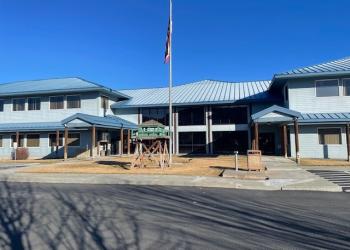
Address: 431 Patterson Bridge Road John Day, OR 97845
Phone: (541) 575-3000
Hours: Monday-Friday, 8:00 a.m. - 4:30 p.m. (Closed on federal holidays)
Office Email: SM.FS.malpubinfo@usda.gov
Getting There
Directions
Water from springs, lakes, ponds, and streams should have proper treatment before you drink it. No matter how pure it may look, surface water should be considered unsafe to drink until properly treated. The most common disease associated with surface water is giardiasis, caused by ingesting the microscopic parasite Giardia lamblia. To be safe, boil or treat the water before drinking. The recommended treatment is to bring water to a rolling boil for five minutes.
If you are patient, lucky, and observant, you may see many kinds of wildlife in the wilderness. The list includes: elk, mule deer, antelope, black bear, cougar, California bighorn sheep, ruffed and blue grouse, pileated woodpecker, sharp-shinned hawk, bald eagle, pine marten, mink, beaver, and many more birds, fur-bearing animals, and other creatures. In fact, 378 kinds of animals and 22 fish species can be found in the area.
- Key access points: View hiking activity below the map for a list of trails in the area.
Topo Maps
Download free U.S. Forest Service Topo maps.
Buy maps online
Go to the National Forest Store.
Wilderness.net
Go to Wilderness.net for online maps and other important Wilderness information.
Facility and Amenity Information
Restrooms
Restrooms are not available at this site.
Water
Potable water is not available at this site.