





Cat Gap Loop Trail
4.4 mi - Moderate - Pass through the gate on the gravel road near the main building; the trailhead is on your right just past the bridge. The trail crosses John Rock Creek, and then soon converges with Cedar Rock Creek, where there is a pleasant cascade and a popular primitive campsite on the left. It then passes Picklesimer Fields, near the intersection with Butter Gap Trail (#123); early summer is a good time to see the blooms of mountain laurel in this area. [*Note: Cat Gap Loop is open (seasonally) to mountain bikes, but only from the described trailhead to the intersection with Butter Gap Trail.] The trail then climbs moderately to Cat Gap to join the Art Loeb Trail. Turn left and proceed about 100 feet before leaving the Art Loeb Trail and dropping steeply toward Horse Cove. [Note: If the Art Loeb Trail is not on your itinerary, the rather uninteresting and steep climb to it may be largely avoided by taking the Cat Gap Bypass (#120A), which is to the left about ¾ mile from Picklesimer Fields.] The trail then becomes moderate and rocky as you pass large hemlocks and tulip poplars. After crossing the gravel road in Horse Cove, the grade becomes easy. The last mile is a pleasant walk along the Davidson River to return to the parking lot. Spring is a good time to see Pink Lady’s Slippers along the river.
Approximate Elevation Change: 1000 feet
Blaze: Orange
Specific Trail Information
Trail Number
Trail Type
General Information
Year-round
yes
Hiking Trail: Foot traffic (sections open seasonally to mountain bike use October 15-April 15).
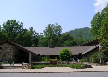
Address: 1600 Pisgah Highway Pisgah Forest , NC 28768
Phone: (828) 866-3437
Hours: Peak Season Hours (April 1-Nov. 15) -- 9 AM-5 PM daily; Off-season Hours (Nov. 16-March 31) -- 9 am-5 pm M-F (Closed on federal holidays)
Office Email: sm.fs.pisgahrd@usda.gov
Getting There
Directions
From the Pisgah District Ranger Station/Visitor Center parking lot, turn right onto US 276; proceed approximately 3 ½ miles to FS 475 (signed for Pisgah Center for Wildlife Education and Pisgah Forest Fish Hatchery) and turn left. Continue 1½ mile to Pisgah Center for Wildlife Education. The trail starts from the parking lot of that facility.
Additional Information
Operated By
US Forest Service


