

| imageID: | 21676 |
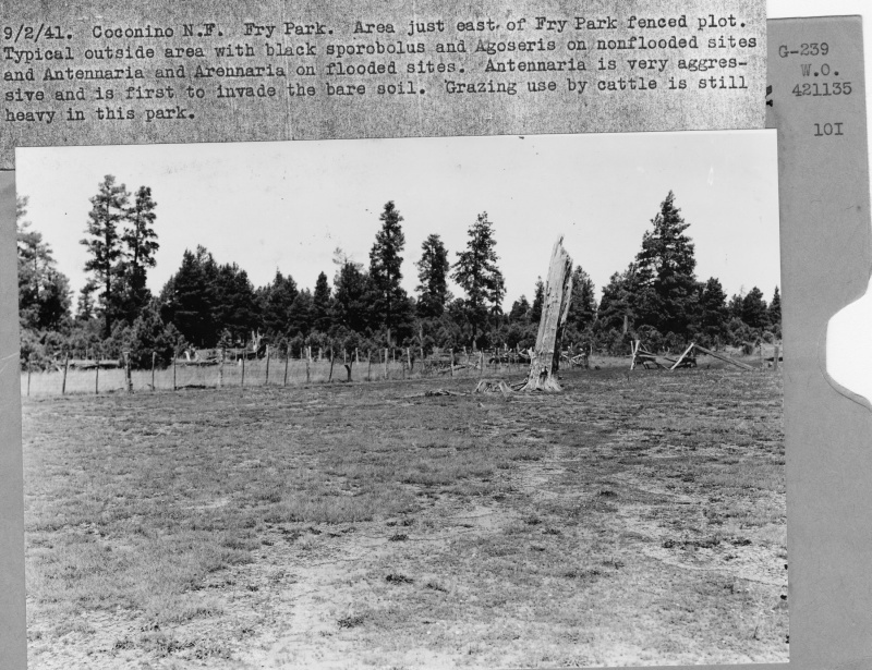
| Description: | Fry Park Fenced Plot |
| Keywords: | grasses flooding fence line effect protected area overgrazed |
| Photographer: | G.E. Glendening |
| Original collection id: | 421135 |
| Media: | Black & White Print |
| Collection: | Fort Valley Experimental Forest historical photographs |
| Quality: | 3 |
| Location: | Coconino NF; AZ; USA |
| Date(mm/dd/yyyy): | 09/02/1941 |
| Comments: | Area just east of Fry Park fenced plot. Typical outside area with black sporobolus and Agoseris on nonflooded sites and Antennaria and Arennaria on flooded sites. Antennaria is very agressive and is 1st to invade the bare soil. Grazing use by cattle is still heavy in this park. |
| Citation: | Use of this image is governed by Creative Commons CC BY. If you use the image, please include the following citation: Olberding, Susan D.; Huebner, Daniel P.; Edminster, Carleton B. 2007. Fort Valley Experimental Forest historical photographs. Fort Collins, CO: U.S. Department of Agriculture, Forest Service, Rocky Mountain Research Station. https://doi.org/10.2737/RDS-2007-0005 |
Your help is appreciated. If you see an image that has any inaccuracy please send a note to the Archive team. Thank you!