

| imageID: | 22635 |
| Description: | Woodrow Range |
| Keywords: | erosion brush Improvement drainage range |
| Photographer: | Joseph F. Arnold |
| Original collection id: | 471521 |
| Media: | Black & White Print |
| Collection: | Fort Valley Experimental Forest historical photographs |
| Quality: | 3 |
| Location: | Gila NF (nearby); NM; USA |
| Date(mm/dd/yyyy): | 10/28/1952 |
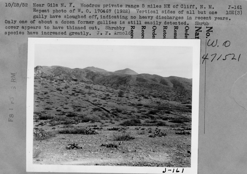
| Comments: | Woodrow private range 5 mi NE of Cliff, NM. Repeato photo of W.O. 170467 (1922). Vertical sides of all but one gully have sloughed off indicating no heavy discharges in recent years. Only one of about a dozen former gullies is still easily detected. Shrub cover appears to have thinned out. Shrubby species have increased greatly. |
| Citation: | Use of this image is governed by Creative Commons CC BY. If you use the image, please include the following citation: Olberding, Susan D.; Huebner, Daniel P.; Edminster, Carleton B. 2007. Fort Valley Experimental Forest historical photographs. Fort Collins, CO: U.S. Department of Agriculture, Forest Service, Rocky Mountain Research Station. https://doi.org/10.2737/RDS-2007-0005 |
Your help is appreciated. If you see an image that has any inaccuracy please send a note to the Archive team. Thank you!