| Collection: | RMRS Archive Images |
| Keywords: |
Water Erosion Prediction Project watershed management |
| Location: | Prescott; AZ; United States |
| Description: | Prescott, wepp |
| Date: | 6/1989 |
| Collection: | RMRS Archive Images |
| Keywords: |
demonstration area watershed management |
| Organisms: | chaparral |
| Location: | Prescott; AZ; United States |
| Description: | Senator Road looking north |
| Date: | 1986 |
| Collection: | RMRS Archive Images |
| Keywords: |
wildlife watershed management |
| Location: | Prescott; AZ; United States |
| Description: | Buck on Senator Road south of Palace Station |
| Date: | 1979 |
| Collection: | RMRS Archive Images |
| Keywords: | watershed management |
| Location: | Prescott; AZ; United States |
| Description: | Buck on Senator Road south of Palace Station |
| Date: | 1979 |
| Collection: | RMRS Archive Images |
| Keywords: |
wildlife watershed management |
| Location: | Prescott; AZ; United States |
| Description: | Doe on Senator Road north of Goodwin |
| Date: | 1979 |
| Collection: | RMRS Archive Images |
| Keywords: |
wildlife watershed management |
| Location: | Prescott; AZ; United States |
| Description: | Doe on Senator Road north of Goodwin |
| Date: | 1979 |
| Collection: | RMRS Archive Images |
| Location: | Prescott; AZ; United States |
| Description: | Ips lecontei group kill. Trees faded July 1966. |
| Date: | 6/7/1967 |
| Collection: | RMRS Archive Images |
| Location: | Prescott; AZ; United States |
| Description: | Ips lecontei pitch tube. New attack. |
| Date: | 6/7/1967 |
| Collection: | RMRS Archive Images |
| Location: | Prescott; AZ; United States |
| Description: | Ips lecontei attack in May, 1967. Silvisar-treated tree. Adults were alive. |
| Date: | 6/7/1967 |
| Collection: | RMRS Archive Images |
| Location: | Prescott; AZ; United States |
| Description: | I. lecontei attack in may, 1967. Silvisar treated tree. |
| Date: | 6/7/1967 |
| Collection: | Fort Valley Experimental Forest historical photographs |
| Keywords: |
grasses landscape |
| Location: | Prescott; Az; USA |
| Description: | Ranger Study Plot Bar Heart |
| Date: | 11/26/1940 |
| Collection: | Fort Valley Experimental Forest historical photographs |
| Keywords: | erosion |
| Location: | Prescott; AZ; USA |
| Description: | Grantic soil is eroding |
| Date: | 11/16/1939 |
| Collection: | Fort Valley Experimental Forest historical photographs |
| Keywords: | erosion |
| Location: | Prescott; AZ; USA |
| Description: | Loose granite soil is eroding rapidly |
| Date: | 11/16/1939 |
| Collection: | Fort Valley Experimental Forest historical photographs |
| Keywords: | erosion |
| Location: | Prescott; AZ; USA |
| Description: | Loose granite soil is eroding |
| Date: | 11/16/1939 |
| Collection: | Fort Valley Experimental Forest historical photographs |
| Keywords: | grasses |
| Location: | Prescott; AZ; USA |
| Description: | Granite Basin |
| Date: | 11/14/1939 |
| Collection: | Fort Valley Experimental Forest historical photographs |
| Keywords: | grasses |
| Location: | Prescott; AZ; USA |
| Description: | Bcu-Bgr in opening in brush |
| Date: | 11/14/1939 |
| Collection: | Fort Valley Experimental Forest historical photographs |
| Keywords: | erosion |
| Location: | Prescott; AZ; USA |
| Description: | Loose soil and erosion is active |
| Date: | 11/14/1939 |
| Collection: | Fort Valley Experimental Forest historical photographs |
| Keywords: | erosion |
| Location: | Prescott; AZ; USA |
| Description: | Loose granite soil is eroding rapidly |
| Date: | 11/14/1939 |
| Collection: | Fort Valley Experimental Forest historical photographs |
| Keywords: | grasses |
| Location: | Prescott; AZ; USA |
| Description: | Prescott Plot #P-4-C |
| Date: | 11/13/1939 |
| Collection: | Fort Valley Experimental Forest historical photographs |
| Keywords: | grasses |
| Location: | Prescott; AZ; USA |
| Description: | Plot #P-4-0 |
| Date: | 11/13/1939 |
| Collection: | Fort Valley Experimental Forest historical photographs |
| Keywords: | flooding |
| Location: | Prescott; Az; USA |
| Description: | Plot on Walnut Creek Rd |
| Date: | 08/1939 |
| Collection: | Fort Valley Experimental Forest historical photographs |
| Keywords: | flooding |
| Location: | Prescott; Az; USA |
| Description: | Flood Waters on Walnut Creek Rd |
| Date: | 08/1939 |
| Collection: | Sierra Ancha Historical Images |
| Keywords: | grassland |
| Location: | Prescott; AZ; USA |
| Description: | Range |
| Date: | 11/19/1937 |
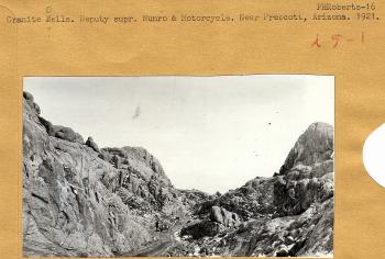
| Collection: | Fort Valley Experimental Forest historical photographs |
| Keywords: |
vehicles rock formation |
| Location: | Prescott; AZ; USA |
| Description: | Granite Dells and motorcycle |
| Date: | 1921 |
| Collection: | RMRS Archive Images |
| Location: | Prescott; AZ; United States |
| Description: | Tree killed by Ips lecontei |
| Date: |
| Collection: | RMRS Archive Images |
| Keywords: | r3 forest health e.p. |
| Organisms: |
flea beetle alder |
| Location: | Hassayampa River, Prescott; AZ; United States |
| Description: | Alder Flea Beetle defoliation |
| Date: |


