| Collection: | Pacific Northwest Research Station, Alaska Image Archive |
| Keywords: |
hydrology water conservation, soil conservation and erosion watershed management studies on stream-flow and bank erosion: miscellaneous |
| Location: | Alaska; Admiralty Island; Young Bay |
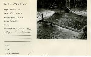
| Description: | East Creek - Young Bay. Shows one of the cut off walls for stream control section. |
| Date: | 11/20/1961 |
| Collection: | Pacific Northwest Research Station, Alaska Image Archive |
| Keywords: |
hydrology water conservation, soil conservation and erosion watershed management studies on stream-flow and bank erosion: miscellaneous |
| Location: | Alaska; Admiralty Island; Young Bay |
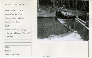
| Description: | East Creek - Young Bay. Control section. |
| Date: | 11/20/1961 |
| Collection: | Pacific Northwest Research Station, Alaska Image Archive |
| Keywords: |
hydrology water conservation, soil conservation and erosion watershed management studies on stream-flow and bank erosion: miscellaneous |
| Location: | Alaska; Admiralty Island; Young Bay |
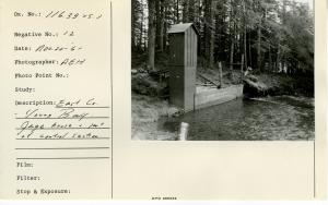
| Description: | East Creek - Young Bay. Gage house & part of control section. |
| Date: | 11/20/1961 |
| Collection: | Pacific Northwest Research Station, Alaska Image Archive |
| Keywords: |
hydrology water conservation, soil conservation and erosion watershed management studies on stream-flow and bank erosion: miscellaneous |
| Location: | Alaska; Admiralty Island; Young Bay |
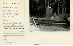
| Description: | East Creek - Young Bay. Gage house & control section. |
| Date: | 11/20/1961 |
| Collection: | Pacific Northwest Research Station, Alaska Image Archive |
| Keywords: |
hydrology water conservation, soil conservation and erosion watershed management studies on stream-flow and bank erosion: miscellaneous |
| Location: | Alaska; Admiralty Island; Young Bay |
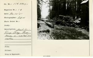
| Description: | West Creek - Young Bay. Gage house & "control" (??) section. |
| Date: | 11/20/1961 |
| Collection: | Pacific Northwest Research Station, Alaska Image Archive |
| Keywords: |
hydrology water conservation, soil conservation and erosion watershed management studies on stream-flow and bank erosion: miscellaneous |
| Location: | Alaska; Admiralty Island; Young Bay |
| Description: | West Creek - Young Bay. Downstream view from gage house. |
| Date: | 11/20/1961 |
| Collection: | Pacific Northwest Research Station, Alaska Image Archive |
| Keywords: |
hydrology water conservation, soil conservation and erosion watershed management studies on stream-flow and bank erosion: miscellaneous |
| Location: | Alaska; Admiralty Island; Young Bay |
| Description: | West Creek - Young Bay. Gage house & control section. |
| Date: | 11/20/1961 |
| Collection: | Pacific Northwest Research Station, Alaska Image Archive |
| Keywords: |
hydrology water conservation, soil conservation and erosion watershed management studies on stream-flow and bank erosion: miscellaneous |
| Location: | Alaska; Admiralty Island; Young Bay |
| Description: | East Creek - Young Bay control section. |
| Date: | 11/20/1961 |
| Collection: | Pacific Northwest Research Station, Alaska Image Archive |
| Keywords: |
hydrology water conservation, soil conservation and erosion watershed management studies on stream-flow and bank erosion: miscellaneous |
| Location: | Alaska; Admiralty Island; Young Bay |
| Description: | East Creek - Young Bay. Control below gage house. |
| Date: | 11/20/1961 |
| Collection: | Pacific Northwest Research Station, Alaska Image Archive |
| Keywords: |
hydrology water conservation, soil conservation and erosion watershed management studies of infiltration, run-off and water erosion: effects of meteorological factors:\ 25 effects of vegetation |
| Location: | Alaska; Prince of Wales Island; Maybeso Valley |
| Description: | Landslides in Maybeso Valley. |
| Date: | 10/19/1961 |
| Collection: | Pacific Northwest Research Station, Alaska Image Archive |
| Keywords: |
hydrology water conservation, soil conservation and erosion watershed management studies of infiltration, run-off and water erosion: effects of meteorological factors:\ 25 effects of vegetation |
| Location: | Alaska; Prince of Wales Island; Maybeso Valley |
| Description: | Soil slip - associated with landslides in Maybeso Valley. |
| Date: | 10/19/1961 |
| Collection: | Pacific Northwest Research Station, Alaska Image Archive |
| Keywords: |
hydrology water conservation, soil conservation and erosion watershed management studies of infiltration, run-off and water erosion: effects of meteorological factors:\ 25 effects of vegetation |
| Location: | Alaska; Prince of Wales Island; Maybeso Valley |
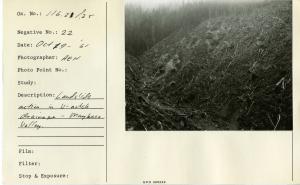
| Description: | Landslide action in V-notch drainage - Maybeso Valley. |
| Date: | 10/19/1961 |
| Collection: | Pacific Northwest Research Station, Alaska Image Archive |
| Keywords: |
hydrology water conservation, soil conservation and erosion watershed management studies on stream-flow and bank erosion: miscellaneous |
| Location: | Alaska; Prince of Wales Island; Maybeso Valley |
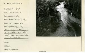
| Description: | Upper log jam area, Maybeso Creek, after high flows and jam washout, which occurred Oct. 13. Photo point: Tree sta. |
| Date: | 10/19/1961 |
| Collection: | Pacific Northwest Research Station, Alaska Image Archive |
| Keywords: |
hydrology water conservation, soil conservation and erosion watershed management studies on stream-flow and bank erosion: miscellaneous |
| Location: | Alaska; Prince of Wales Island; Maybeso Valley |
| Description: | Upper log jam study area. After high flows, and jam washout of October 13 1961. Photo point: Tree sta. |
| Date: | 10/19/1961 |
| Collection: | Pacific Northwest Research Station, Alaska Image Archive |
| Keywords: |
hydrology water conservation, soil conservation and erosion watershed management studies on stream-flow and bank erosion: miscellaneous |
| Location: | Alaska; Prince of Wales Island; Maybeso Valley |
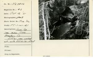
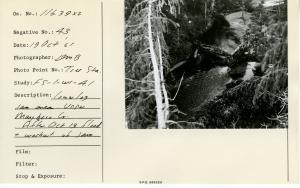
| Description: | Lower log jam area - Upper Maybeso Creek. After Oct 13 1961 flood washed the jam under key log. Photo point: Tree sta. |
| Date: | 10/19/1961 |
| Collection: | Pacific Northwest Research Station, Alaska Image Archive |
| Keywords: |
hydrology water conservation, soil conservation and erosion watershed management studies on stream-flow and bank erosion: miscellaneous |
| Location: | Alaska; Prince of Wales Island; Maybeso Valley |
| Description: | Lower log jam area. Upper Maybeso Creek. After jam washout by October 13, 1961 flood. Photo point: Tree sta. |
| Date: | 10/19/1961 |
| Collection: | Pacific Northwest Research Station, Alaska Image Archive |
| Keywords: |
hydrology water conservation, soil conservation and erosion watershed management studies on stream-flow and bank erosion: miscellaneous |
| Location: | Alaska; Prince of Wales Island; Maybeso Valley |
| Description: | Lower log jam area. Upper Maybeso Creek. After jam washout with October 13, 1961 flood. Photo point: Tree sta. |
| Date: | 10/19/1961 |
| Collection: | Pacific Northwest Research Station, Alaska Image Archive |
| Keywords: |
hydrology water conservation, soil conservation and erosion watershed management studies on stream-flow and bank erosion: miscellaneous |
| Location: | Alaska; Prince of Wales Island; Maybeso Valley |
| Description: | Lower log jam area. Upper Maybeso Cr. After October 13, 1961 flood & washout of jam. Photo point: Tree sta. |
| Date: | 10/19/1961 |
| Collection: | Pacific Northwest Research Station, Alaska Image Archive |
| Keywords: |
hydrology water conservation, soil conservation and erosion watershed management studies of infiltration, run-off and water erosion: effects of meteorological factors:\ 25 effects of vegetation |
| Location: | Alaska; Prince of Wales Island; Maybeso Valley |
| Description: | Mudslide washout in ravine of Maybeso Valley. |
| Date: | 10/1961 |
| Collection: | Pacific Northwest Research Station, Alaska Image Archive |
| Keywords: |
hydrology water conservation, soil conservation and erosion watershed management studies of infiltration, run-off and water erosion: effects of meteorological factors:\ 25 effects of vegetation |
| Location: | Alaska; Prince of Wales Island; Maybeso Valley; Halfmile Creek |
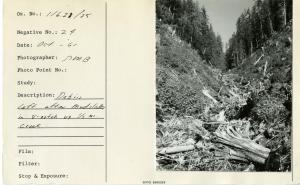
| Description: | Debris left after mudslides in v-notch up 1/2 mile creek. |
| Date: | 10/1961 |
| Collection: | Pacific Northwest Research Station, Alaska Image Archive |
| Keywords: |
hydrology water conservation, soil conservation and erosion watershed management studies of infiltration, run-off and water erosion: effects of meteorological factors:\ 25 effects of vegetation |
| Location: | Alaska; Prince of Wales Island; Maybeso Valley |
| Description: | Same mud flow as shown by negative #23. 100 road washed out. |
| Date: | 10/1961 |
| Collection: | Pacific Northwest Research Station, Alaska Image Archive |
| Keywords: |
hydrology water conservation, soil conservation and erosion watershed management studies of infiltration, run-off and water erosion: effects of meteorological factors:\ 25 effects of vegetation |
| Location: | Alaska; Prince of Wales Island; Maybeso Valley; Halfmile Creek |
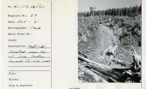
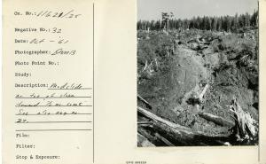
| Description: | Mudslide: located near toe of slope leading toward "1/2 - mile" creek. |
| Date: | 10/1961 |
| Collection: | Pacific Northwest Research Station, Alaska Image Archive |
| Keywords: |
hydrology water conservation, soil conservation and erosion watershed management studies of infiltration, run-off and water erosion: effects of meteorological factors:\ 25 effects of vegetation |
| Location: | Alaska; Prince of Wales Island; Maybeso Valley; Halfmile Creek |
| Description: | V-notch of "1/2 mi creek". Debris left by landslides. |
| Date: | 10/1961 |
| Collection: | Pacific Northwest Research Station, Alaska Image Archive |
| Keywords: |
hydrology water conservation, soil conservation and erosion watershed management studies of infiltration, run-off and water erosion: effects of meteorological factors:\ 25 effects of vegetation |
| Location: | Alaska; Prince of Wales Island; Maybeso Valley |
| Description: | Mudslide paths in Maybeso valley. |
| Date: | 10/1961 |
| Collection: | Pacific Northwest Research Station, Alaska Image Archive |
| Keywords: |
hydrology water conservation, soil conservation and erosion watershed management studies of infiltration, run-off and water erosion: effects of meteorological factors:\ 25 effects of vegetation |
| Location: | Alaska; Prince of Wales Island; Maybeso Valley; Halfmile Creek |
| Description: | Mudslide near toe of slope towards "1/2 mile creek". See also neg. no. 27. |
| Date: | 10/1961 |
| Collection: | Pacific Northwest Research Station, Alaska Image Archive |
| Keywords: |
hydrology water conservation, soil conservation and erosion watershed management studies of infiltration, run-off and water erosion: effects of meteorological factors:\ 25 effects of vegetation |
| Location: | Alaska; Prince of Wales Island; Harris River Valley |
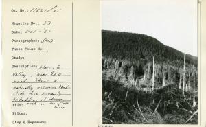
| Description: | Harris River valley, near 260 road. Shows a naturally occurring landslide due primarily to bedding of rock on the lower slope. |
| Date: | 10/1961 |
| Collection: | Pacific Northwest Research Station, Alaska Image Archive |
| Keywords: |
hydrology water conservation, soil conservation and erosion watershed management studies on stream-flow and bank erosion: miscellaneous |
| Location: | Alaska; Prince of Wales Island; Maybeso Valley |
| Description: | Located 1/3 mile down from 150 bridge over Maybeso Creek. Shows "fire-hose" method at hydraulic-ing sediment Into stream. [Photographer possibly John Tallmadge.] |
| Date: | 8/16/1961 |
| Collection: | Pacific Northwest Research Station, Alaska Image Archive |
| Keywords: |
hydrology water conservation, soil conservation and erosion watershed management studies on stream-flow and bank erosion: miscellaneous |
| Location: | Alaska; Prince of Wales Island; Maybeso Valley |
| Description: | 1/3 mile down stream from 150 bridge over Maybeso Creek. Shows stream bank which has been used as a sediment source. [Photographer possibly John Tallmadge.] |
| Date: | 8/16/1961 |
| Collection: | Pacific Northwest Research Station, Alaska Image Archive |
| Keywords: |
hydrology water conservation, soil conservation and erosion watershed management studies on stream-flow and bank erosion: miscellaneous |
| Location: | Alaska; Prince of Wales Island; Maybeso Valley |
| Description: | Located about 1/3 mile downstream from 150 bridge. Shows stream bank which was used as a sediment source. [Photographer possibly John Tallmadge.] |
| Date: | 8/16/1961 |
| Collection: | Pacific Northwest Research Station, Alaska Image Archive |
| Keywords: |
hydrology water conservation, soil conservation and erosion watershed management studies on stream-flow and bank erosion: miscellaneous |
| Location: | Alaska; Prince of Wales Island; Maybeso Valley |
| Description: | Lee Alberta sampling Maybeso Creek. [Photographer possibly John Tallmadge.] |
| Date: | 8/16/1961 |
| Collection: | Pacific Northwest Research Station, Alaska Image Archive |
| Keywords: |
hydrology water conservation, soil conservation and erosion watershed management studies on stream-flow and bank erosion: miscellaneous |
| Location: | Alaska; Prince of Wales Island; Maybeso Valley |
| Description: | 1/2 mile down from 150 bridge on Maybeso Creek. Shows sample intake and temporary stream gage above test riffle #1. [Photographer possibly John Tallmadge.] |
| Date: | 8/16/1961 |
| Collection: | Pacific Northwest Research Station, Alaska Image Archive |
| Keywords: |
hydrology water conservation, soil conservation and erosion watershed management studies on stream-flow and bank erosion: miscellaneous |
| Location: | Alaska; Prince of Wales Island; Maybeso Valley |
| Description: | Located 1/3 mile downstream from 150 bridge over Maybeso Creek. Jerry Smith, Bill Craig shooting sediment into stream. [Photographer possibly John Tallmadge.] |
| Date: | 8/16/1961 |
| Collection: | Pacific Northwest Research Station, Alaska Image Archive |
| Keywords: |
hydrology water conservation, soil conservation and erosion watershed management studies on stream-flow and bank erosion: miscellaneous |
| Location: | Alaska; Prince of Wales Island; Maybeso Valley |
| Description: | 1/2 mile downstream from 150 bridge on Maybeso Creek. Shows turbidity sample intake device and pool above test riffle #1. [Photographer possibly John Tallmadge.] |
| Date: | 8/16/1961 |
| Collection: | Pacific Northwest Research Station, Alaska Image Archive |
| Keywords: |
hydrology water conservation, soil conservation and erosion watershed management studies on stream-flow and bank erosion: miscellaneous |
| Location: | Alaska; Prince of Wales Island; Maybeso Valley |
| Description: | Located 1/2 mile down from 150 bridge, Maybeso Creek. View downstream shows turbidity sample intake device. Temporary stream gage on right. [Photographer possibly John Tallmadge.] |
| Date: | 8/16/1961 |
| Collection: | Pacific Northwest Research Station, Alaska Image Archive |
| Keywords: |
hydrology water conservation, soil conservation and erosion watershed management studies on stream-flow and bank erosion: miscellaneous |
| Location: | Alaska; Prince of Wales Island; Maybeso Valley |
| Description: | Located 1/2 mile down from 150 bridge. Shows washed stream bank and equipment use for job. [Photographer possibly John Tallmadge.] |
| Date: | 8/16/1961 |
| Collection: | Pacific Northwest Research Station, Alaska Image Archive |
| Keywords: |
plant ecology ecosystems vegetation types ecotypes |
| Location: | Alaska; Prince of Wales Island; Maybeso Valley |
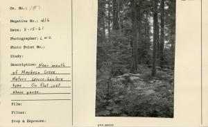
| Description: | Near mouth of Maybeso Creek. Mature spruce-hemlock type. On flat just above gauge. |
| Date: | 8/15/1961 |
| Collection: | Pacific Northwest Research Station, Alaska Image Archive |
| Keywords: |
hydrology water conservation, soil conservation and erosion watershed management studies on stream-flow and bank erosion: miscellaneous |
| Location: | Alaska; Southeast |
| Description: | Study Area 2 immediately after jam construction. |
| Date: | 8/15/1961 |
| Collection: | Pacific Northwest Research Station, Alaska Image Archive |
| Keywords: |
regeneration and formation of stands tending of stands and trees opening of the canopy (increment fellings, overhead release and improvement fellings) girdling and poisoning |
| Location: | Alaska; Cat Island |
| Description: | Decomp plot. Poison Plot #22, Tree #2. Cat Island. |
| Date: | 8/14/1961 |
| Collection: | Pacific Northwest Research Station, Alaska Image Archive |
| Keywords: |
regeneration and formation of stands tending of stands and trees opening of the canopy (increment fellings, overhead release and improvement fellings) girdling and poisoning |
| Location: | Alaska; Cat Island |
| Description: | Decomp plot. Poison Plot #22, Tree #4. Cat Island. |
| Date: | 8/14/1961 |
| Collection: | Pacific Northwest Research Station, Alaska Image Archive |
| Keywords: |
regeneration and formation of stands tending of stands and trees opening of the canopy (increment fellings, overhead release and improvement fellings) girdling and poisoning |
| Location: | Alaska; Cat Island |
| Description: | Decomp plot. Poison Plot #22, Tree #5. Cat Island. |
| Date: | 8/14/1961 |
| Collection: | Pacific Northwest Research Station, Alaska Image Archive |
| Keywords: |
regeneration and formation of stands tending of stands and trees opening of the canopy (increment fellings, overhead release and improvement fellings) girdling and poisoning |
| Location: | Alaska; Cat Island |
| Description: | Decomp. Plot. Poison Plot #13, Tree #2, Cat Island. |
| Date: | 8/14/1961 |
| Collection: | Pacific Northwest Research Station, Alaska Image Archive |
| Keywords: |
forest mensuration increment development and structure of stands surveying and mapping |
| Location: | Alaska; Tuxekan Passage |
| Description: | Plot 300 Tuxekan Pass Growth Plot outside plot toward water. John Tallmadge. |
| Date: | 8/11/1961 |
| Collection: | Pacific Northwest Research Station, Alaska Image Archive |
| Keywords: |
forest mensuration increment development and structure of stands surveying and mapping |
| Location: | Alaska; Tuxekan Passage |
| Description: | Plot 300 Tuxekan Pass Growth Plot. From camera point #2(1141). |
| Date: | 8/11/1961 |
| Collection: | Pacific Northwest Research Station, Alaska Image Archive |
| Keywords: |
forest mensuration increment development and structure of stands surveying and mapping |
| Location: | Alaska; Tuxekan Passage |
| Description: | Plot 300 Tuxekan Pass Growth Plot. Inside plot looking toward camera point #2(1141). |
| Date: | 8/11/1961 |
| Collection: | Pacific Northwest Research Station, Alaska Image Archive |
| Keywords: | treatment of defective, derelict or very open stands |
| Location: | Alaska; Prince of Wales Island; Maybeso Valley |
| Description: | Crown of Residual Tree #30, full crown, & #41 (right). Maybeso Valley. |
| Date: | 8/7/1961 |













![Located 1/3 mile down from 150 bridge over Maybeso Creek. Shows "fire-hose" method at hydraulic-ing sediment Into stream. [Photographer possibly John Tallmadge.] Located 1/3 mile down from 150 bridge over Maybeso Creek. Shows "fire-hose" method at hydraulic-ing sediment Into stream. [Photographer possibly John Tallmadge.]](/rds/imagedb/images/_thm/31557.jpg)
![1/3 mile down stream from 150 bridge over Maybeso Creek. Shows stream bank which has been used as a sediment source. [Photographer possibly John Tallmadge.] 1/3 mile down stream from 150 bridge over Maybeso Creek. Shows stream bank which has been used as a sediment source. [Photographer possibly John Tallmadge.]](/rds/imagedb/images/_thm/31558.jpg)
![Located about 1/3 mile downstream from 150 bridge. Shows stream bank which was used as a sediment source. [Photographer possibly John Tallmadge.] Located about 1/3 mile downstream from 150 bridge. Shows stream bank which was used as a sediment source. [Photographer possibly John Tallmadge.]](/rds/imagedb/images/_thm/31559.jpg)
![Lee Alberta sampling Maybeso Creek. [Photographer possibly John Tallmadge.] Lee Alberta sampling Maybeso Creek. [Photographer possibly John Tallmadge.]](/rds/imagedb/images/_thm/31560.jpg)
![1/2 mile down from 150 bridge on Maybeso Creek. Shows sample intake and temporary stream gage above test riffle #1. [Photographer possibly John Tallmadge.] 1/2 mile down from 150 bridge on Maybeso Creek. Shows sample intake and temporary stream gage above test riffle #1. [Photographer possibly John Tallmadge.]](/rds/imagedb/images/_thm/31561.jpg)
![Located 1/3 mile downstream from 150 bridge over Maybeso Creek. Jerry Smith, Bill Craig shooting sediment into stream. [Photographer possibly John Tallmadge.] Located 1/3 mile downstream from 150 bridge over Maybeso Creek. Jerry Smith, Bill Craig shooting sediment into stream. [Photographer possibly John Tallmadge.]](/rds/imagedb/images/_thm/31562.jpg)
![1/2 mile downstream from 150 bridge on Maybeso Creek. Shows turbidity sample intake device and pool above test riffle #1. [Photographer possibly John Tallmadge.] 1/2 mile downstream from 150 bridge on Maybeso Creek. Shows turbidity sample intake device and pool above test riffle #1. [Photographer possibly John Tallmadge.]](/rds/imagedb/images/_thm/31563.jpg)
![Located 1/2 mile down from 150 bridge, Maybeso Creek. View downstream shows turbidity sample intake device. Temporary stream gage on right. [Photographer possibly John Tallmadge.] Located 1/2 mile down from 150 bridge, Maybeso Creek. View downstream shows turbidity sample intake device. Temporary stream gage on right. [Photographer possibly John Tallmadge.]](/rds/imagedb/images/_thm/31564.jpg)
![Located 1/2 mile down from 150 bridge. Shows washed stream bank and equipment use for job. [Photographer possibly John Tallmadge.] Located 1/2 mile down from 150 bridge. Shows washed stream bank and equipment use for job. [Photographer possibly John Tallmadge.]](/rds/imagedb/images/_thm/31565.jpg)
