Southwest Jemez Mountains Collaborative Landscape Restoration
The Southwest Jemez Collaborative Forest Landscape Restoration Project was a long-term forest and watershed restoration project to increase the landscape's resilience to severe wildfire and other large-scale disturbances.
Summary Monitoring Report 2021
The Landscape
The landscape area is approximately 210,000 acres in the Southwest Jemez Mountains (SWJM) comprising the entire upper Jemez River watershed and including 110,000 acres on the Santa Fe National Forest, the 86,000-acre Valles Caldera National Preserve, the Pueblo of Jemez Pueblo, and additional parcels of state, private, and tribal lands (Vicinity Map, Project Map).
The project area includes ponderosa pine, mixed conifer, aspen and piñon-juniper forests as well as grasslands, meadows, riparian areas and aquatic habitats.
The Need for Restoration
The effect of human activities has significantly changed the ecological complexion of the landscape within the Jemez Mountains. Over time, the suppression of natural wildfires has dramatically altered the diversity, age, and productivity of native plant species. The forests have experienced dramatic increases in tree densities, thick understories, and ground litter. Decades of livestock grazing have left river and creek embankments without enough vegetation to hold the soil and shade the waterways to provide optimal temperatures for native trout and other aquatic species. Invasive plants and noxious weeds have encroached across the landscape, diminishing the quality, quantity and diversity of native forage for both wildlife and livestock.
Project Goals
The overall goal was to restore the forest to conditions that were common to this geographical area prior to the first European contact. The SWJM project was designed to meet four primary purposes:
- Restore the forest's resilience to wildfire and other disturbances by using low-intensity fire to return fire to the landscape
- Protect cultural resources
- Improve wildlife habitat, watershed and riparian conditions, vegetation diversity and water quality
- Create local economic development opportunities
Forest Restoration Activities
Prescribed fire is one of the most effective tools available to resource managers for restoring fire-adapted ecosystems like the Jemez Mountains. These fires mimic natural fires by reducing forest fuels, recycling nutrients and increasing habitat diversity. Learn more about other forest restoration activities.
Collaboration
Collaboration is about doing more together than any of us can do alone! Read more about the partners and their contributions to this project. More about our partners and their contributions.
Is Your Home Firewise?
Many people who have chosen to live along the wildland-urban interface (WUI) appreciate being nestled in the forest and surrounded by nature. But an essential part of that bargain is to understand the risk of wildfire on these landscapes that we treasure. There are proactive steps residents and property owners can take to mitigate that risk. The National Fire Protection Association website has information about Firewise programs and how to prepare and protect your property. You can also contact the Jemez Ranger District's Fire Prevention Officer for additional information.
Alerts & Warnings
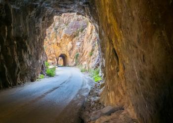
- TEMPORARY AREA AND ROAD CLOSURE FOR THE GILMAN TUNNELS ROCK SCALING PROJECT
- Temporary Area Closure for the Tesuque Peak Powerline # 30-10-06-24-12
- Camping Area Closure at Headquarters Well Order Number # 03-10-06-24-07
- Temporary Area, Road and Trail Closure - Hermits Peak and Calf Canyon Post-Fire
- Federal Holiday: offices closed Monday, October 14.