
Welcome to Dixie National Forest
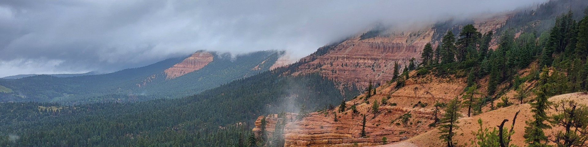
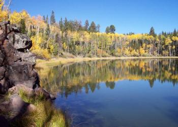
Dixie National Forest straddles the divide between the Great Basin and the Colorado River in southern Utah. Scenery ranges from desert canyon gorges of amber, rose, and sienna to high mountain forests, plateaus, and alpine lakes. The forest is a part of the world-renowned landscapes of Southern Utah—it provides a backdrop and serves as a gateway to surrounding National Parks and Monuments. Nationally recognized highways and trails course through the forest and provide ready access to the distinctive natural highlights of the forest landscape. The Dixie is known for its scenery, from red rock canyons to high mountain plateaus. Always check conditions before you venture out and enjoy the Dixie National Forest.
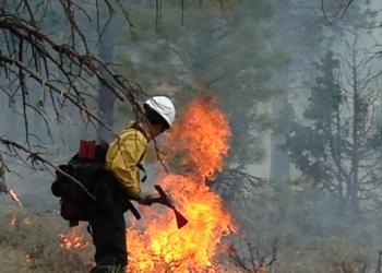
What is Prescribed Fire?
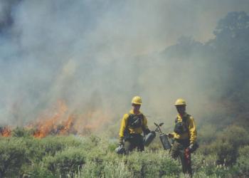
Learn more about planned, on-going and completed prescribed fire operations across the USDA Forest Service Intermountain Region.
Recreation.gov

Find information about recreation and camping on the Dixie National Forest by visiting Recreation.gov
Pine Valley Landscape Priority Investment Project
USDA identified funding for the Pine Valley Landscape Priority Investment project on January 19, 2023. The project encompasses 250,000 acres in the Pine Valley Ranger District of the Dixie National Forest. There is another 150,000 acres of other ownership including private, state and other federal lands.
Resource Advisory Committee
One of the best ways to influence the care and use of our Forest Service lands is to join a Forest Service Resource Advisory Committee, also known as a RAC. We encourage all interested individuals to apply.
Dixie National Forest Pollinators

Visit the Insect Pollinators in the Intermountain West story map here.