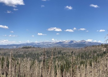
Eldorado National Forest

Your Gateway to the Sierra!

Come discover, explore, and enjoy your Eldorado National Forest.

Your Adventure Awaits!

Alerts

  • Storm Damage:
    • 11 Pines Road - There is a rough section where a washout occurred, but the road is passable. 
    •  Culvert failure on Rock Creek road at Al Brass Creek.  The road is currently impassable and barricades have been setup.  From the north, you can not access sites south of the northern intersection of Rock Creek and trail 11E43 (trail 4).  From the south, you can not access sites north of the intersection of 12N70G.

    • North South Road in the Placerville Ranger District is passable, but has an asphalt washout south of the Caldor OHV staging area. Orange K-rails are installed to alert the public. This location is approximately 12 miles south of MET (Iron Mountain Road).

    • Much of the Rock Creek Trail System is impassable due to downed trees and erosion damange from this year's winter storms. The West Zone has been mostly cleared. The East and Southern Zones are temporarily closed while repair work continues. See Forest Orders 03-23-02 and 03-23-03

    • Alder Creek Rd / 11N46 - Impassable. A rockfall is blocking the road 2.6 miles south of the Highway 50 intersection

    • Camp Creek Rd / 10N57 - Impassable. The road is completely washed out due to a failed culvert 2.7 miles north of the Sciaroni Rd intersection

    • Caldor Rd / 9N45 - Impassable. The road is undercut and partially washed out 1/3 of a mile west of the Plummer Ridge loop trail intersection

    • Salt Springs Rd / 08N50 - Landslide after crossing the Mokelumne River. No access to trailhead or reservoir. Work has been initiated to clear road. 

    • See also road status under current conditions

POST-FIRE ADVISORY - The Mosquito and Caldor fire areas continue to have potential for falling trees, mudslides and debris flows. Recreating in a post-fire area always carries a number of hazards and dangers. We recommend checking out other areas in the forest outside the fire areas for your recreation activities.

Thousands of visitors are drawn each year to the Eldorado National Forest’s rivers, lakes, and streams alive with fish; mountains and meadows for alpine and nordic skiing; campsites and picnic areas in alpine backcountry and dense forests. Four hundred miles of hiking trails pass through all kinds of terrain, from gentle oak foothills on the west to the 10,000-foot crest of the Sierra Nevada. Two major highways - Highway 50 and Highway 88 - run through the Forest, making it an easy drive from Sacramento and the San Francisco Bay Area.

The Forest Service is committed to nurturing and managing the National Forests in order to ensure the health of the land. As we respectfully use and play in these precious public lands, we are taking part in a shared vision for the future.

Quick Links

Features

Revised Date for Request For Bids Release

Please be advised that the RFB packages for the Vulcan Skyline Project, Scottiago Forest Health and Fuels Reduction Project, & Caldor Hazard Tree Removal Project will be delayed due to US Forest Service administrative review.

View Feature

Caldor Fire Recovery

Recovery after a major wildfire is a long term process. The first steps involve repairing areas damaged by fire suppression, and mitigating safety hazards such as fire weakened trees, burning stump holes, damaged utilities, and hazmat concerns. Recovery also includes the Burned Area Emergency Response, information on access to recreation residences and the forest, debris cleanup, the rebuilding process for recreation residences, and future Caldor Fire restoration and management activities.

View Feature