

Visitor Maps and Guides
Get ready for your visit by checking out our detailed maps, brochures, and information guides. Visitor maps and publications are available in-person at forest offices and online at the US Geological Survey Map Store or find mobile friendly maps at the Avenza map store.
Maps and Publications
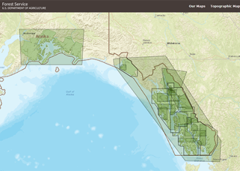
Alaska Region Vicinity Map

View a detailed vicinity map of National Forest System Lands within the Alaska Region. The Alaska Region is home to the nation's two largest national forests, the Chugach and Tongass, traditional homelands of Alaska Native peoples. The Alaska Region offers amazing diversity and a multitude of uses.
Visitor Map Finder Application
Search for Forest Service Visitor, District, Wilderness or other specialty maps using our online Map Finder.
Forest Service Digital Maps
These free downloadable geo-enabled topographic maps are updated annually using authoritative inter-agency data.
Motor Vehicle Use Maps

Motor Vehicle Use Maps show national forest system roads & trails open to motorized travel. The map is a black and white map with no topographic features. These maps are free and available at Forest Service Offices or online at the Avenza Map Store.
Alaska Region GeoHub
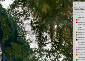
Use the navigation tools to explore the different Story Maps and Web Apps, and data that the USDA Forest Service has produced for the Alaska Region.
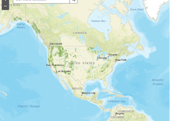
Interactive Visitor Map
Looking for you next adventure on the Chugach or Tongass National Forest? Check out our National Interactive Visitor Map to help you start your trip planning.
More Alaska Region Maps & Data
- Chugach National Forest maps and guides
- Tongass National Forest maps and guides
- Alaska Geospatial Council
- US Geological Survey Topographic Maps
Geospatial Data
Contacts
Kim Homan
Geospatial Program Manager
907-318-8061
Kim.Homan@usda.gov
Justin Martens
Regional GIS Coordinator
907-713-5718
Justin.Martens@usda.gov
Jacob Hofman
Cartographer
907-586-7887
Jacob.Hofman@usda.gov
Melinda Lamb
Geospatial Services Specialist
907-586-8761
Melinda.S.Lamb@usda.gov
Joseph Moore
Geospatial Data Specialist
Joseph.Moore2@usda.gov
Dustin Wittwer
Remote Sensing Coordinator
907-586-8764
Dustin.Wittwer@usda.gov
Michael Hill
Natural Resources Coordinator
michael.a.hill@usda.gov
907-204-8368
Disclaimer: The USDA Forest Service recognizes that some of the terms found on these archived documents may be considered offensive to many. These terms are not representative of USDA policy but reflect the actual place names that were in use at the time of original publication of these historical maps and documents.