
Gibbons Pass Interpretive Site
Set out on a journey through time as you explore the historic route across the Continental Divide forged by some of America’s most storied travelers.
On July 3, 1806, determined to discover a more efficient passage, Lewis and Clark divided their Corps at Traveler’s Rest near Lolo, Montana. Captain Lewis ventured northeast through Hellgate Canyon and over what would become Lewis and Clark Pass, while Captain Clark guided his party along the Bitterroot River to the area near present-day Sula. From there, Clark’s group ascended an ancient Indigenous trail rising from the valley floor to today’s Gibbons Pass before descending into the vast Big Hole Valley.
This same pathway later carried Chief Joseph and the non‑treaty Nez Perce during their difficult 1877 flight toward the Big Hole Valley—adding another profound chapter to the historic corridor.
Visitors today can discover this rich heritage firsthand, with interpretive signs placed along the Bitterroot–Big Hole Road and a restroom facility located at the summit of Gibbons Pass.
General Information
Open 24 hours/day
The Bitterroot-Big Hole Road (Forest Road 106) from the Sula Ranger Station to the top of Gibbons Pass is a steep, winding and narrow road with few turnouts and is not suitable for vehicles over 25 feet.
No fees are required for this site
No fees charged
Contact Phone: 406-821-3913
Address: 712 N. Main Darby, MT 59829
Phone: 406-821-3913
Hours: Monday-Friday, 8:00 a.m. - 4:30 p.m. (Closed on federal holidays)
Getting There
Latitude / Longitude
Latitude: 45.7476
Longitude: -113.9146
Directions
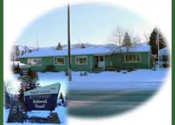
Discover the scenic Gibbons Pass Road, beginning just behind the Sula Ranger Station off Highway 93 in Sula, Montana. This memorable route offers travelers a gateway into breathtaking Bitterroot and Big Hole country.
Road Advisory: Please note that the Bitterroot–Big Hole Road (Forest Road 106), stretching from the Sula Ranger Station to the summit of Gibbons Pass, is a steep, winding, and narrow mountain road with limited turnouts. For your safety, it is not recommended for vehicles over 25 feet.
Facility and Amenity Information
Restrooms
Vault toilet(s)Water
Potable water is not available at this site.
Recreation Opportunities
Recreation Groups

Experience the powerful story of the 1877 Nez Perce flight as you travel the Nez Perce National Historic Trail through the breathtaking Bitterroot Valley.

The Continental Divide National Scenic Trail in the Bitterroot National Forest invites adventurers to explore 25 miles of high-elevation beauty along the rugged spine of th

The Bitterroot Valley played a major role in the Lewis and Clark Expedition (1804-1806), and it is one of the most meaningful stretches of their journey west.