





Chaffin Creek Trail # 528
The Chaffin Creek Trail #528 follows its namesake creek for approximately 6.3 miles. As the trail ascends 2,700 feet in elevation, hikers can expect to experience beautiful views of the forested areas along the creek with glimpses of the canyon mixed in. Climbing in elevation, the trail crosses some rocky talus areas and and becomes steep and difficult on the approach to Hart, Tamarack and Chaffin Lakes. Here, the lakes provide a scenic vista back into the valley while surrounded by towering granite walls and a prominent Sugarloaf Peak at 9,475' elevation.
Specific Trail Information
Trail Type
General Information
Food Storage Required: Bitterroot National Forest Food Storage Order
Camping is limited to 16 consecutive days: Camping Restrictions Regional Order
Weed Seed Free feed is required on all national forest land: Weed Free Forage Order for Northern Region
Campfires allowed, dependent upon seasonal fire restrictions.
Practice good trail etiquette by staying on designated paths, yielding to uphill users, and giving space to others.
Pets must be under control. Leashes are recommended to avoid user and wildlife conflicts. Properly dispose of animal waste bags. Do not put animal waste bags in vault toilets
Selway Bitterroot Wilderness party size is limited to a maximum 20 people and 20 head of pack and saddle stock.
Open year-round, snow dependent
Chaffin Creek Trail enters the Selway-Bitterroot Wilderness at approximately mile 2.5
- Leave No Trace
Prohibited uses include:
- Motorized equipment and mechanized travel including e-bikes
- No Drones in Wilderness areas
- No cutting switchbacks
Contact Name: Darby-Sula Ranger District
Contact Phone: (406) 821-3913
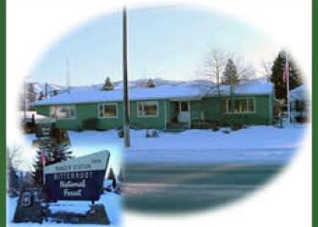
Address: 712 N. Main Darby, MT 59829
Phone: 406-821-3913
Hours: Monday-Friday, 8:00 a.m. - 4:30 p.m. (Closed on federal holidays)
Getting There
Trailhead/Starting Points
Parking
Chaffin Creek Trailhead has adequate parking for approximately 4 passenger vehicles.
Directions
From Darby travel south for 4.3 miles on Highway 93. Turn south (right) on West Fork Rd and travel 0.2 miles. Turn west (right) onto Chaffin Creek Rd (National Forest Road #374) and go 2.5 miles to fork in road. Stay to the north (right) and road will become National Forest Road #716. Follow for approximately 1.5 miles to the trailhead.


