





Grass Ridge Trail # 65
The Grass Ridge trail is 6.4 miles long. It begins at Trail 4 and ends at Road 224 - Hells Half Lookout. The trail is open for the following uses: Horseback Riding and Backpacking.
Current conditions: Bitterroot National Forest Trail Clearing Status (Interactive Map)
Specific Trail Information
Trail Type
General Information
- The Grass Ridge trail #65 is entirely in the Frank Church River of No Return Wilderness.
- Practice Leave No Trace principles when visiting forest lands.
- Pack it in, Pack it out, no garbage service provided.
- Weed Seed Free Feed is required on all national forest land.
- Campfires allowed, dependent upon seasonal fire restrictions.
- Practice good trail etiquette by staying on designated paths, yielding to uphill users, and giving space to others.
- Pets must be under control. Leashes are recommended to avoid user and wildlife conflicts.
Forest Visitor Map: Bitterroot National Forest Maps and Guides
Bitterroot National Forest Trail Clearing Status (Interactive Map)
Typical season of use is from May 15 into November.
No permits required for non-commercial use.
No potable water is available. All water must be sourced naturally.
No motorized equipment: chainsaws.
No Mechanized equipment: vehicles, OHV, motorcycles, bikes, drones, gliders, aircraft landings.
Max group size: 20 people and 20 stock animals.
Contact Name: West Fork Ranger Station
Contact Phone: 406-821-3269
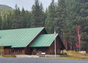
Address: 6735 West Fork Road Darby, MT 59829
Phone: 406-821-3269
Hours: Monday-Friday, 8:00 a.m. - 4:30 p.m. (Closed on federal holidays)
Getting There
Trailhead/Starting Points
Magruder Ranger Station
Parking
Parking is located at the Magruder visitor parking area or Hells Half Acre Lookout visitor parking area.
Directions
Directions to Magruder is to turn south from FS Road #468 onto FS Road #468A for 1/2 mile.


