
Motor Vehicle Use Maps
The Motor Vehicle Use Maps (MVUM) show the roads and trails that are authorized for motorized use. Roads and trails not shown on these maps are not authorized for public motorized use.
There is an MVUM associated with each Ranger District on the Rio Grande National Forest. The MVUM is a black and white map with no topographic features. It is not intended as a stand alone map and is best used in conjunction with a Forest Visitor Map or other topographic map. The MVUM is available for free on this website and sections of it may be printed from your home computer.
Rio Grande National Forest MVUM's (PDF Format)
These maps are geo-referenced pdfs. If you do not already have a copy of Adobe Reader, you can download a free copy from Adobe. If you would like a mobile friendly map, please see this page.
Conejos Peak Ranger District - East MVUM
Conejos Peak Ranger District - West MVUM
Divide Ranger District - East MVUM
Divide Ranger District - West MVUM
Saguache Ranger District - East MVUM
Saguache Ranger District - West MVUM
Each map with "West" title has the motorized vehicle use rules and regulations on it. Also, there is a QR code on that map that no longer has a valid path to the mobile maps.
It is recommended that the legend box, as well as applicable special designations, be printed to aid in interpretation of the MVUM.
Reminder, electric bicycles, also called e-bikes are considered motorized vehicles and are not allowed on closed roads or non-motorized trails and cannot be used for off-road game retrieval.
Frequently Asked Questions
A full-size version of the MVUM is 34" x 44" and cannot be printed on conventional home printers. A full-size version can only be printed from a large plotter. Local engineering and survey business may be willing to print the map for a nominal fee.
To print the MVUM on 8 ½" x 11" paper using a home printer, download the map and open with Adobe Acrobat. Use the “Print Current View” function to print the view on your screen.
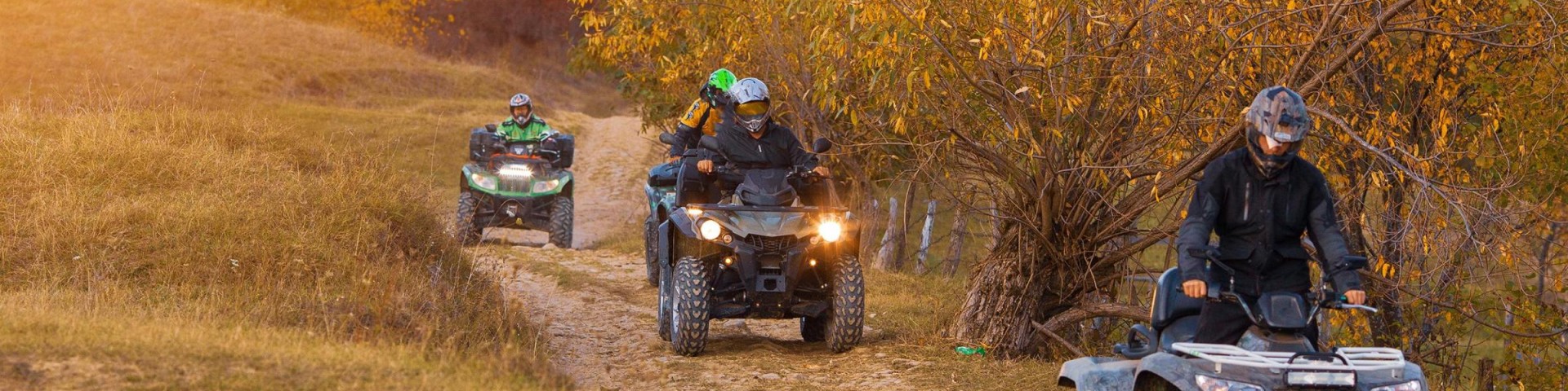
The map displays all NFS roads, trails and designated areas allowing public motor vehicle use. Motorized use includes, but is not limited to, Motorcycles, ATV's, and 4-wheel drive vehicles. Designation details, including vehicle class, time of year, and any motorized access for the purpose of dispersed camping (camping in locations other than campgrounds).
The MVUM also shows roads where only highway-legal vehicles are allowed due to user safety considerations. Motor vehicle access may occur on routes not shown on the MVUM for the purpose of limited administrative access by Forest Service personnel; for fire and law enforcement for emergency purposes and by persons authorized by a written special-use permit or contract from the Forest Service.
No, a visitor use map or recreation opportunity map will provide information on motorized routes as well as non-motorized routes, including mechanized trails, hiking, and horse trails. Over-snow vehicle use is exempted from designations on the MVUM. These maps, once developed, will be available for purchase at FS offices.
By vehicle class, we are referring to certain categories of motorized vehicles. The following are typical vehicle class route designations:
- Roads open to highway legal vehicles only
- Roads open to all vehicles (licensed and unlicensed)
- Trails open to vehicles 50 inches or less in width (ATV, motorcycle, etc.)
- Trails open to all vehicles (trails may be rugged and narrow- intended for jeeps)
- Trails open to motorcycles only (single track)
It's important to understand that routes and areas shown open to certain vehicle classes does not mean they are maintained for or are suitable for travel using those vehicles. It simply means it is legal to use them. For example, many low standard roads may be open to all motor vehicles. This designation includes passenger cars, although it may not be prudent to drive this type of vehicle on the route due to the condition of the surface or during inclement weather. Please check with the local Ranger District Offices for more information.
Some routes or areas may be open only during certain times of the year for various reasons such as to reduce wildlife disturbance, protect users from unsafe or impassable conditions and to reduce impacts to other resource values.
Routes designated for motorized use may not always be signed on the ground. In some cases, a route marker may exist at the entrance of the road/trail with symbols indicating which classes of vehicles are allowed. Routes designated for motorized uses will be identified on the MVUM.
The MVUM is an enforcement tool to ensure individuals are on the correct route. It is the responsibility of the user to determine if they are on a route designated for the motor vehicle being used. MVUM's have been developed for each forest nationwide. It is not only a tool for motorized users, but also a consistent and standardized law enforcement tool.
Travel Management
Motor Vehicle Use Map (MVUM)
The MVUM is a requirement of the Travel Management Final Rule and reflects travel management decisions on each forest. The MVUM displays National Forest System (NFS) routes (roads and trails), or areas designated open to motorized travel. The MVUM also displays allowed uses by vehicle class (highway-legal vehicles, vehicles 50 inches or less in width and motorcycles), seasonal allowances, and provides information on other travel rules and regulations. Routes not shown on the MVUM are not open to public motor vehicle travel. Routes designated for motorized use may not always be signed on the ground but will be identified on the MVUM. It will be the public's responsibility to reference the MVUM to determine designated routes for motor vehicle use. The MVUM will be updated periodically, to correct mapping errors or discrepancies and update travel decisions.