
Water, Air and Soil

Why are these resources important?
Watershed
Concern over damaged watersheds led to the creation of the National Forest System. The Organic Administration Act of 1897 defined the National Forest purposes to improve and protect the forest, secure favorable conditions of water flows, and furnish a continuous supply of timber. The Rio Grande National Forest’s air, soil, and water support timber supplies and water based recreation, provide unique riparian and aquatic habitat for wildlife, are important to the persistence of plant species of conservation concern, and provide forage and water for grazing. Properly functioning watersheds regulate stream temperature, provide late season flows, mitigate flood impacts, and improve water quality by trapping sediment and pollutants.
Water from the Rio Grande National Forest is also important for the Rio Grande Basin’s municipalities and its recreation and agricultural based economy. Our headwaters and wetlands provide spring runoff and baseflow for the San Luis Valley’s population and its many water users. Water based recreation in the Rio Grande Basin supports 3,332 jobs, contributes $476.5 million for the economy, and supplied $69.1 million in tax revenue (Business for Water Stewardship 2020). Agriculture is the main economic force in the Rio Grande Basin with approximately 513,300 acres of irrigated land. Agriculture accounts for 29% of the San Luis Valley’s workforce (State of Colorado, Department of Local Affairs, Planning and Management 2017). In 2015 its top three crops were valued at $357 million (San Luis Valley Development Resource Group 2019).
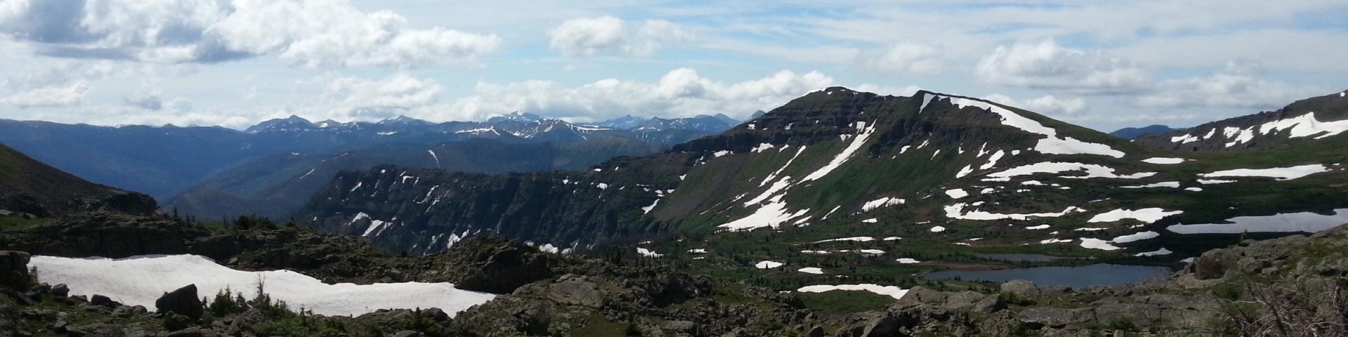
OSC Mean Fraction of Runoff from Forest Service Lands Map
- Approximately 100% of the Rio Grande’s runoff at its confluence with the Alamosa River comes from National Forest lands.
- Approximately 93% of Saguache Creek’s runoff comes from National Forest lands.
- Approximately 97% of runoff in the Alamosa River at the confluence with the Rio Grande comes from National Forest lands.
- Approximately 97% of runoff in the Conejos River at its confluence with the Rio Grande comes from National Forest lands.
- Water is one of the most important natural resources flowing from forests. National Forests and Grasslands are the largest source of fresh water in the U.S. under a single manager, with about 20 percent originating from 193 million acres of land.
- Forest Service lands are located in source areas for many important rivers as well as local and regional aquifer systems. They are the largest source of municipal water supply in the Nation, serving over 60 million people in 3,400 communities in 33 States.
- The national forests and grasslands support more than 46 million fishing visits annually, generating over $2 billion in revenues, supporting about 51,000 jobs, and generating more than $264 million in Federal taxes.
- Based on the statistics above, it is vitally important that we protect the integrity and hydrologic function of our soils and watersheds on the Rio Grande National Forest.

Soils
Healthy and productive soils are an essential part of ecosystems and watersheds and are important to all processes on the Forest. Soils act as a buffer to changes in these systems, natural or anthropogenic, such as climate change, beetle infestations, and wildfire.
Air
Air quality affects National Forests in many ways. Impacts of air quality and resulting atmospheric deposition can affect sensitive vegetation, lake chemistry, and soil nutrients. Air quality can also harm terrestrial and aquatic ecosystems. It can also affect visibility through the suspension of fine particulates in the air. Examples of sources of pollution are motorized vehicles, mining, and road construction. The Clean Air Act of 1977 requires Federal land managers to protect air quality related values in Class 1 areas (wilderness areas over 5,000 acres in size, and national parks greater than 6,000 acres) as well as human health and basic resource values in all others.

The Rio Grande National Forest’s Air program participates in 2 air quality monitoring programs, the National Atmospheric Depositional Program (NADP) and the Long-term Lake monitoring program. The NADP program provides high quality data that inform decisions about environmental and public health issues as they relate to atmospheric deposition chemistry, and our understanding of atmospheric processing. The Long-term Lake monitoring program is administered through the Forest Service Air Resource Management Program. It was created in response to the Clean Air Act of 1977. The program monitors water chemistry of high elevation lakes and was started in the early 1990s with the identification of water chemistry as a key sensitive indicator of atmospheric deposition and its effects on related ecosystems in Regions 2 and 4.
The water, air, and soil program is charged with protecting and managing these valuable resources. Goal 2 of the Rio Grande National Forest’s Land Management Plan, “Protect and restore watershed health, water resources, aquatic ecosystems, and the systems that rely on them”.
Geology
Forest Service lands contain deposits of minerals as well as renewable and non-renewable resources. The Forest Service is the surface-management agency responsible for surface values during leasable, locatable and salable mineral activities. Minerals activities are administered through a plan of operations and permits which include reclamation and mitigation measures necessary to protect resources. These resources are important for Forest operations. The Forest uses these resources as a source of aggregate for roads, rock for rip rap and check dams, and boulders for restricting access to damaged resource areas.
The Rio Grande National Forest (RGNF) plays a role in the remediation of two mine sites under the Comprehensive Environmental Response, Compensation, and Liability Act of 1980 (CERCLA). These superfund sites include the Nelson Tunnel in Mineral County and the Summitville Mine in Rio Grande County. The RGNF is actively participating in the ongoing remediation plan development and maintenance operation plans for both of these sites. Please contact the district offices for more information on these projects.
What work is being done?
Managers and hydrologists, in conjunction with the RGNF’s Wildlife and Engineering programs, work with the valley’s watershed community to design and implement watershed restoration projects which improve aquatic habitat and resilience to climate change. These include anything from installing beaver dam analogs to aquatic organism passages at stream crossings. Through survey and design, soil scientists and hydrologists ensure projects on the forest comply with the clean water act.

Watershed
- Watershed analysis to support timber and vegetation projects
- Best Management Practices Monitoring
- Stream Crossing Design for trails, bridges, roads etc.
- Beaver Dam Analog site assessments
Soils
- Soils analysis to support timber and vegetation projects
- Post-harvest soils monitoring
- Best Management Practices monitoring
Air
- National Atmosphereic Depositional Program sampling
- Long-term Lake Monitoring sampling
Geology
- Working on Nelson Tunnel related projects
- Bulldog Mine related projects
- Processing Notice of Intents
- Locating aggregate pits for Forest use
More Information and Resources
- Rio Grande National Forest Geology Page
- Soil and Ecological Inventories have been completed for most of the lands of the Rio Grande National Forest.
- In 2000, a wetland improvements project, called the Viers Creek Wetland Improvement Project, was undertaken to restore a de-watered wetland.
- Photos and descriptions of soil treatments during the 3 year monitoring of winged subsoiler treatment areas.
- Clean Water Act
- National Core Best Management Practices Program
- National Atmospheric Depositional Program
- OSC Mean Fraction of Runoff from Forest Service Lands Map\
- US Forest Service Water Facts
- Business for Water Stewardship, Southwick Associates. 2020. Economic Contributions of Water-related Outdoor Recreation in Colorado. Prepared for: Business for Water Stewardship.
- State of Colorado, Department of Local Affairs, State Demography Office. No date. State Demography Office website.
- San Luis Valley Development Resources Group. 2013. 2019 Annual Comprehensive Economic Development Strategy (CEDS) and Progress Report. Alamosa, Colo.